I can’t be the only person who thinks that Northland is one of the most criminally underrated destinations in New Zealand.
Nestled above Auckland at the northern tip of the North Island, Northland is a must-visit if you love islands, pristine beaches, coastal views and miles and miles of native bush.
I love photography (so much so that I need to factor in extra hiking time whenever I bring a camera!), so in this guide, I’m going to show you some of my favourite viewpoints in Northland.
Some spots are accessed via hiking tracks, but I’ll list all the information below.
- Dukes Nose Track
- St. Pauls Rock
- Cape Reinga Lighthouse
- Tapoutopouto Bay Lookout
- Managawhai Cliffs Coastal Walkway
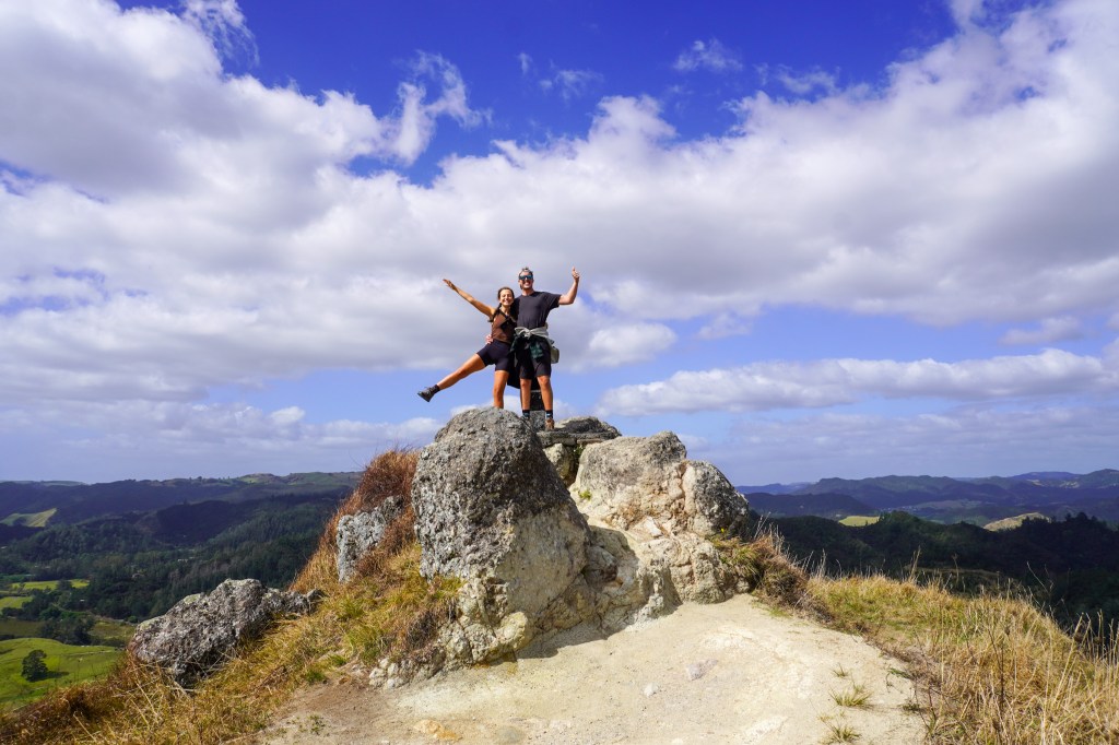
Dukes Nose Track
3.5 hours – 10.8km – Moderate
I’m going to let the cat out of the bag early and introduce you to my favourite viewpoint first.
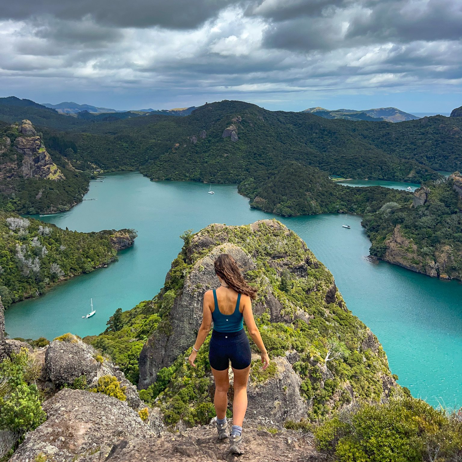
Located in Whangaroa (about 40 minutes from Kerikeri), Dukes Nose is jaw-dropping and boasts ridiculous views of Whangaroa Harbour.
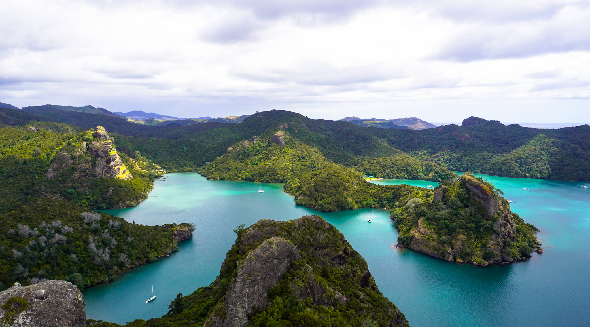
To get here, follow the Dukes Nose via Wairaku Stream Track.

All Trails will tell you that this hike is only suitable for experienced tramplers. That’s because there’s a bit of rock climbing at the end. Still, anyone with a reasonable fitness level and some upper-body strength could reach the top.
St. Pauls Rock
30 minutes – 1.1km – Moderate
Also located in Whangaroa, St Paula Rock is an excellent option if you don’t have time for the Duke’s Nose Track.
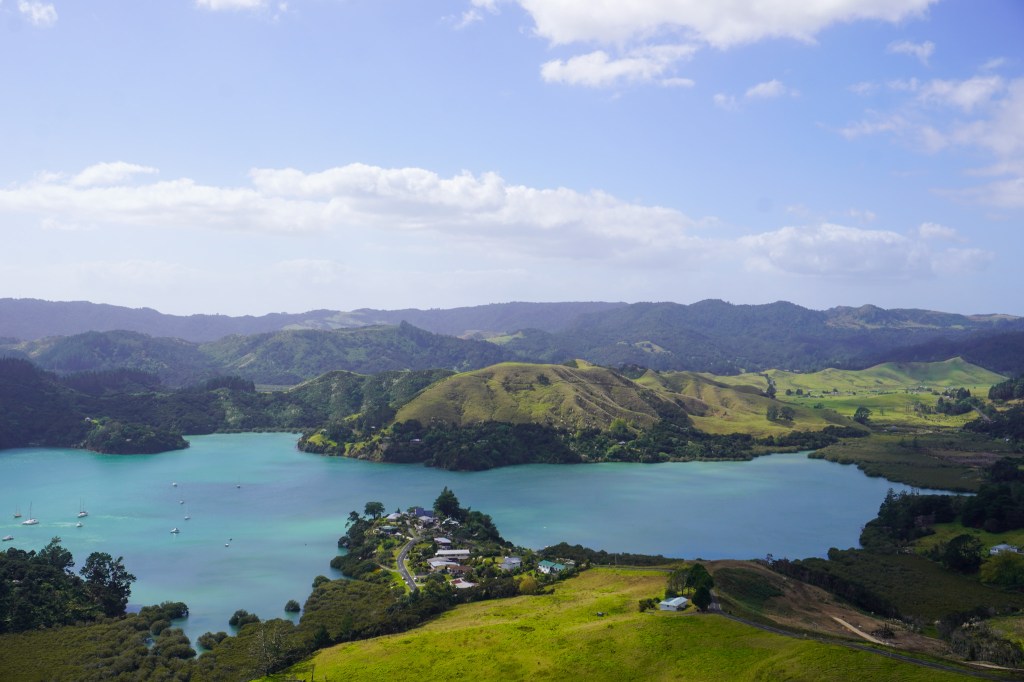
This track is completely uphill from the carpark to the viewpoint and very steep in sections. But it’s short, and the views are SO worth it.
Just before you reach the viewpoint’s top, you’ll need to climb the rock using a chain ladder. It’s not for the faint-hearted, but it’s so much fun!
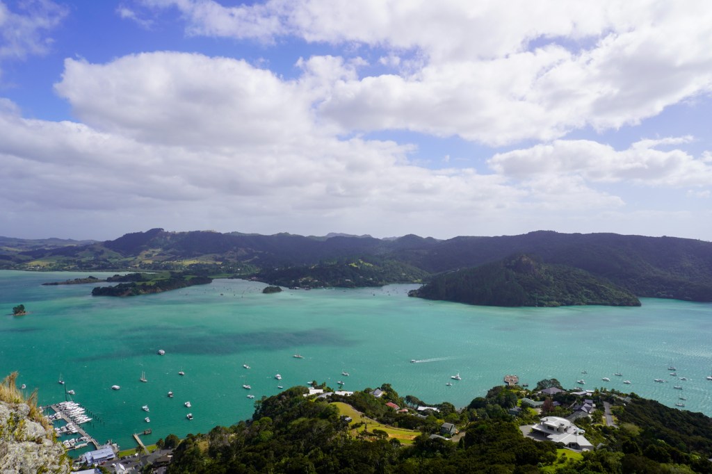
If you’re visiting St. Paul’s Rock (or Dukes Nose above), I recommend staying in Kerikeri (about 30-40 minutes away) and driving to the lookouts.
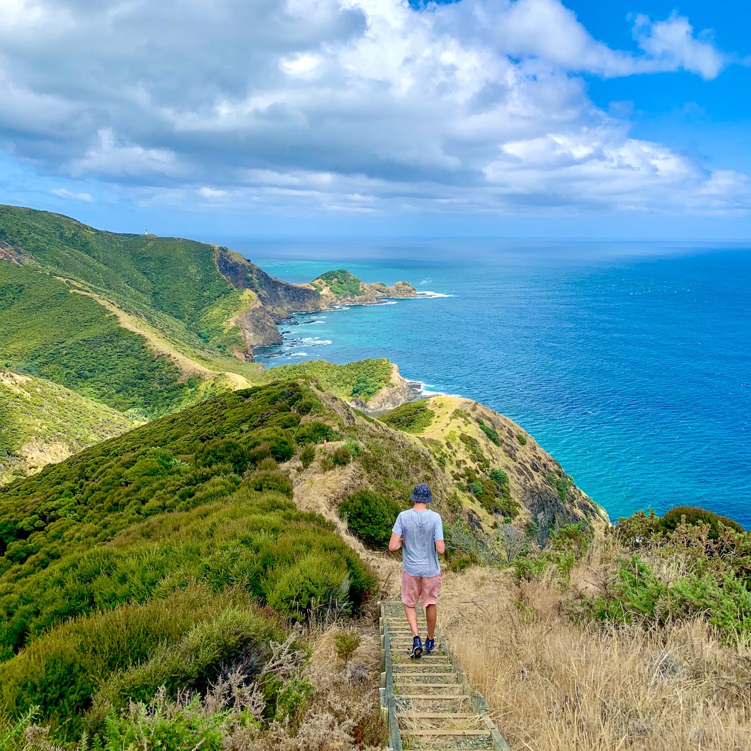
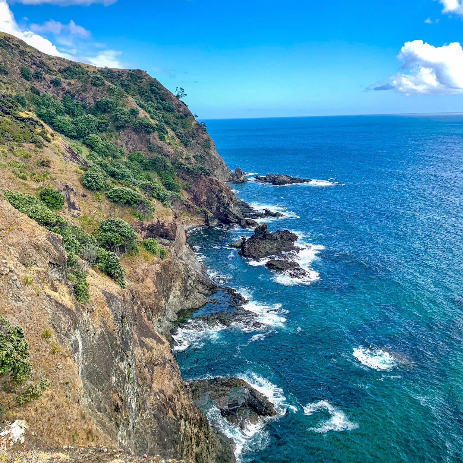
Cape Reinga Lighthouse
30 minutes – 800m – easy
Located at the northern tip of New Zealand, Cape Reinga is steeped in sacred Maori history and a must-visit on any Northland itinerary!
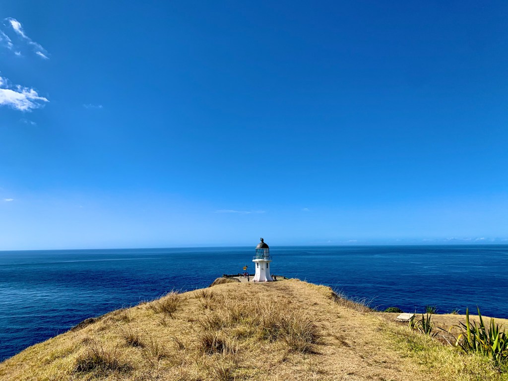
Visiting the Cape Reinga Lighthouse offers panoramic views over the coast, where you’ll see the Tasman Sea collide with the Pacific Ocean.
At the northernmost tip of the Cape is a gnarled pohutukawa tree, which is believed to be over 800 years old. Cape Reinga is so sacred as, according to Maori history, the spirits of deceased Maori leap from this tree into the ocean to return to their ancestral homeland of Hawaiki.
It takes about 1.5 hours to get to Cape Reinga from Kaitaia. But accommodation options are limited here, so I recommend staying in the Bay of Islands instead.
Whilst you’re in Cape Reinga, make sure to visit Ninety Mile Beach (it’s not actually ninety miles long, but that’s a story for another day) and the Te Paki Sand Dunes!
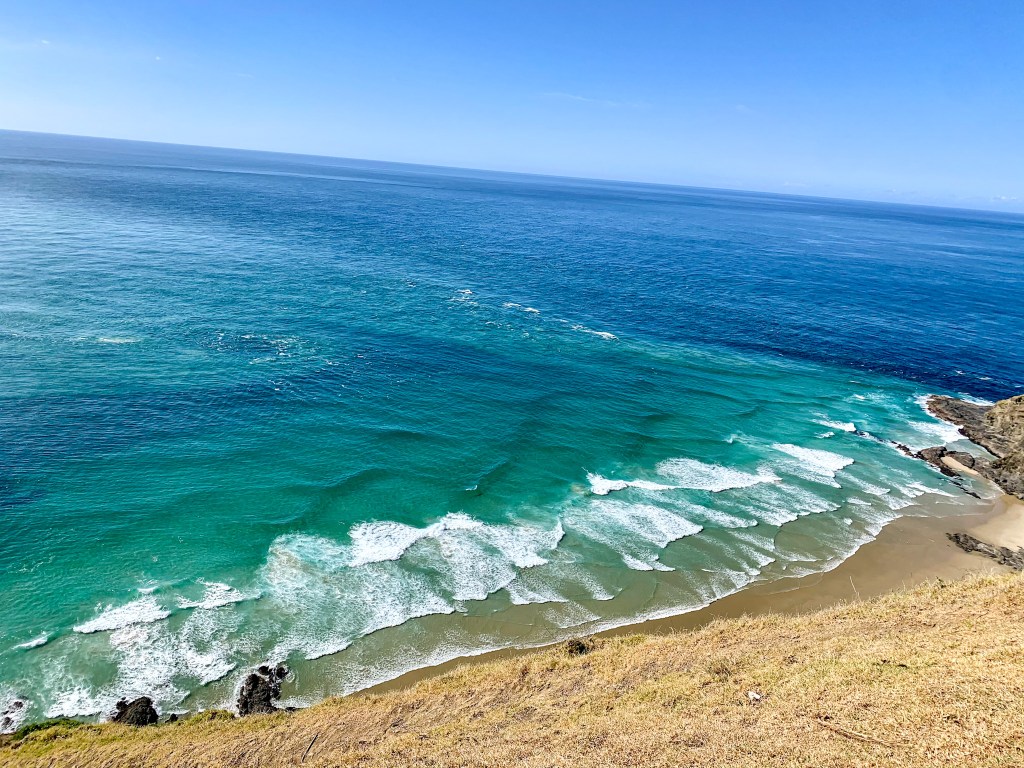
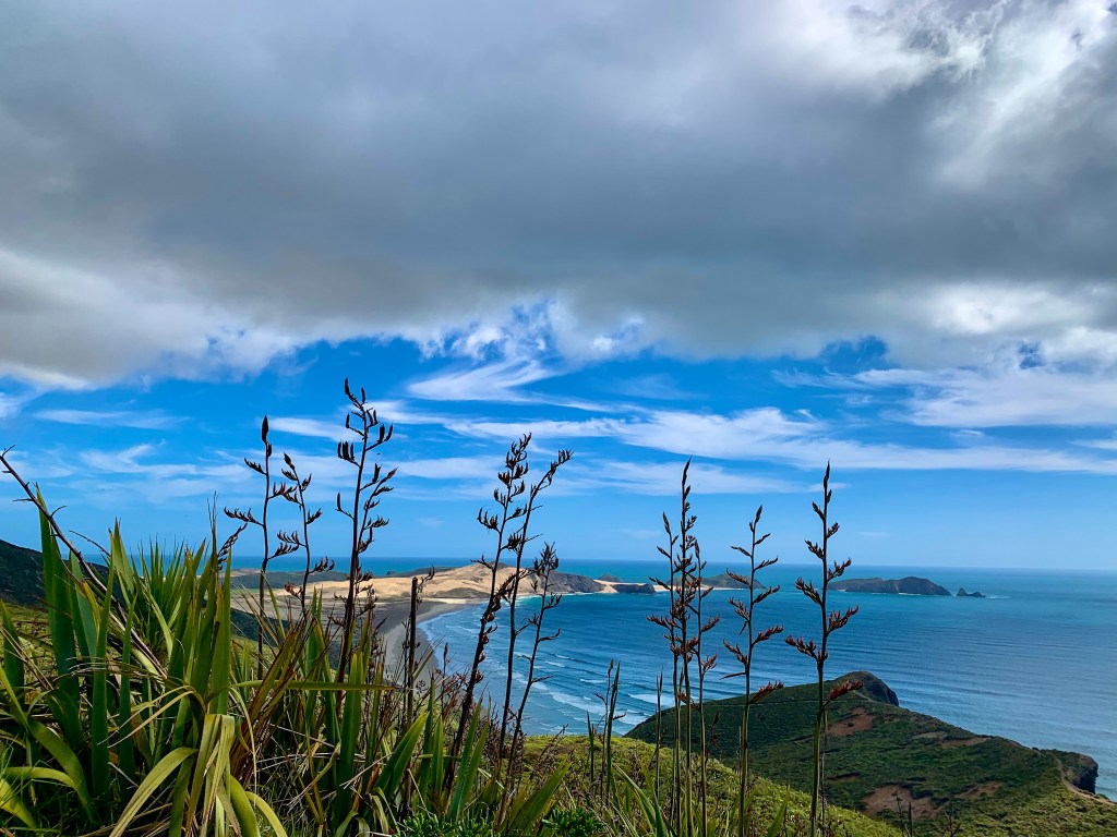
Tapoutopouto Bay Lookout
3 hours – 4.5km – Moderate
If you’re traveling up to Cape Reinga and have the means to camp or stay in a camper van, you have to stay at Tapoutopouto Bay DOC Camp.
Located smack bang on the beach, Tapoutopouto Bay is one of the best campsites in New Zealand (especially in the summer months!)
There’s a 3-hour walk from Tapoutopouto Bay to Cape Reinga, which I highly recommend. It boasts out-of-this-world coastal views and is one of the best hikes in the North Island.
There are some steep sections and uneven terrain, but it’s manageable!
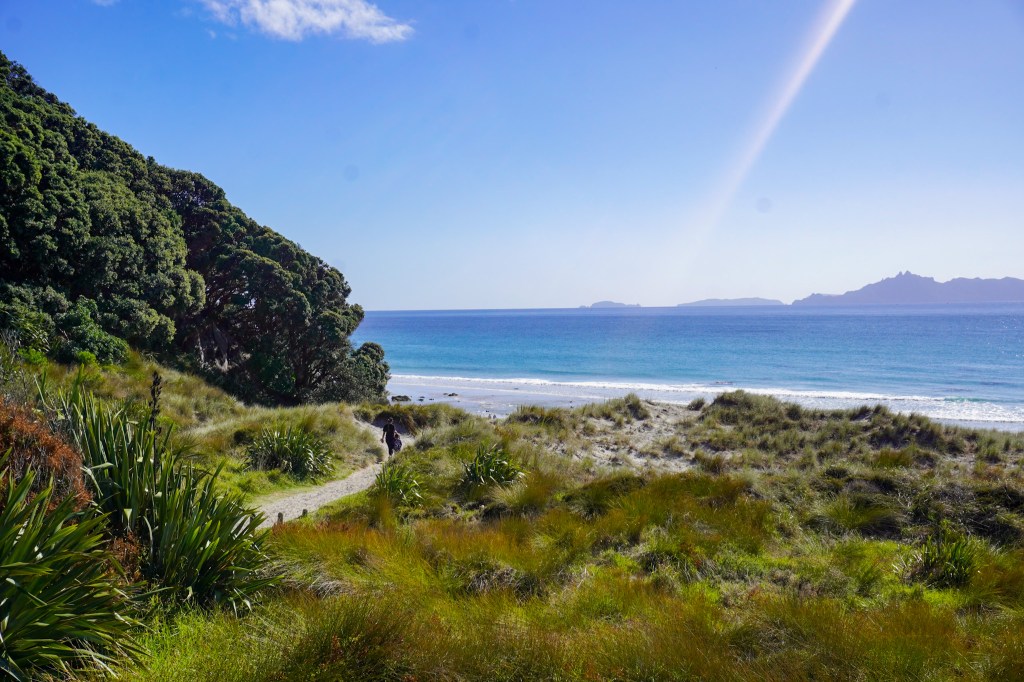
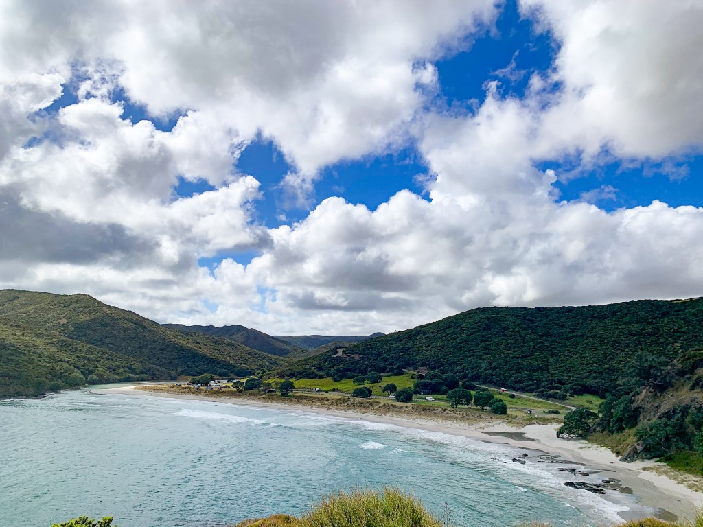
Managawhai Cliffs Coastal Walkway
2.5 hours – 8.7km – Easy
Mangawhai is a gorgeous little coastal town 1.5 hours north of Auckland.

Although it’s home to sand dunes, shops and amazing fishing, my favourite thing to do here is to walk along the Coastal Walkway.
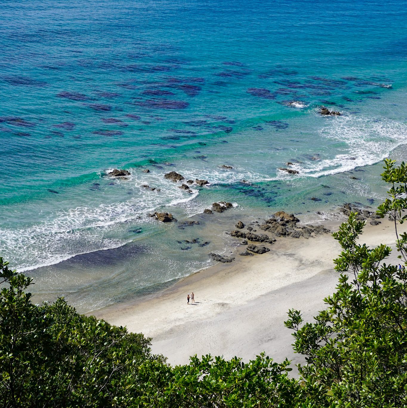
I reckon these photos speak for themselves!