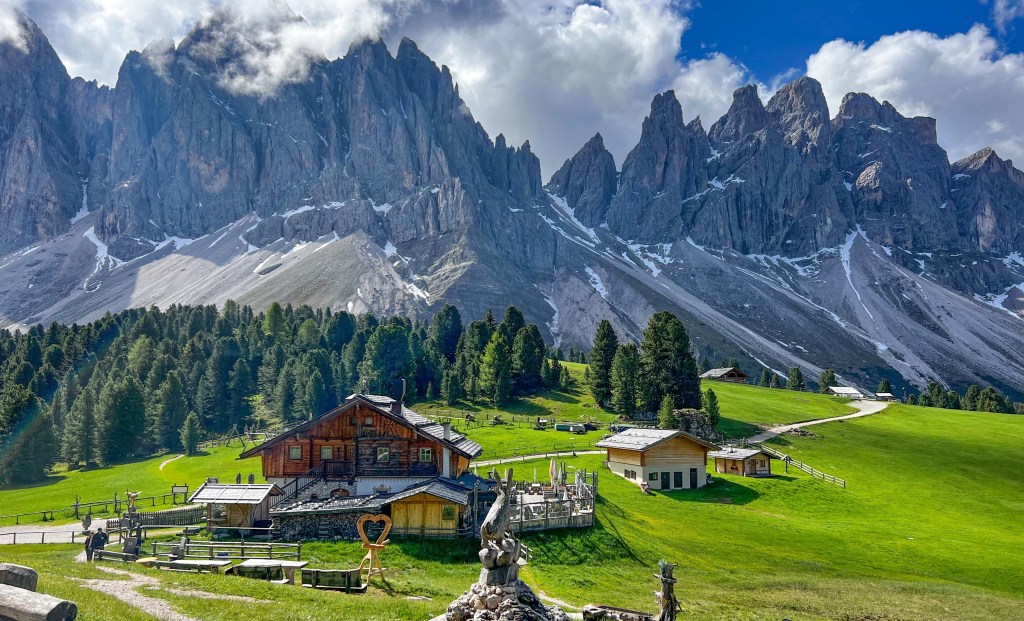
The Adolf Munkel Trail (Adolf Munkel Weg in German) was one of my favourite hikes on our recent trip to the Dolomites! Running along the Odle/Gisler mountains in Val di Funes, this hike boasts views for days and is guaranteed to take your breath away.
The Adolf Munkel Trail is usually a point-to-point hike, but we shortened our trip to turn it into a loop that starts and ends from the same car park.
In this post, I’ll tell you how to hike the loop trail (and have the best day ever!)
- Things to know
- Quick fire trail numbers
- How to get to the Adolf Munkel Trail
- What to pack to go hiking
- Your Step-By-Step Trail Guide
- Zanser Alm Carpark to Dusler Alm
- Dusler Alm to Geisler Alm
- Geisler Alm to Gschnagenhardt Alm
- Gschnagenhart Alm to Zans
Things to know
- Best time of the day to hike: First thing in the morning to beat the crowds and have the trail to yourself!
- Distance: 9.2 km
- Difficulty: Easy
- Time: 4 hours (including time spent at the rifugios)
- Starting point: Zanser Alm carpark
- Finishing point: Zanser Alm carpark
- Public toilets: Available at the trailhead and rifugios on the trail, BUT none of the ones we passed were open when we went in early June, so keep that in mind!
- Rest stops: Dusler Alm and Giesler Alm, located on the trail.
Quick fire trail numbers
Jot these down and keep them handy along the trail!
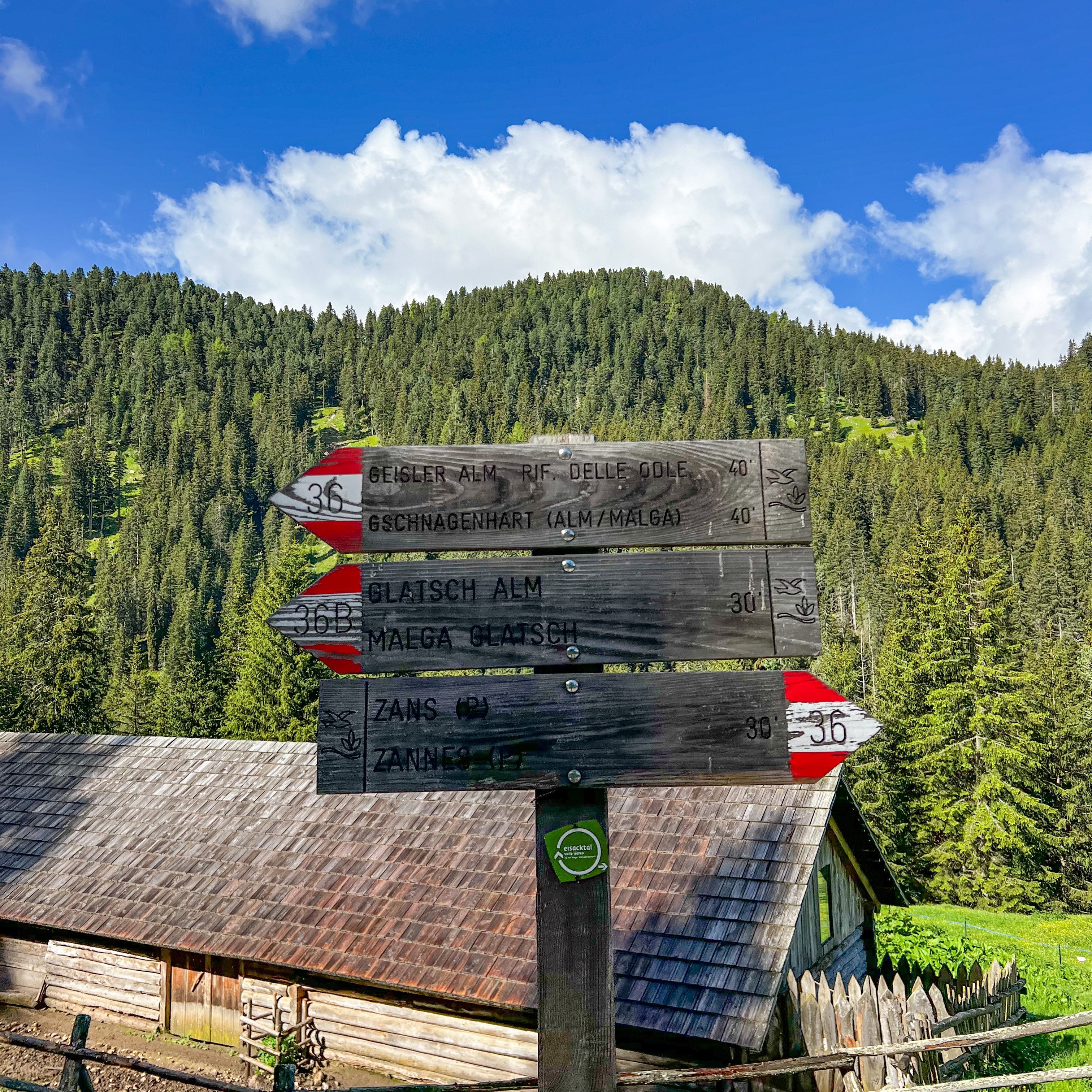
Zanser Alm carpark → track #36 → Dusler Alm → Geisler Alm → Gschnagenhart → track #35 → track #35A → Zanser Alm carpark
How to get to the Adolf Munkel Trail

The Adolf Munkel Trail starts at the Zanser Alm car park in Val di Funes/Villnoss Valley.
Zanser Alm is 40km.55 minutes from Ortisei and 85km/2 hours from Cortina d’Ampezzo!
Parking will cost you 8€ for the day (cash only!), and there are a lot of spaces available when we arrived in June.
What to pack to go hiking
This hike is a bit longer than others, but it’s nothing strenuous! But, as always, remember that the track conditions can change at any time, particularly if you are travelling in the shoulder season.
- Clothing: thermals, layers and a good outer layer as well as a waterproof
- Hiking boots or good walking shoes
- At least 2L of water per person
- Your lunch (unless you’re planning on eating at one of the rifugios!) and enough snacks for 3-4 hours
- Sun cream and a hat
- Your phone or camera (you’re going to want to take 101 photos – trust me) and a power bank
Your Step-By-Step Trail Guide
When planning our hikes in the Dolomites, I found the amount of information on the internet SO confusing. Understanding the different trail junctions and track numbers took me so long!
So, I decided to break down our hikes and put together the step-by-step guides I wish I had. You should have no problems following this loop!
Zanser Alm Carpark to Dusler Alm
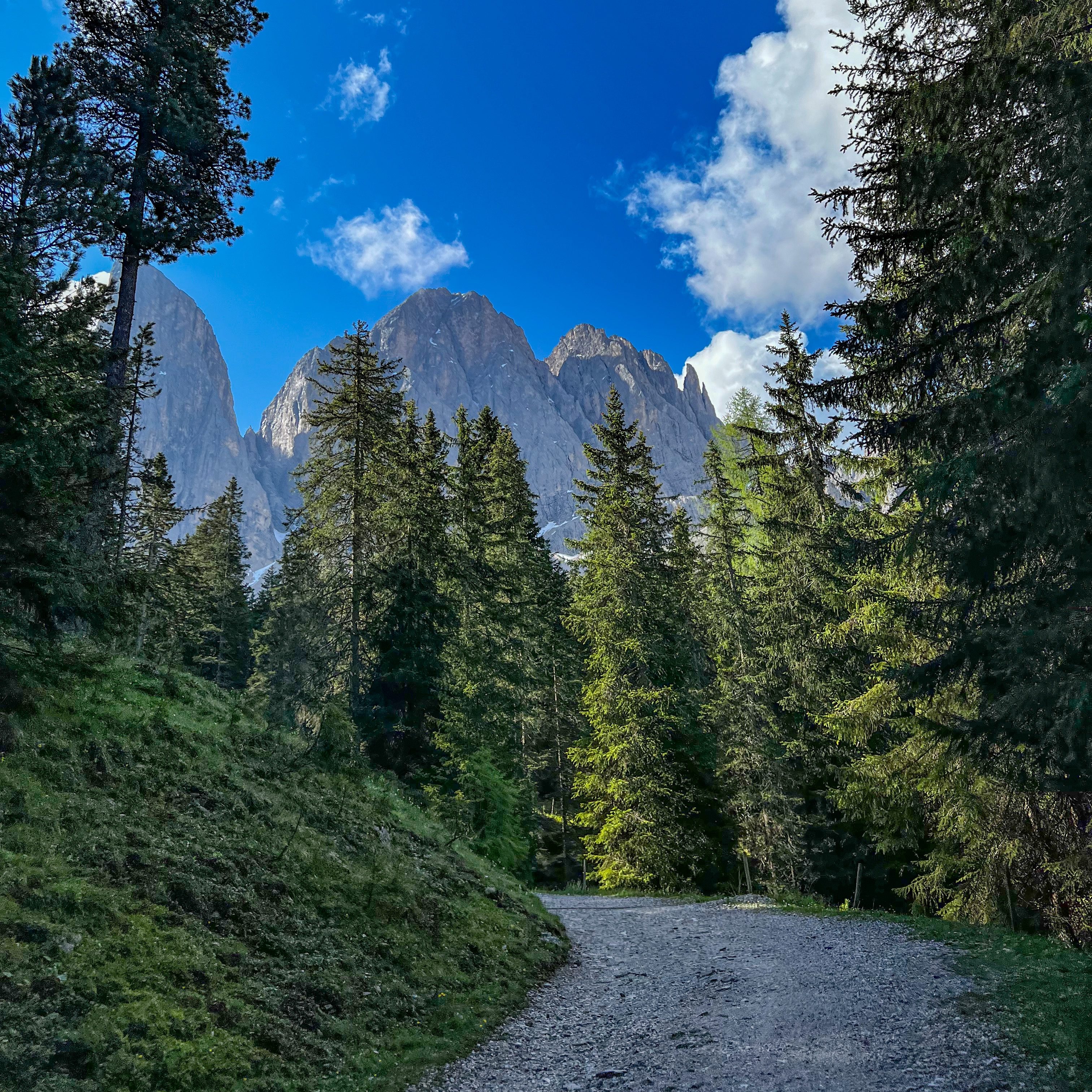
The start of your walk begins on the right-hand side of the bus stop. Follow the stacked signs to Dusler Alm on track number 36 – about 40 minutes. Turn right and walk straight over the bridge. Trail 36 begins once you see a green gate signalling the car park’s end and the forest road entrance.

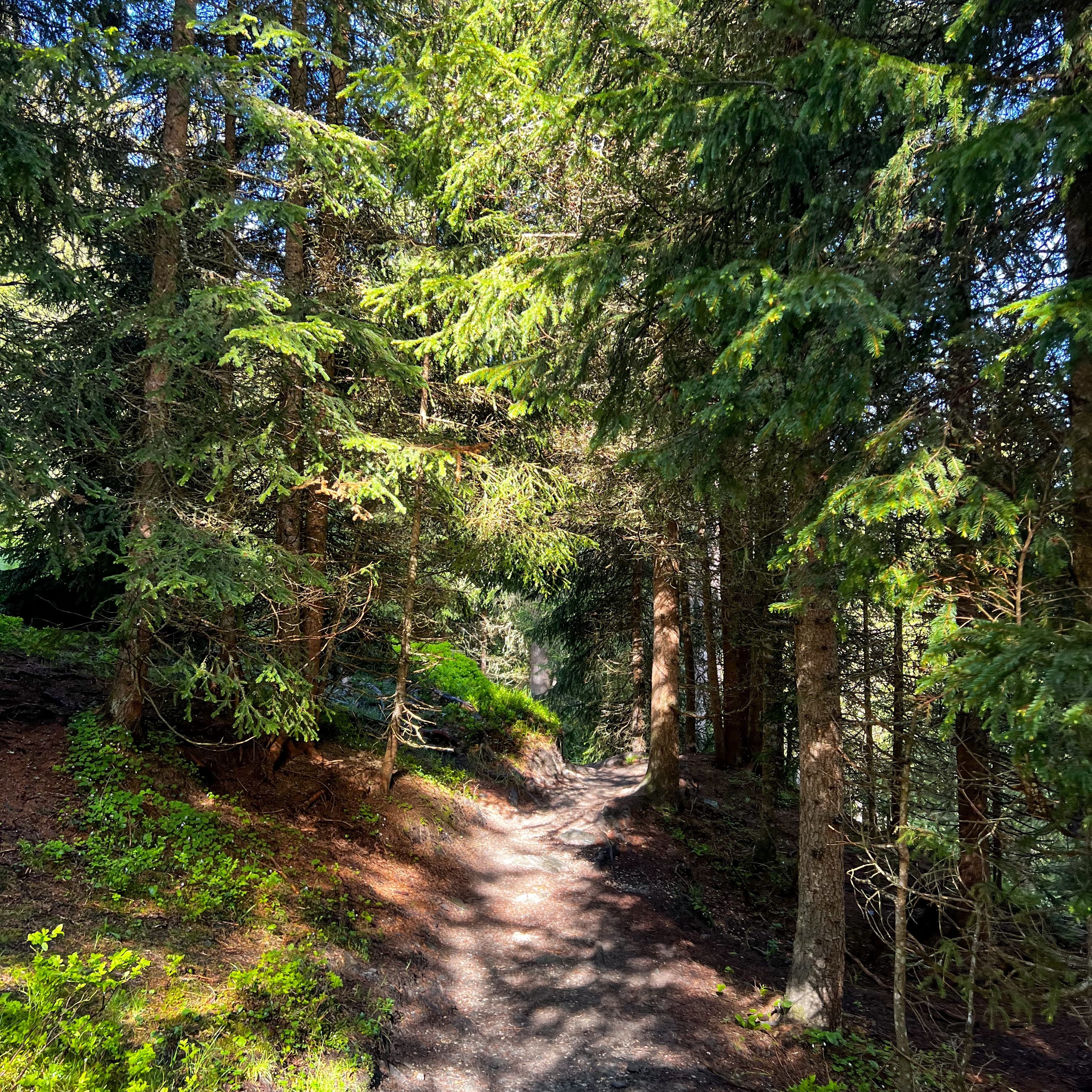
You’ll walk along the forest road for a few minutes until the trail splits, and then head left towards Dusler Alm.
Continue on this path for about 15 minutes, until the trail divides. Take the lefthand path upwards to Dusler Alm. You’ll gain elevation quickly – this portion of your walk will take about 15-20 minutes.
Once you reach the top, you’ll leave the forest behind and get a phenomenal view of the Odle/Geisler peaks. Keep walking along the grass-covered footpath, and you’ll soon reach Dusler Alm.
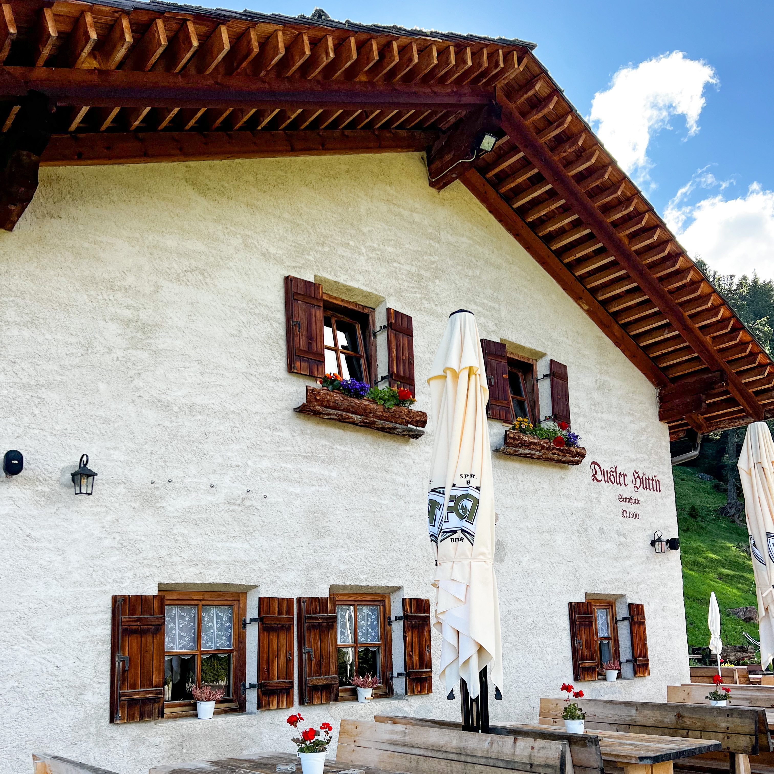
Dusler Alm to Geisler Alm
Walk straight through Dusler Alm along the gravel track. Make a left and then a right almost immediately to stay on track number 36.
Head upwards through the forest before reaching an alpine pasture. When the trail splits, take the righthand path and continue straight until you reach a gravel road. When you’re here, take a left and continue onto Geisler Alm!
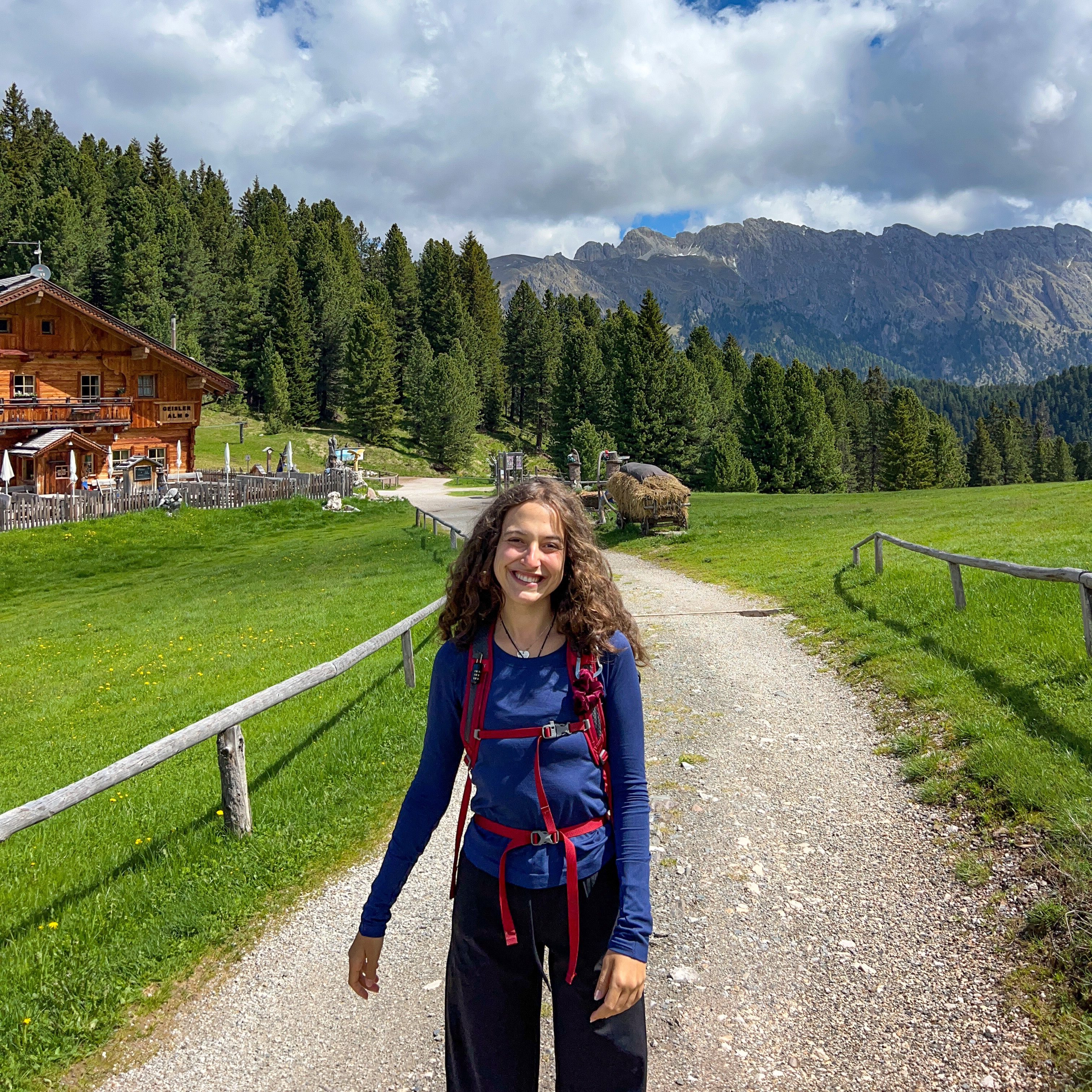
Admittedly, I didn’t realise we would see Geisler Alm when I planned to walk the Adolf Munkel Trail. We stumbled on this gorgeous rifugio by accident, but boy, was it a happy one. Geisler Alm is one of the most photographed locations in the Dolomites and the perfect place to kick back and have lunch.

Try and plan your trip to the Adolf Munkel Trail from Tuesday to Sunday when Giesler Alm is open! We arrived on a Monday, and it was closed, but it was lovely to have a rest here in any case. Who needs a cinema when you’ve got this view!
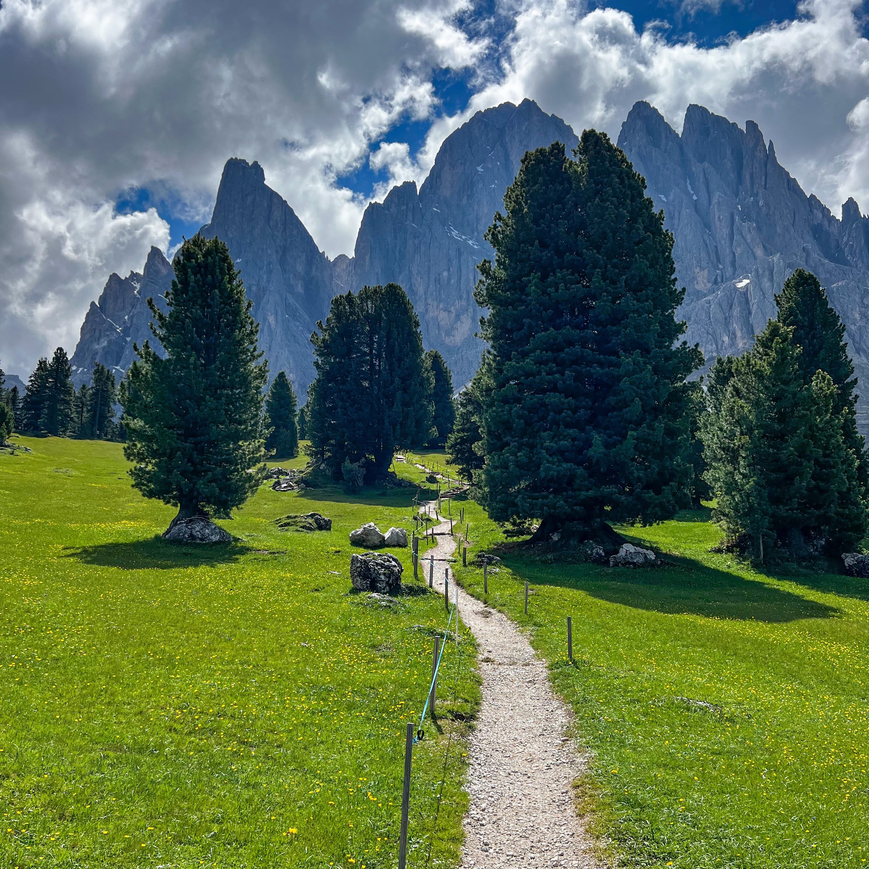
Geisler Alm to Gschnagenhardt Alm
Say goodbye to Giesler Alm and follow the signs to ‘Adolf Munkel Weg’ along the gravel track. You’ll soon come to Gschnagenhardt Alm (about 5 minutes)
Gschnagenhart Alm to Zans
From Gschnagenhardt Alm, you’ll see two paths pointing towards the Geisler Peaks. You want to take the lefthand track, which runs against a fence. You might see other hikers walking towards you in this direction.
Walk through the forest until you reach an interaction with track number 35. Take a left onto track number 35 and walk towards Zans and Gampen Alm.
The track will take you through the foot of the Geisler/Odel peaks in Puez-Odle Nature Park. There are some glorious lookout points along the way as well as places to stop for a rest, a sandwich, or to take in the view!

Continue along the Adolf Munkel Trail until you reach track number 6. Cross the Rio San Zenon/Sankt Zenon Bach stream over the bridge and follow the first sign to Zans on track number 35A. You can extend your walk here and continue on track number 35. But we decided to head back to the car park, and we’re pleased we did – you’ll soon see why!

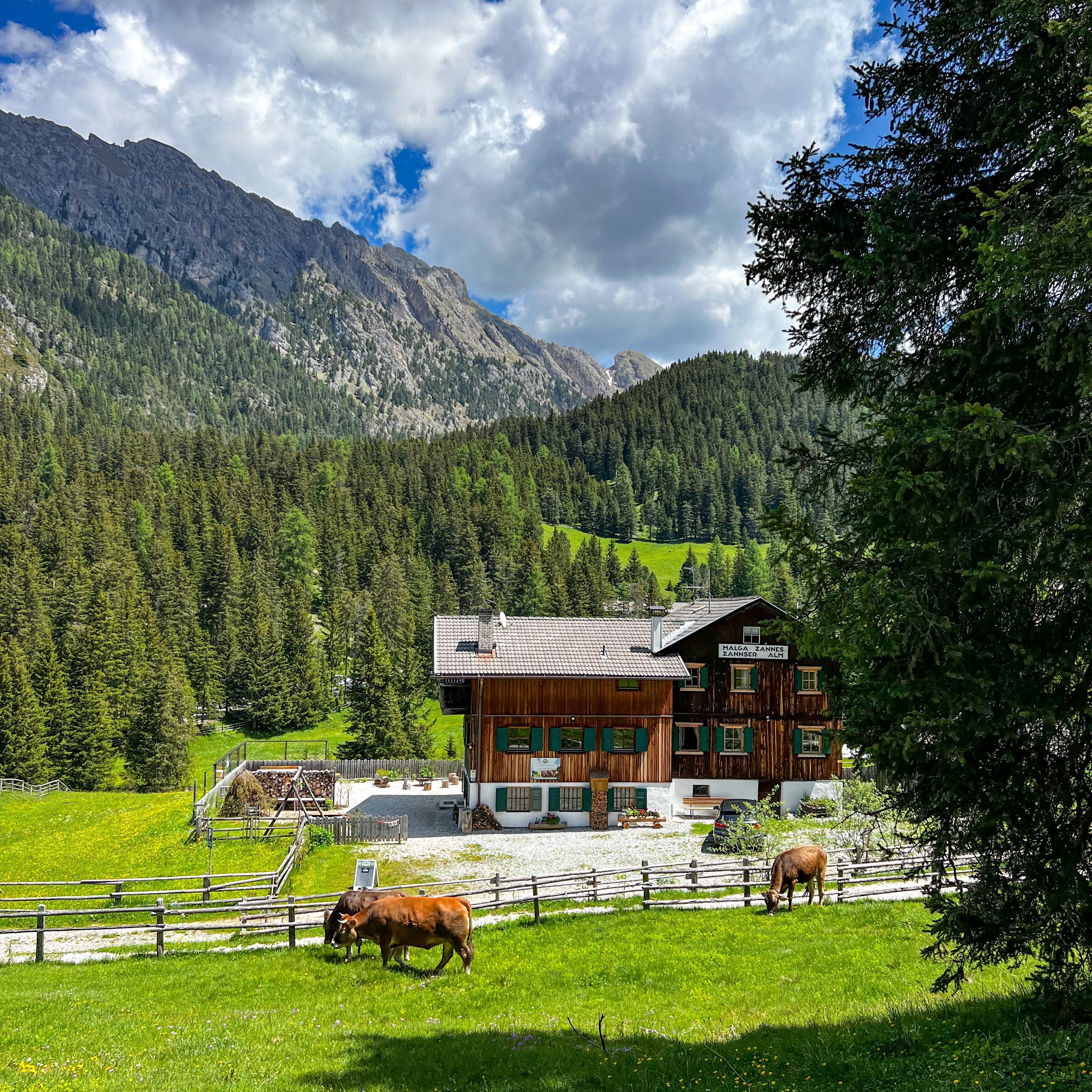
Continue on track number 35A for 30 minutes, where you’ll descend back down to the Zanser Alm car park. Before your walk ends, look to your right, and you’ll get a gorgeous view of the Giesler/Odel Peaks with cows (yes, cows complete with cowbells!!!) in front. No words.
Continue walking across the car park and make your way back to your car. Job done!
