
Hiking is one of the best things to do in New Zealand. On the North Island, you can expect to explore active volcanic areas, beautiful coastlines and beaches. Whereas hiking on the South Island will take you to breathtaking mountain ranges, glaciers and vast alpine plains.
The number of beautiful hikes in New Zealand is endless. Whether you’re looking for a stroll, a multi-day hike, or to try your hand at one of New Zealand’s Great Walks, I’m going to share with you some of my favourite hikes across Aotearoa so that you, too, can enjoy our beautiful country.
Walks 1-7 are on the North Island and 8-15 are on the South Island 🙂
- Tongariro Crossing
- Dukes Nose
- Tapotupotu Bay to Cape Reinga
- Coromandel Coastal Walk
- Omanawanui Track
- Mount Maunganui
- Te Whara Track
- Key Summit
- Lake Marian
- Roys Peak
- Moke Lake Loop Walk
- Franz Josef Glacier Walk
- Blue Pools Track
- Hooker Valley Track
- Blue Lakes and Tasman Glacier View
- What hikes would you add?
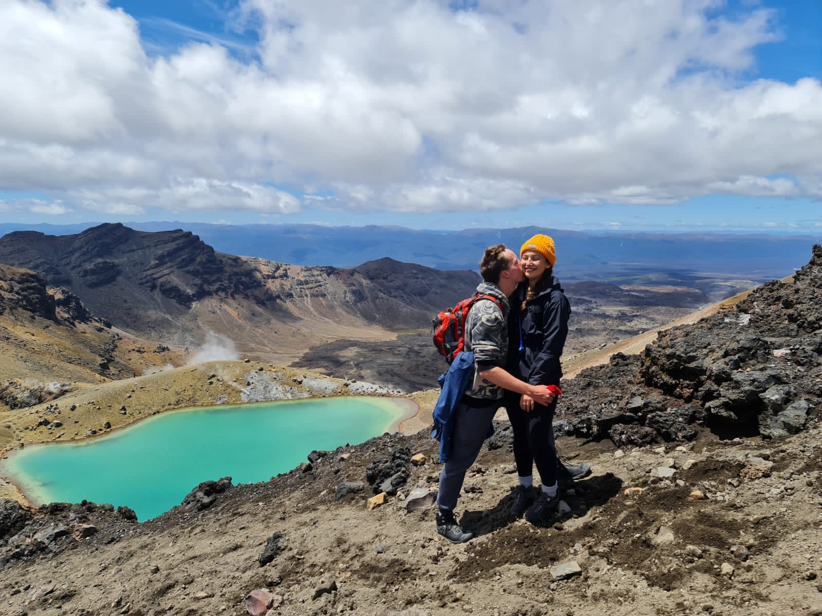
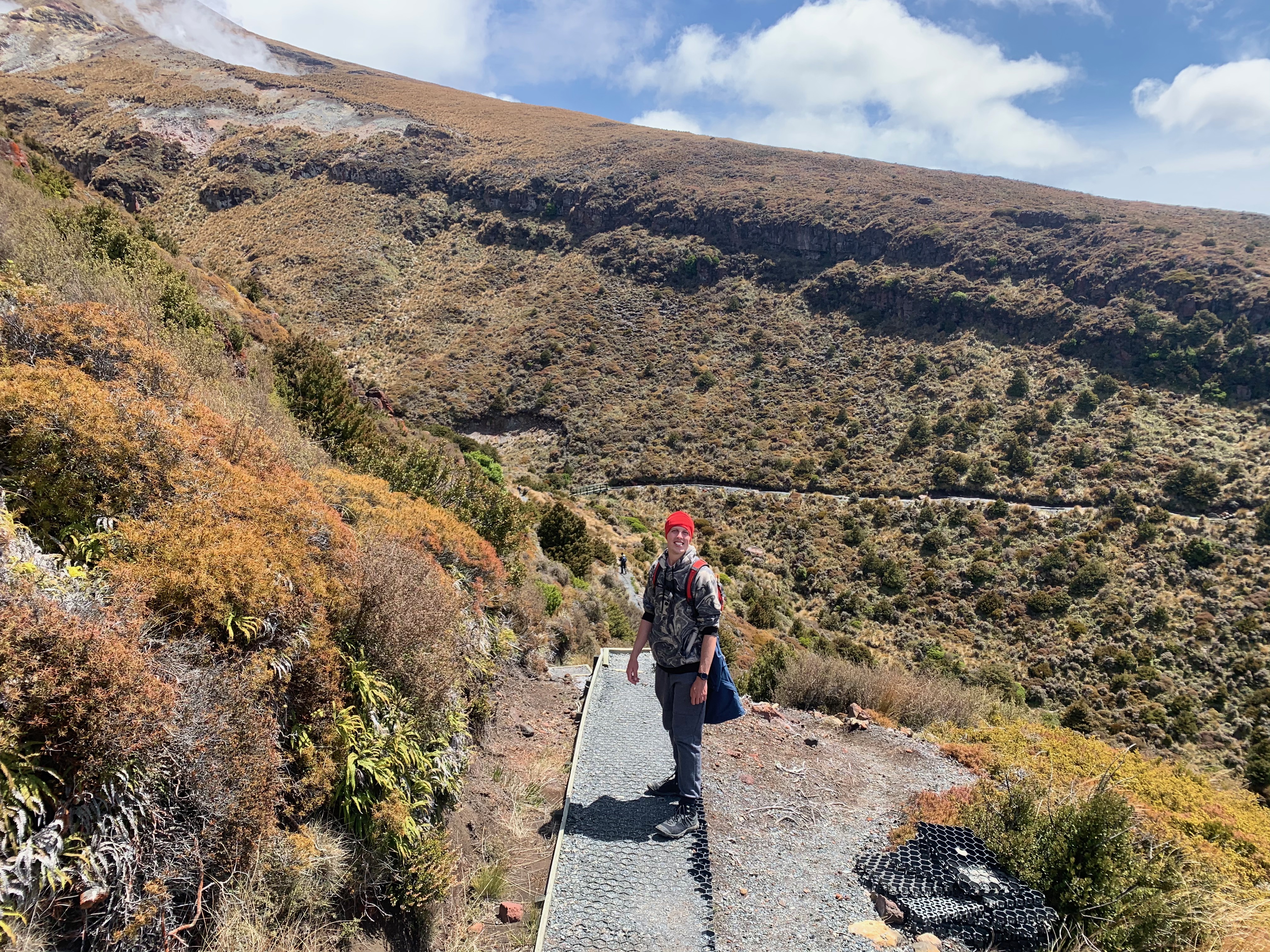
Tongariro Crossing
Tongariro National Park
7 hours – 21km – moderate
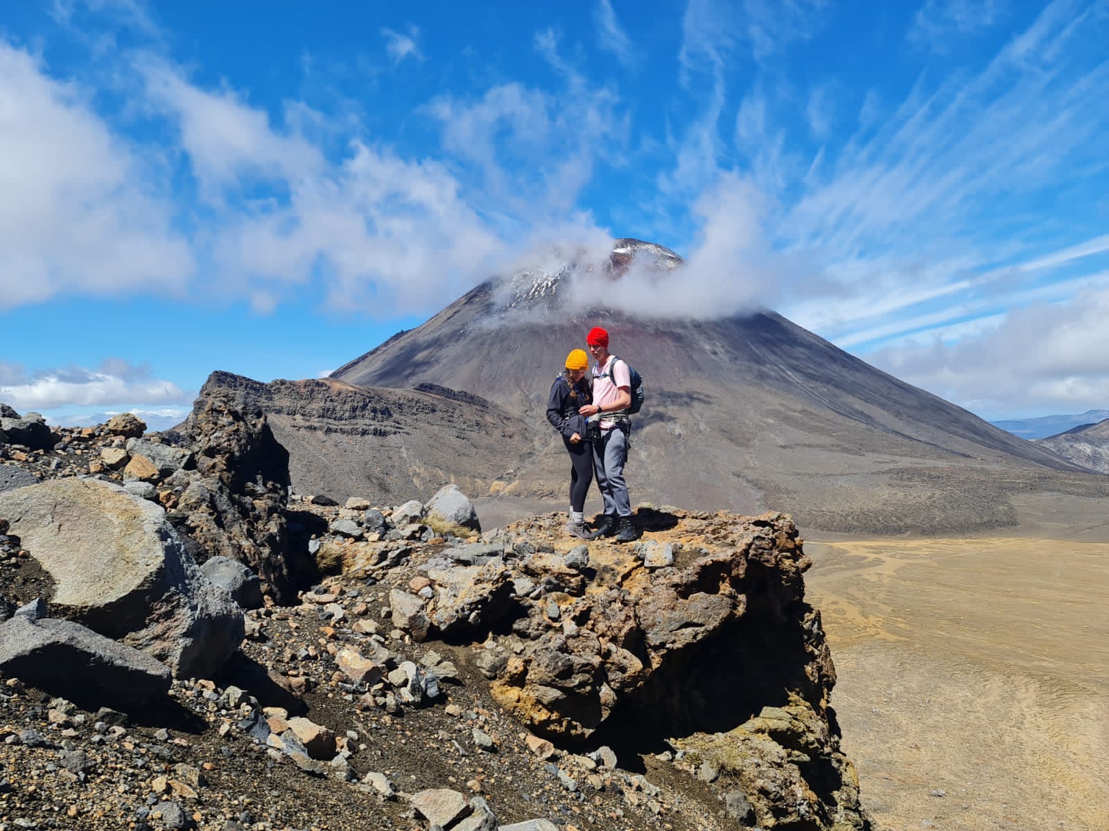

Not only is the Tongariro Crossing the most famous day hike in New Zealand, but it is often regarded as one of the best day hikes in the world.
Starting at Whakapapa Village, this 19.4km hike takes you through phenomenal volcanic landscapes, past glacial valleys and overlooks three volcanic peaks (Mount Ngauruhoe, Mount Tongariro and Mount Ruapehu).
For all of the Lord of the Rings fans, Mount Ngauruhoe was the setting for Mount Doom – a volcano in Mordor where the One Ring was forged and destroyed. Check out my other blog post on The best Lord of the Rings filming locations to visit in New Zealand.
Other highlights on this trek are the Red Crater at 1886m, the Emerald Lakes (bright green lakes caused by volcanic minerals in the water), and the Blue Lake (a bright blue lake coloured by the sky).
You’ll want to start this hike as early as possible as it’s incredibly popular and takes 6-8 hours to complete depending on your fitness level (we began at 06:30 am and took around 7 hours with a few photo stops and a break for lunch !!).
The Tongariro Alpine Crossing is a day hike which makes up part of the Tongariro Northern Circuit. If you’d like to see more of this area, the Northern Circuit is an impressive 3-4 day hike and one of New Zealand’s famous Great Walks, a collection of the country’s most outstanding multi-day hikes.
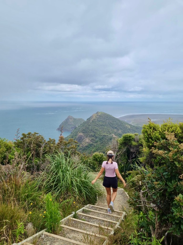
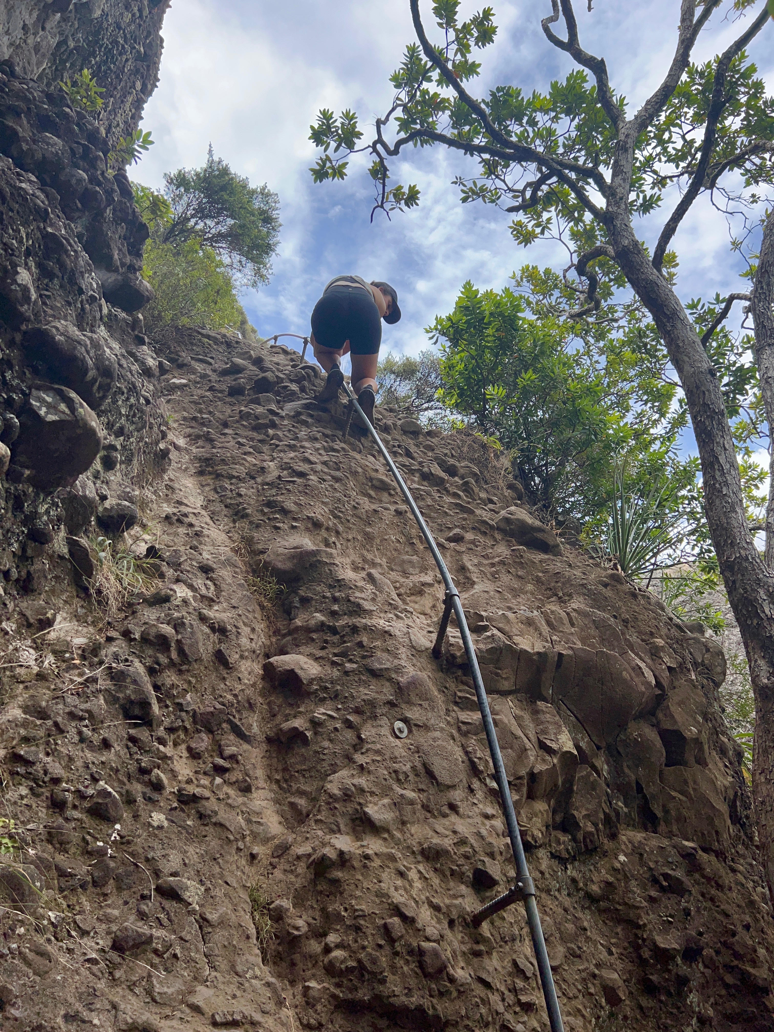
Dukes Nose
Northland
3-4 hours – 5.2km return – Moderate
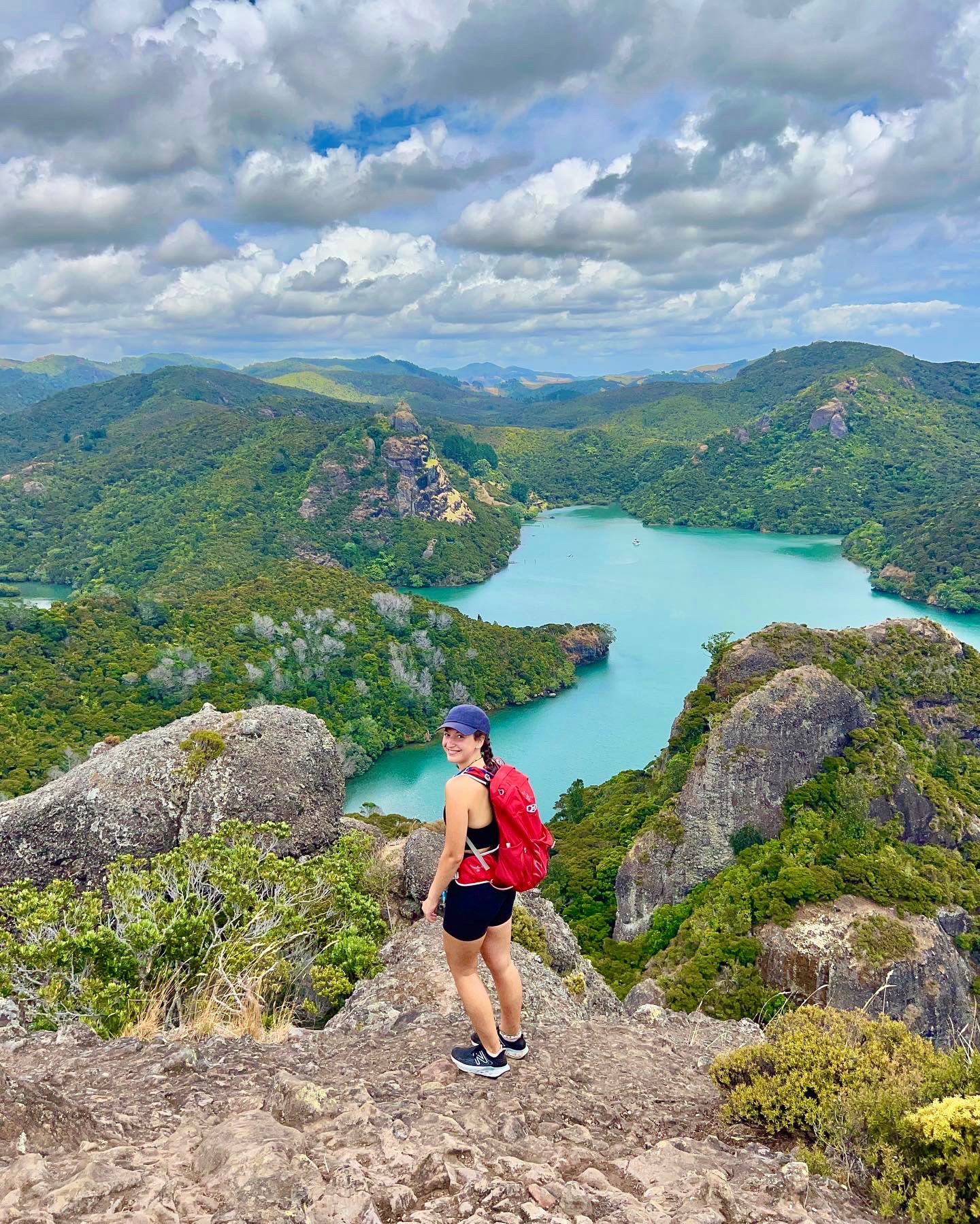

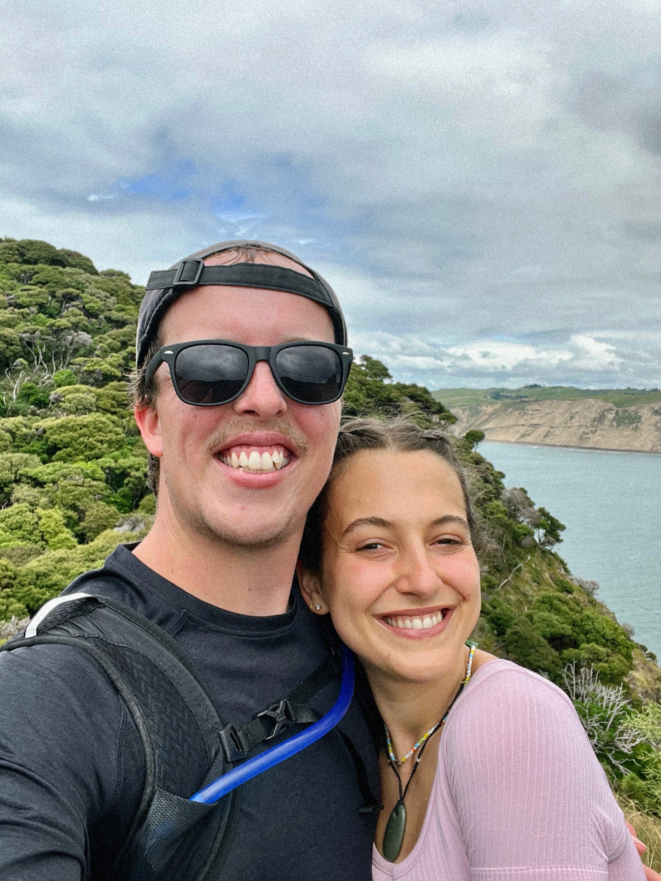
My favourite feeling in the whole world is taking a trip up to Northland in the summer. Car windows down, music up, road trip snacks stocking the glove compartment. Nothing beats it. The Dukes Nose hike is the cherry on top of a good Northland road trip – it’s not for the faint of heart, but the views are phenomenal.
This hike takes about 3-4 hours to complete and requires a reasonable fitness level. Beginning as a 4×4 track, half the walk takes you past freshwater streams, a rock and branch bridge and pohutukawa trees. Then, the route becomes undulating as you begin your ascent to Kairara Rock (DOC estimates this portion of the walk will take one hour. Although there is no doubt that the route is technical and steep, we made it up in well under half an hour).
Following the track will take you on winding turns through Manuka bush until you reach the best 50m of the walk – a steep rock climb assisted by DOC-installed grab rails – exhilarating!
At the top, it’s easy to imagine you’re standing over Vietnam’s Ha Long Bay rather than Whangaroa Harbour. The 360-degree view of the harbour is extraordinary and (in my opinion) offers one of the best lunch spots in New Zealand. Every direction is a spectacle, with Taupo Bay to the northwest and Tauranga Bay to the east; it’s easy to see why we spent almost two hours at the top!
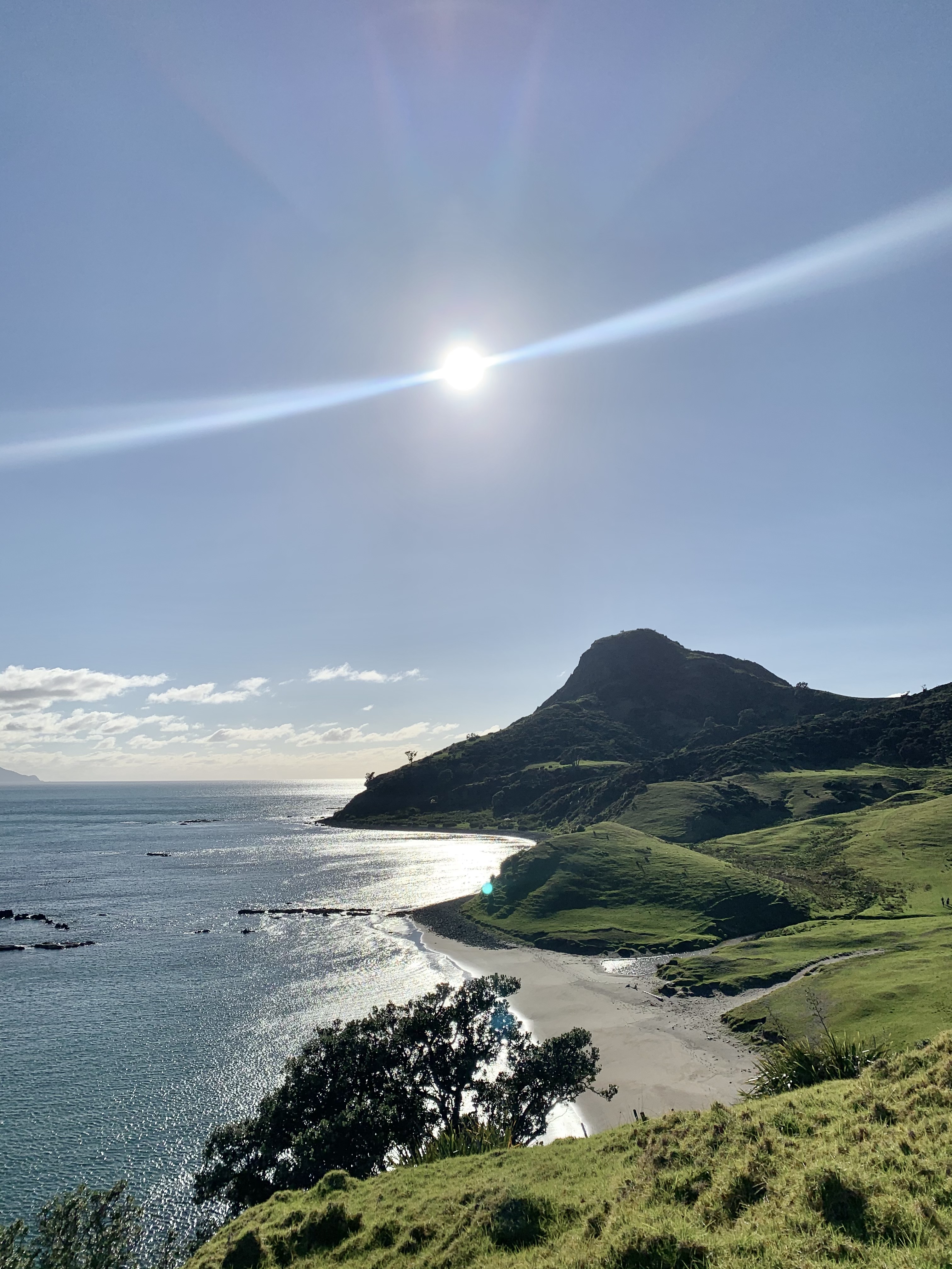
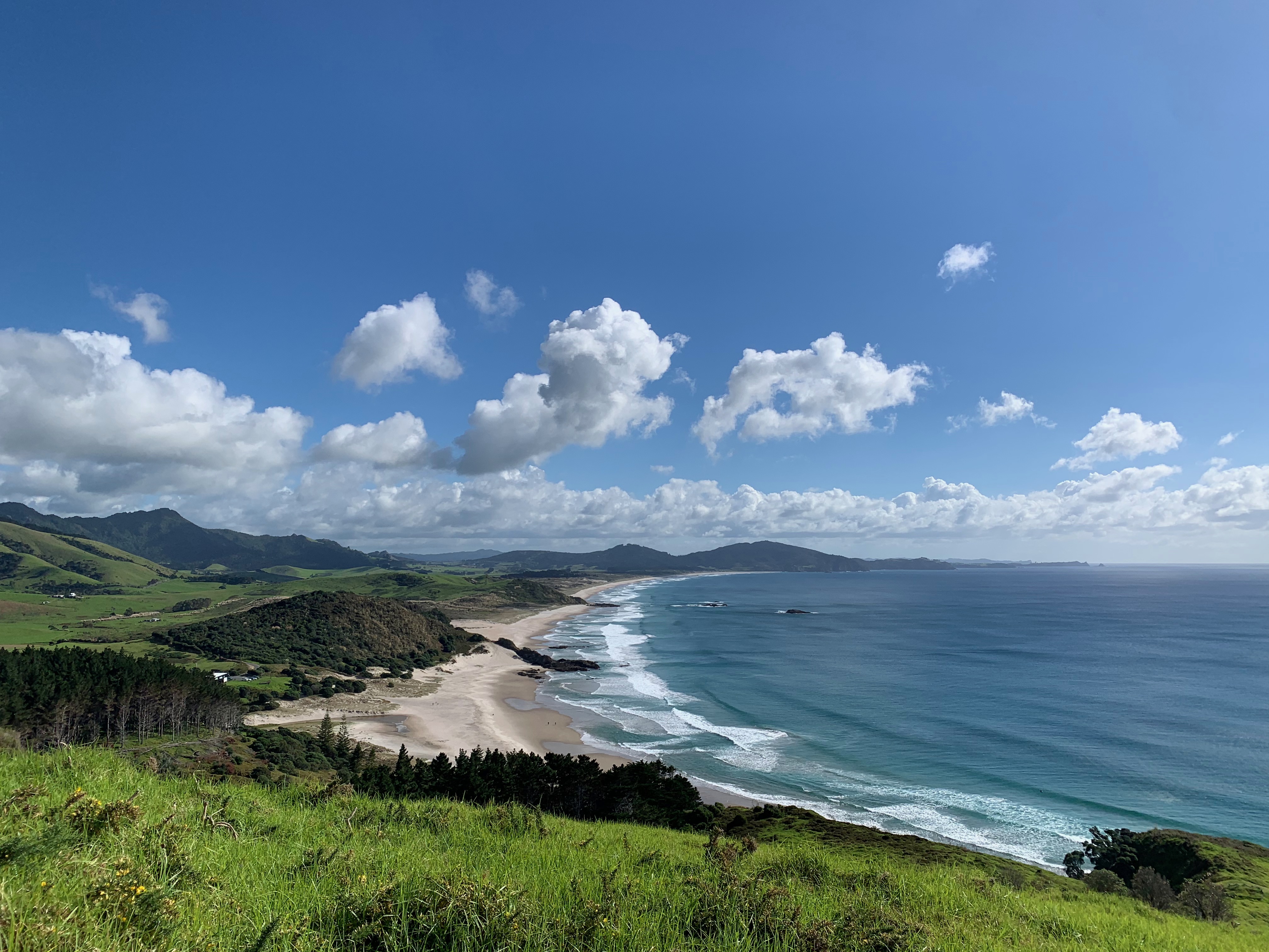
Tapotupotu Bay to Cape Reinga
Northland
3-4 hours – 10km return – Moderate
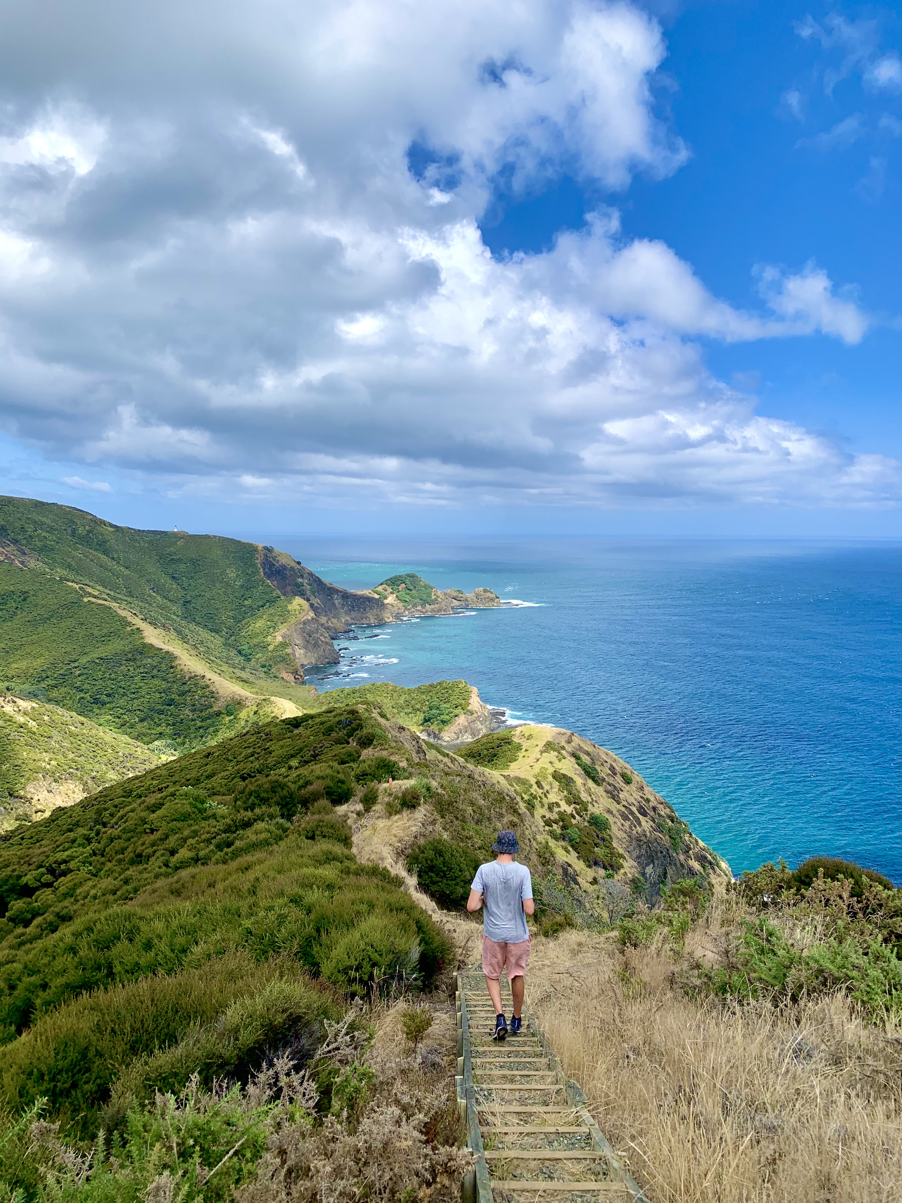
Starting at Tapotupotu Bay (one of the best places to camp in Northland – in our opinion!!), this 3-hour walking track begins with a steep climb out of the bay where you’ll be greeted with a lovely back view of the East Coast – stunning!
Other highlights of this walk include coastal views of Spirits Bay and Cape Reinga lighthouse, plus the Three Kings Islands towards the North.
Once you reach Cape Reinga (the northernmost point of New Zealand), you’ll have the chance to stroll down to the lighthouse itself, where you’ll take in the phenomenal sight of the Tasman Sea and the Pacific Ocean, meeting each other.
Then to the left, you’ll see Cape Maria van Diemen, named after the Dutch explorer Abel Tasman. To the right, you’re greeted by the beautiful arc of Spirits Bay. Once you’ve taken in all that Cape Reinga offers, you can return to Tapotupotu Bay via the same path.
If you want to explore more of the area, you can drive from Tapotupotu Bay and head up the coast to explore Ninety Mile Beach. Or, for the adrenaline junkies amongst us, visit Te Paki Sand Dunes for an exhilarating day of ‘boogie-boarding’ down the dunes!
Please keep in mind that as the Māori believe that Cape Rēinga is where the deceased depart for their final journey, it is not culturally appropriate to eat whilst you are at Cape Reinga/Te Rerenga Wairua. Fuel up before leaving or cool off at Sandy Bay – a great place to stop for lunch!
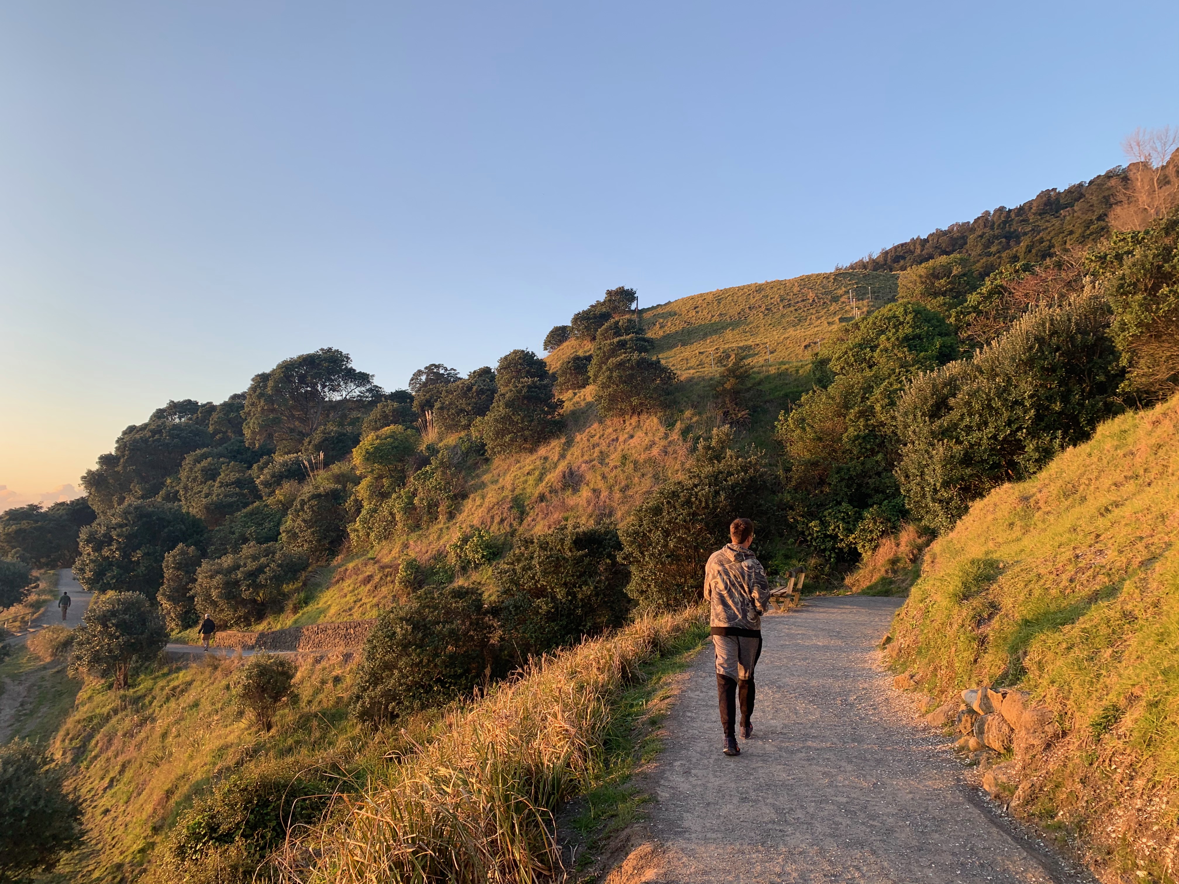
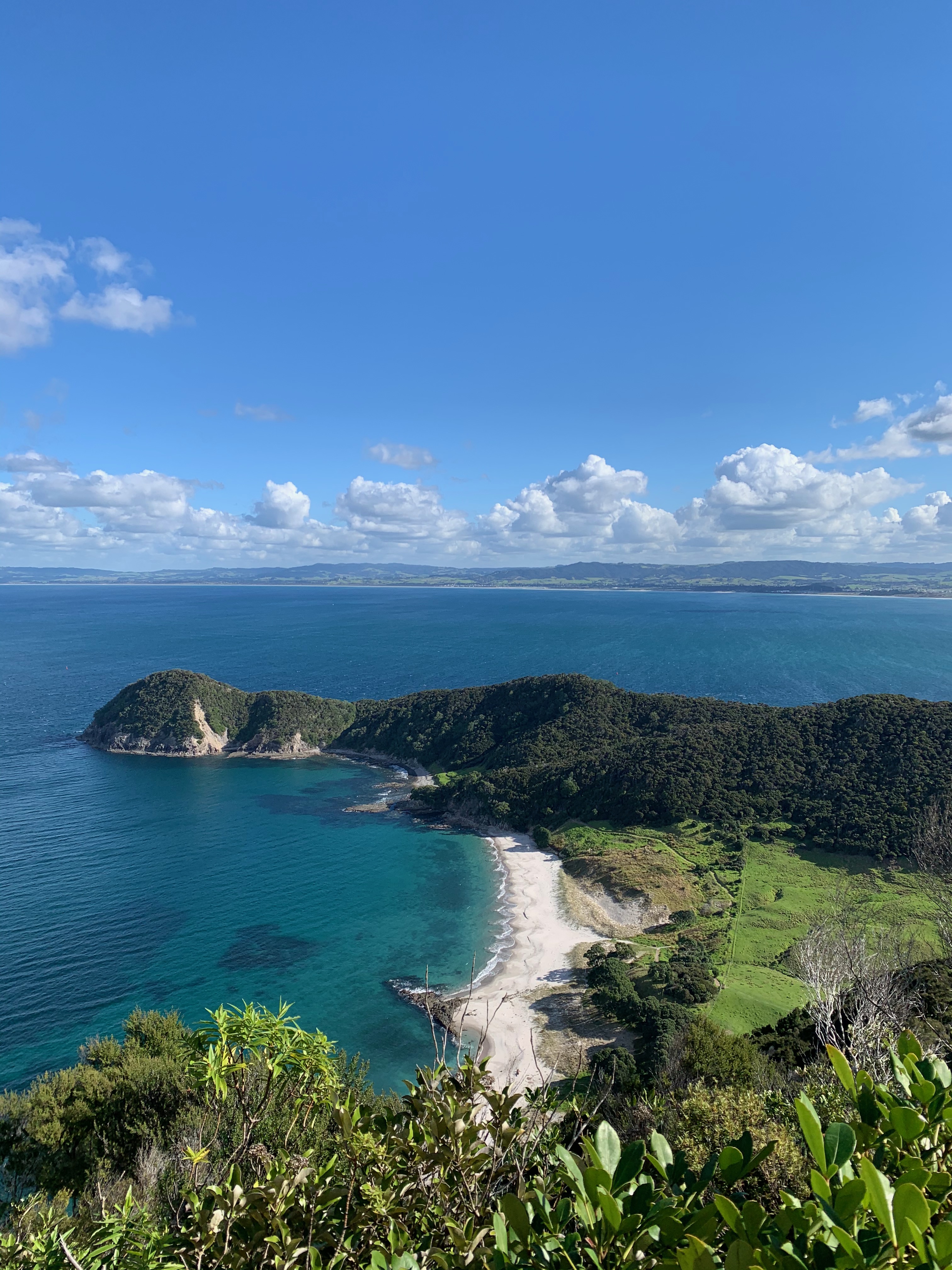
Coromandel Coastal Walk
Northern Coromandel Peninsular
7 hours return – 20km return – Moderate
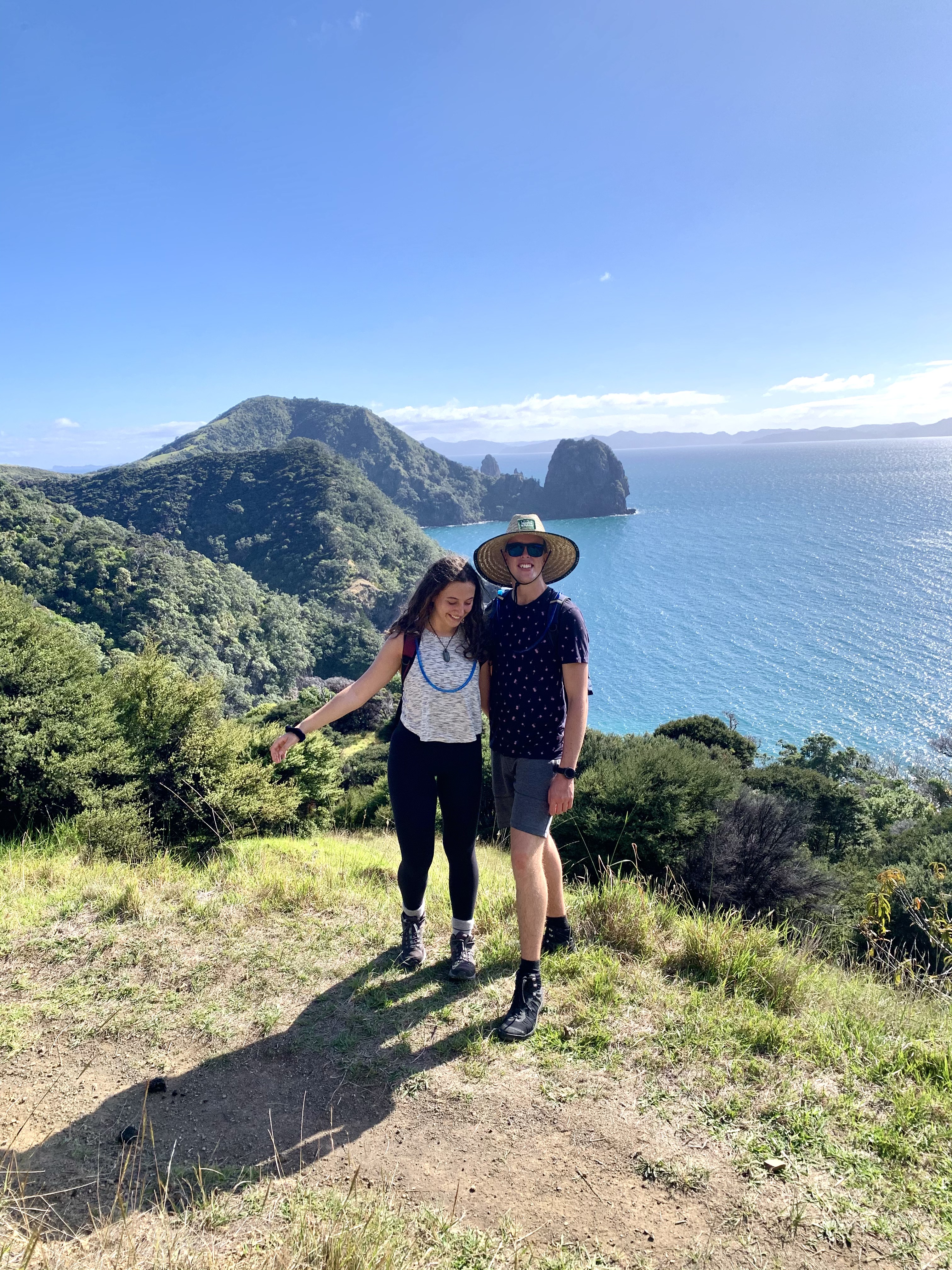
This walk is nothing short of spectacular. Named one of the best day walks in New Zealand, the Coromandel Coastal Walk gives you a chance to take in the unparalleled beauty of the Coromandel Peninsular.
Fletcher Bay and Stony Bay mark the start and finish points of the walk. You can start from either direction. However, I recommend starting from Fletcher Bay. To get there, follow Colville Road north for 31 km to Colville Bay. Then, take Port Jackson Road for 30 km to Fletcher Bay, where you can camp at the DOC campsite. Not only is this one of the best campsites in New Zealand, but I found the journey to be a lot friendlier from this direction! Starting at Fletcher Bay will see you walk through farmland before passing through the shadows of Mount Moehau, pristine native bush and along the coastline.
Before I set out along the Coromandel Coastal Walk, I hit DOC’s website to scope out the track and see what it was like. I was lulled into a false sense of security at words like ‘easy gradient’ ‘one short, steep section’ and ‘relaxing walk’. This track is not the most difficult on our list of North Island hikes, but it’s certainly not as easy as others have described! Be prepared for a long day and plenty of steep sections.
Although it’s not easy, the Coromandel Coastal Walk is one of the most phenomenal hikes on the North Island. Make sure to take a decent packed lunch and lots of water – the views you are rewarded with are well worth your efforts!
Omanawanui Track
West Auckland
2 hours – 5km – Easy
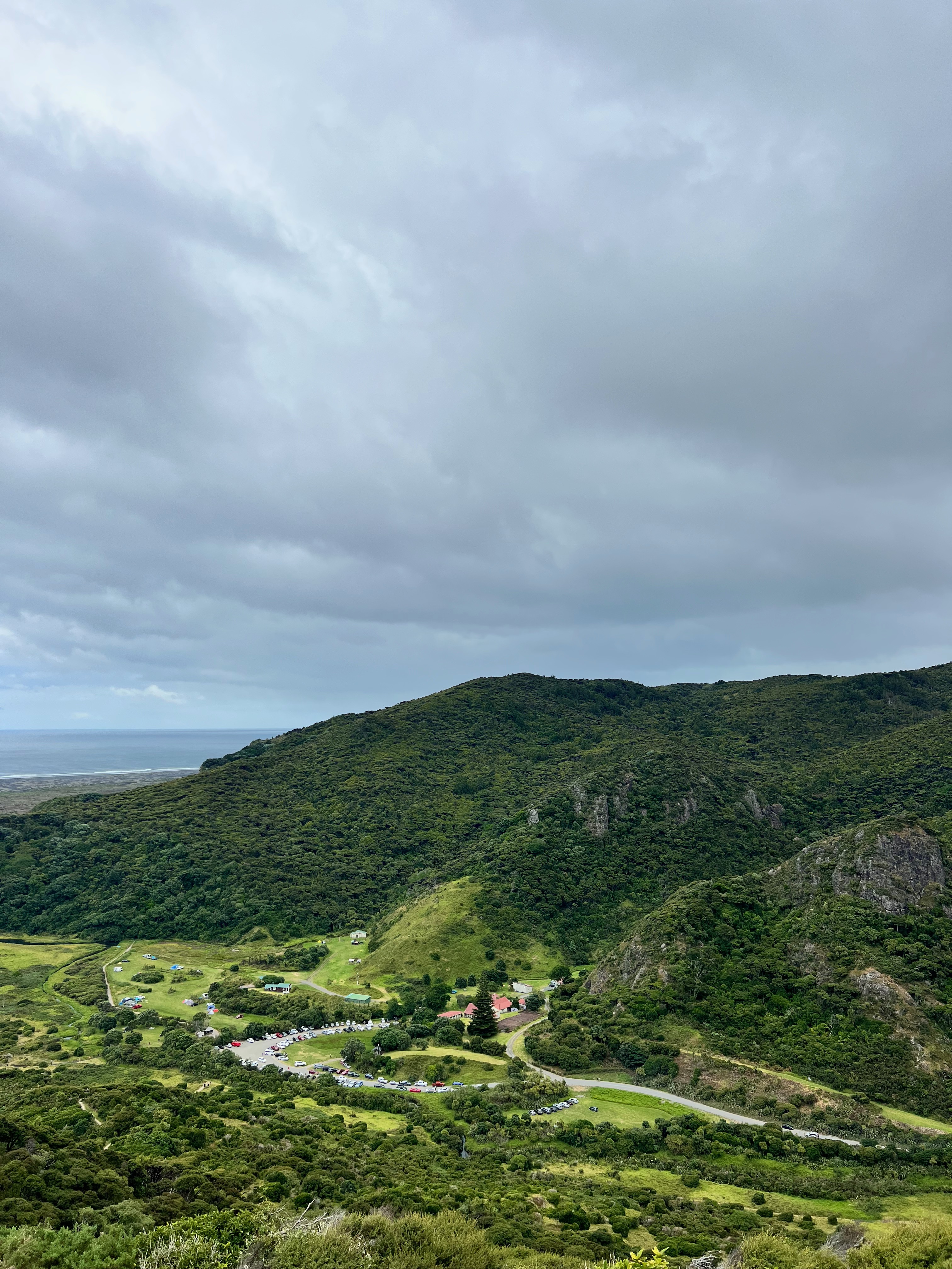
Here’s an absolute stunner in Auckland! The Omanawanui Track recently re-opened in Auckland’s Waitakere Ranges for the first time since the kauri dieback rahui in 2018.
Due to the council’s recent investment, the Omanawanui Track has had a revamp and is incredibly easy to follow. You’ll spend time winding through native bush and forest; the path is clear-cut with bridges, stairs and boardwalks.
You can start the walk from either end, but I’d recommend starting from the Whatipu Beach car park so that you are rewarded with beautiful back views. However, the road out from Huia is windy, uneven and narrow. So, make sure to take it slow!
From Whatipu Beach, the track takes you up many, many steps (tip: the views are so good that you can get away with a ‘photo op’ rather than admitting you need to catch your breath) to the first ridge.
As you follow the trail, you will descend into native bush before claiming more steps to an even more impressive lookout. It’s hard work and a good trek uphill (in some places assisted by chains), but worth it once you reach the trig station (241m). There is a beautiful viewing platform at the top where you can catch your breath, have your lunch and take in endless beautiful views of Manukau Harbour and the Whatipu seaside.
Return via the same path (the views are right in front of you this time!). If you have time, make sure you check out Whatipu Beach. This is a beautiful black sand beach with dunes, great fishing and a small beach lighthouse. Make sure to take your shoes with you in the summer as it gets hot!
Mount Maunganui
Bay of Plenty
1-1.5 hours return – 3km – Easy
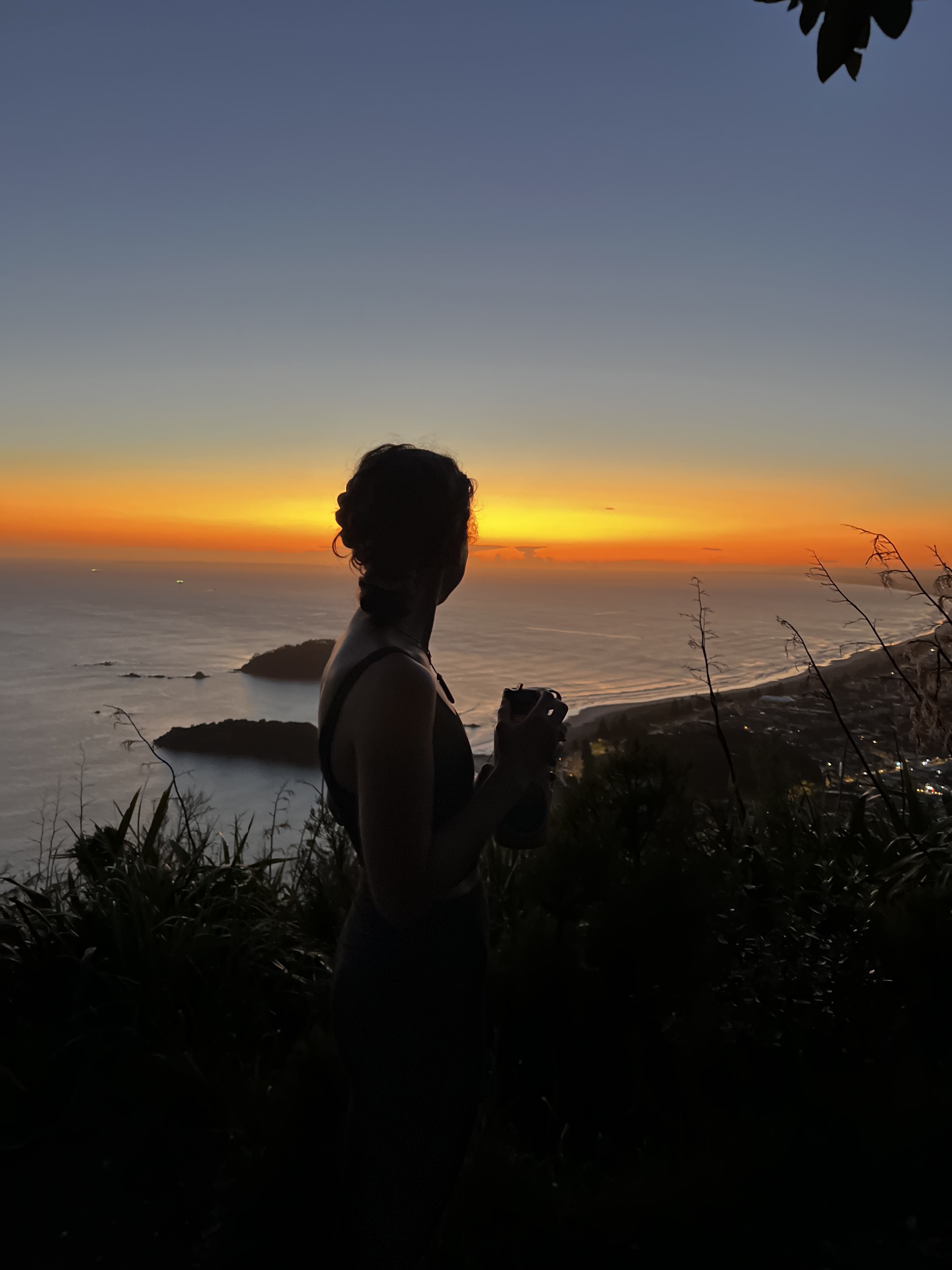

The Bay of Plenty is home to some of New Zealand’s most beautiful beaches and walks. For me, Mount Maunganui takes the cake! Also known as Mauao or the Mount, the Mount Maunganui Summit Track is one of the best walks in the region.
The track heads uphill from the beach for approximately 40 minutes before reaching the summit. If your trip is in the summer, I recommend walking early (sunrise is amazing!) as there is limited shade, and it can get hot in the January sun! As always, make sure to take plenty of sunscreen.
The walk is challenging in places, but the track takes you past the outstanding coastline, so there are plenty of places to stop, catch your breath and soak in the views. Along your walk, you’ll be treated to hoards of Mount Maunganui locals, walking and running up the mount for sport. One day, I am sure I will move here and join the mounts ‘cult-life’ following of exercise enthusiasts hell-bent on beating their summit personal best.
Once you reach the top, you are rewarded with expansive views over Mount Maunganui, Tauranga, Matakana Island and out to Papamoa. It’s an exceptional place to sit and have your lunch, morning coffee or dinner watching the sunset.
If the Mount Maunganui Summit Track may be too challenging, there is a beautiful alternative around the mount which takes approximately 1 hour and follows the shoreline.
Te Whara Track
Whangarei
5.5 hours one way (allow an extra hour if walking to Peach Cove) – 8km – Moderate
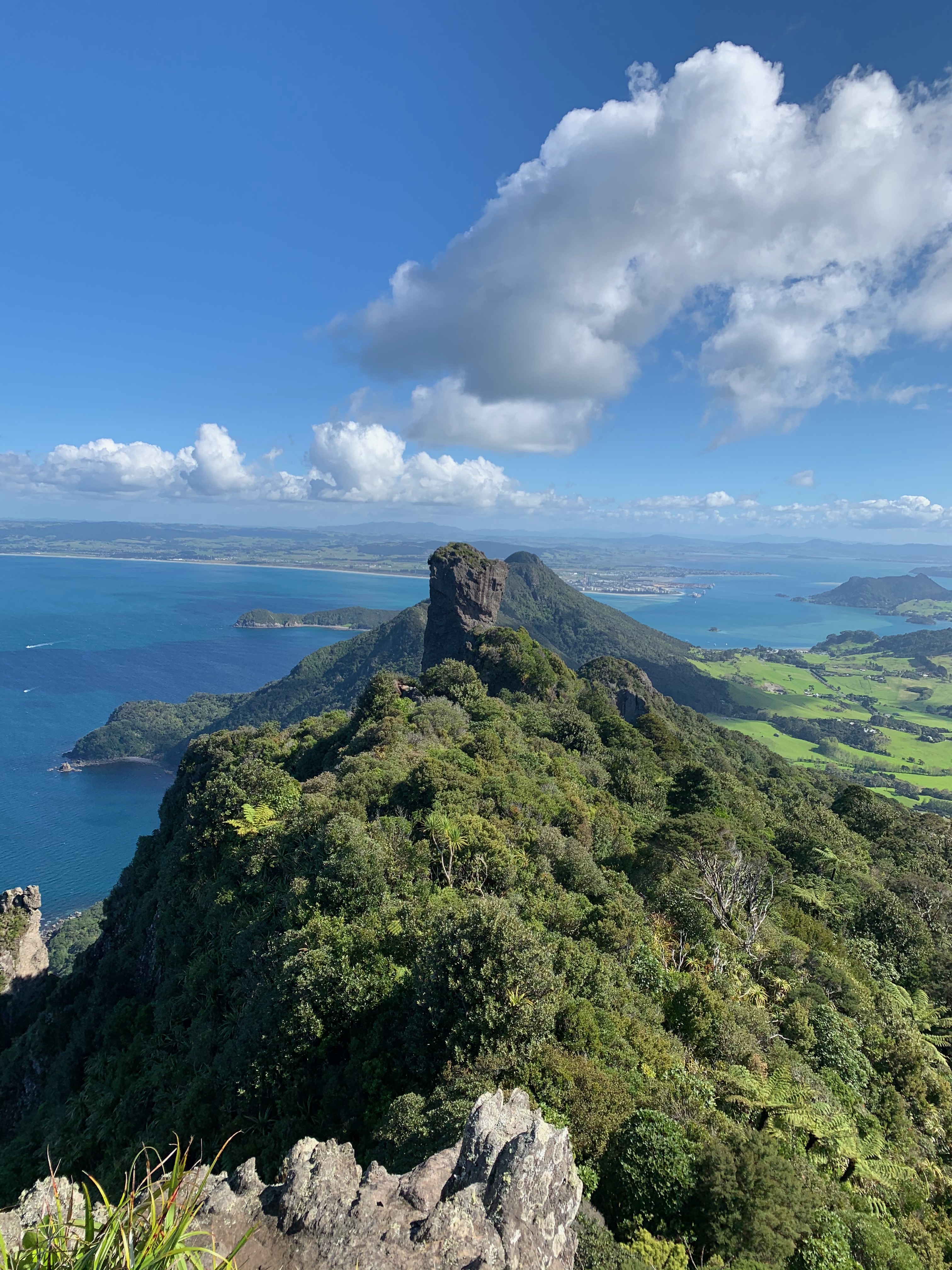
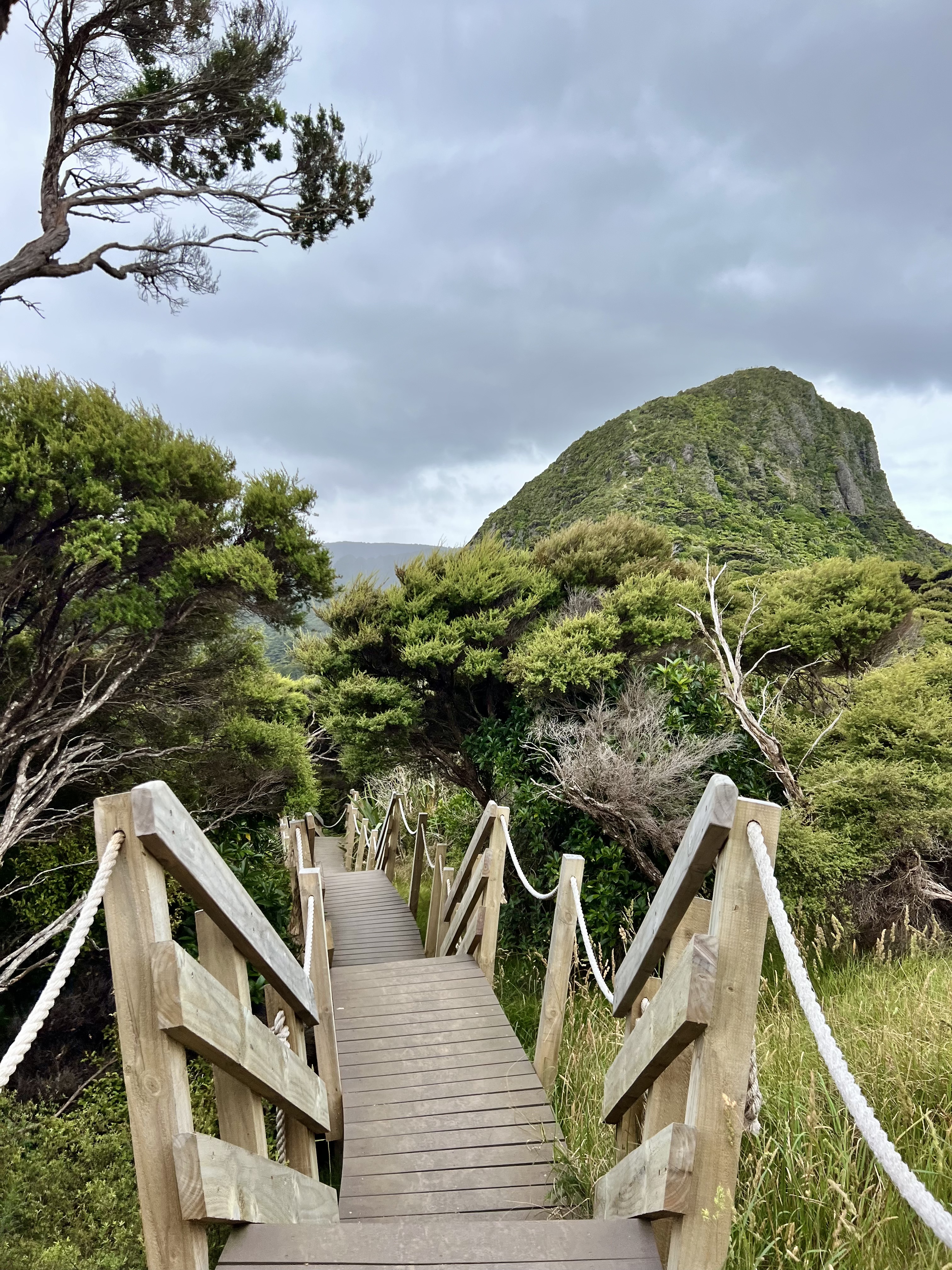
Another beautiful upper North Island walk is the Te Whara Track. Located in the Bream Head Reserve outside Whangarei, this track is a challenging one-day hike, following a 700-year-old Māori trail through thick coastal forest.
As it is a one-day hike, it’s best to attempt this walk with two vehicles! Parking at both ends of the walk (Ocean Beach and Urquharts Bay) is straightforward, and there is plenty of space for the many cars summer brings.
Starting at Ocean Beach is marginally easier (eliminating going up the heinously steep stairs out of Urquharts Bay), so we started from this side!
From Ocean Beach, you pass the ruins of a WWII radar station before attempting the steep ascent through the forest to the first ridge. On the way, you’re treated with phenomenal views of Cape Brett (Motukokako), Cape Rodney (Tawharanui), Poor Knights Islands (Tawhiti Rahi and Aorangi), the Hen and Chickens, Little Barrier Island (Te Hauturu-o-Toi) and Great Barrier Island (Aotea Island).
Once you’ve climbed the ridge, the track continues for another 30 minutes before you reach the Te Whara Summit. Scrambling up the rocky peak isn’t for the faint of heart. The views are well worth the challenge. I’m terrified of heights and found it a challenge, but I am so pleased I did it! There is space for you to sit down and have your lunch – on a clear day, the 360-degree panoramic views are unlike anything I have seen.
Once you’ve caught your breath and taken in the view, you will begin your descent to Urquharts Bay. The track becomes easy-going and undulating through native bush. Half way through, you will come to the Peach Cove Hut turn-off – a worthwhile detour in the summer, but make sure you have the stamina as you will be greeted with a steep, 800-step climb back up to the main track! From Peach Cove, the path continues to wind through native bush before reaching Mount Lion and descending steeply on well-maintained stairs.
This track is one for your bucket list, but make sure to pack plenty of water, snacks and a hearty lunch!
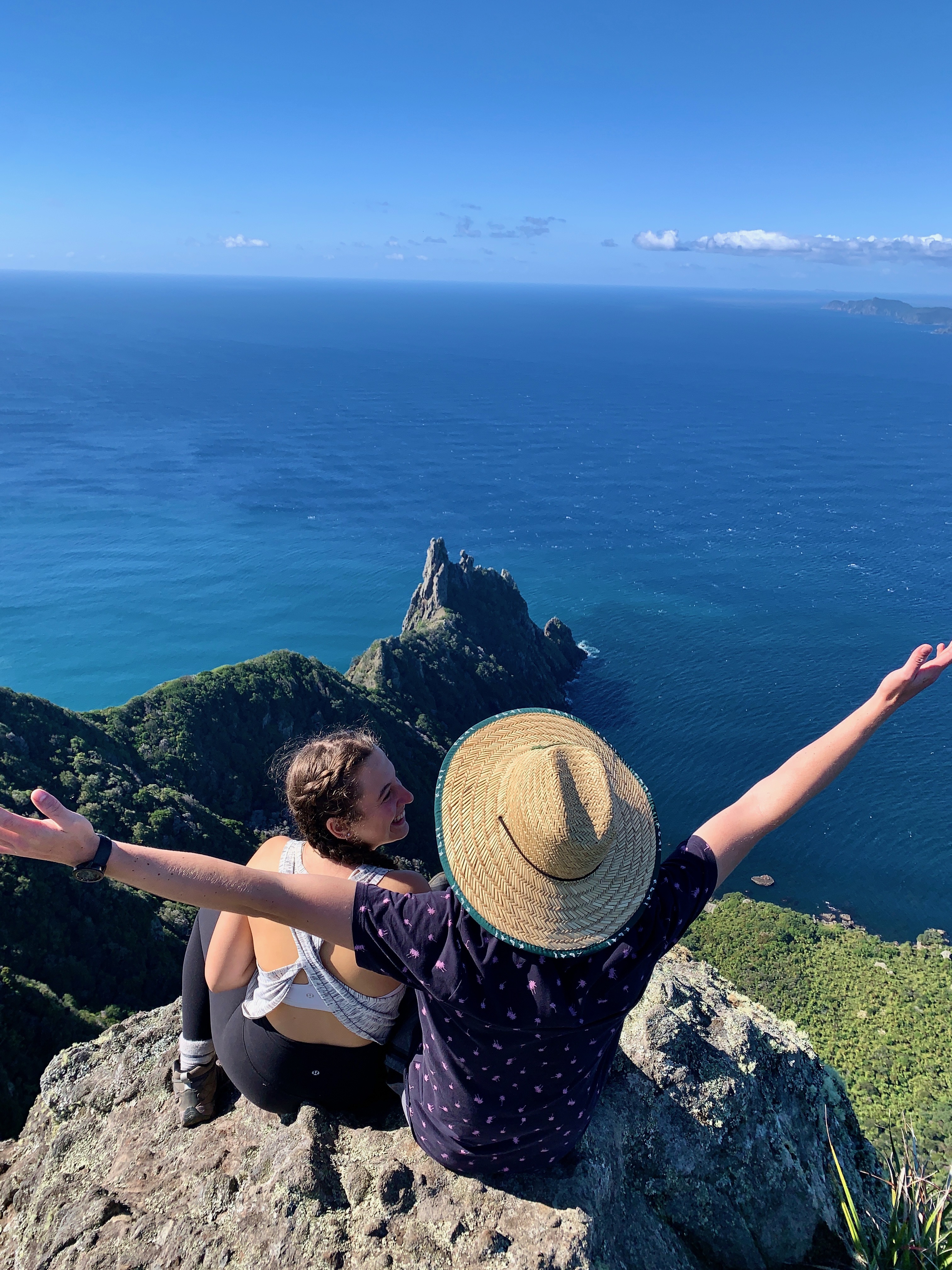
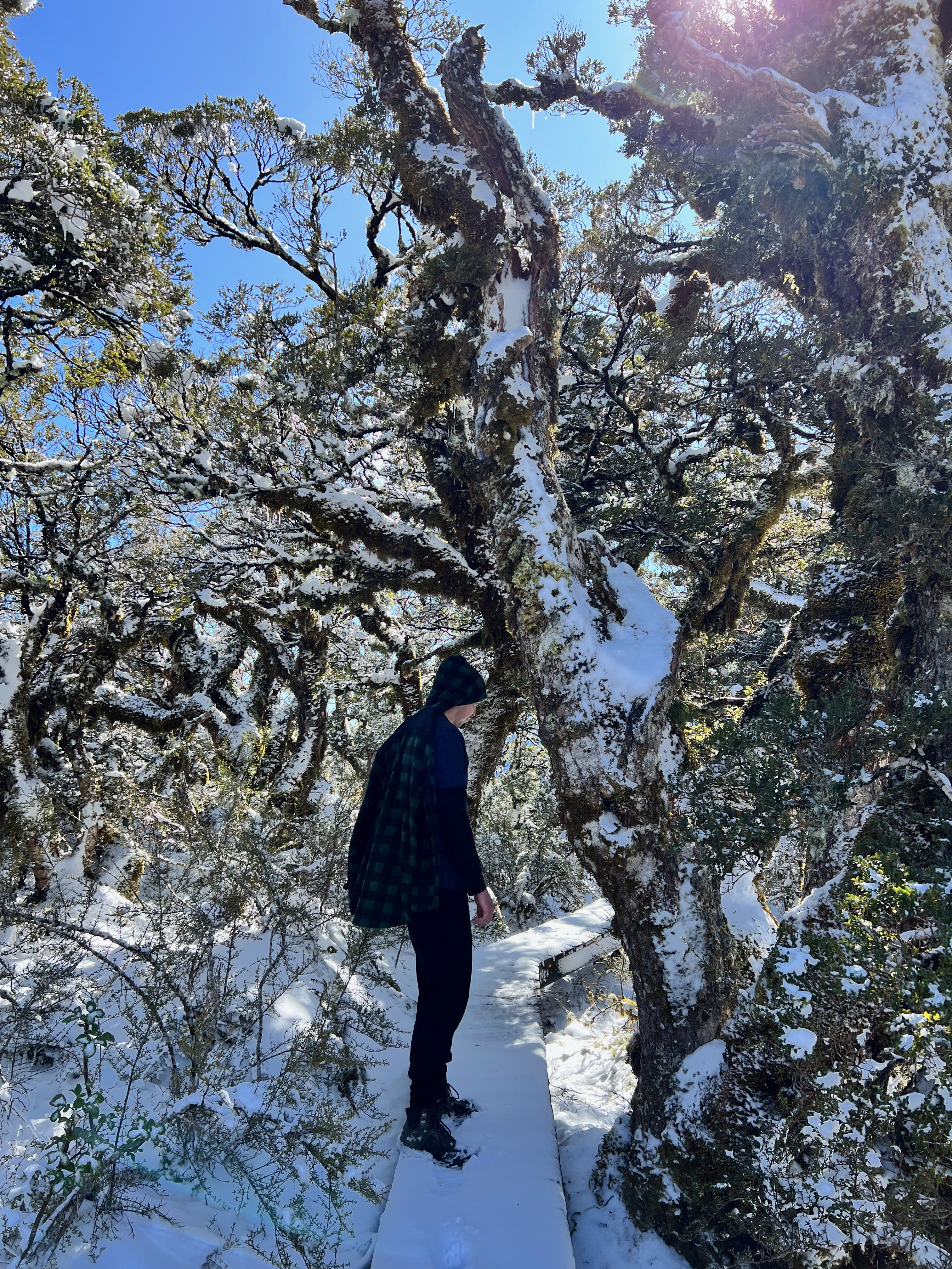
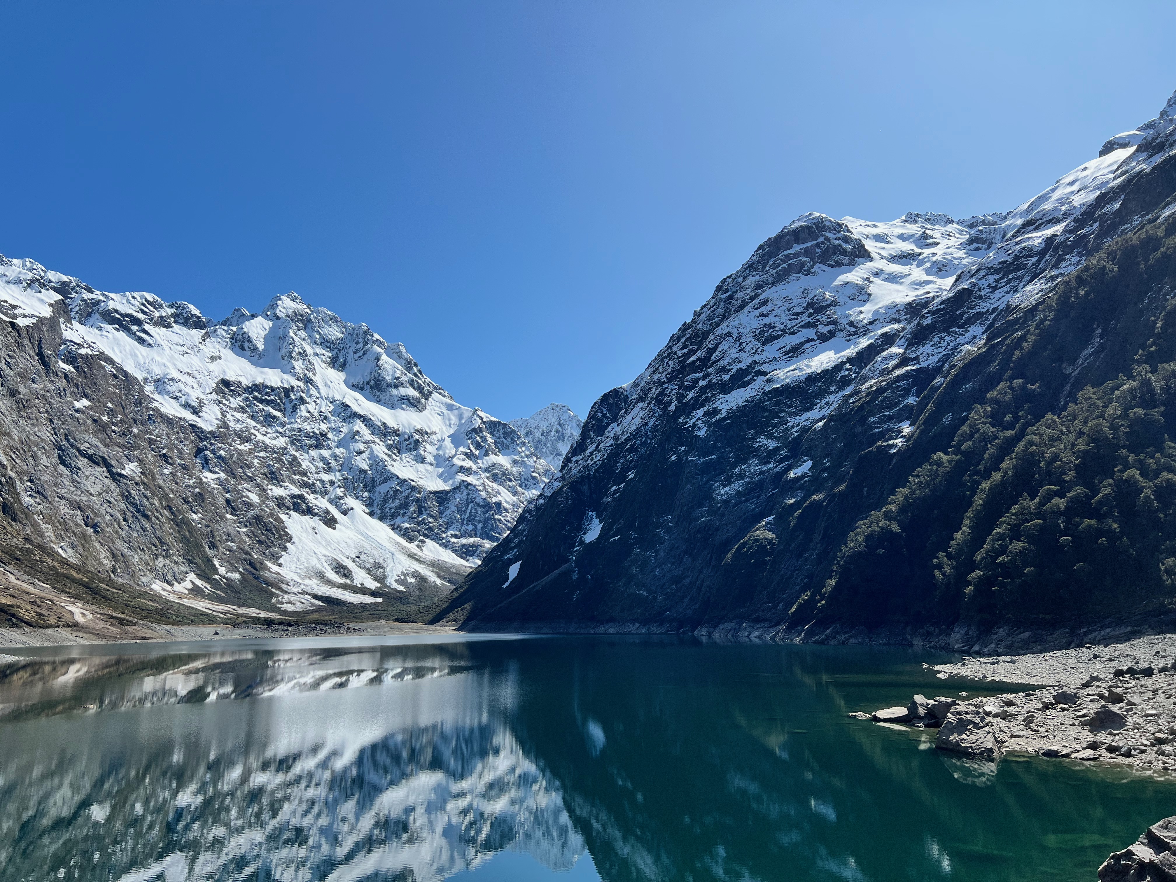
Key Summit
Fiordland
3 hours return – 8.2km – Easy
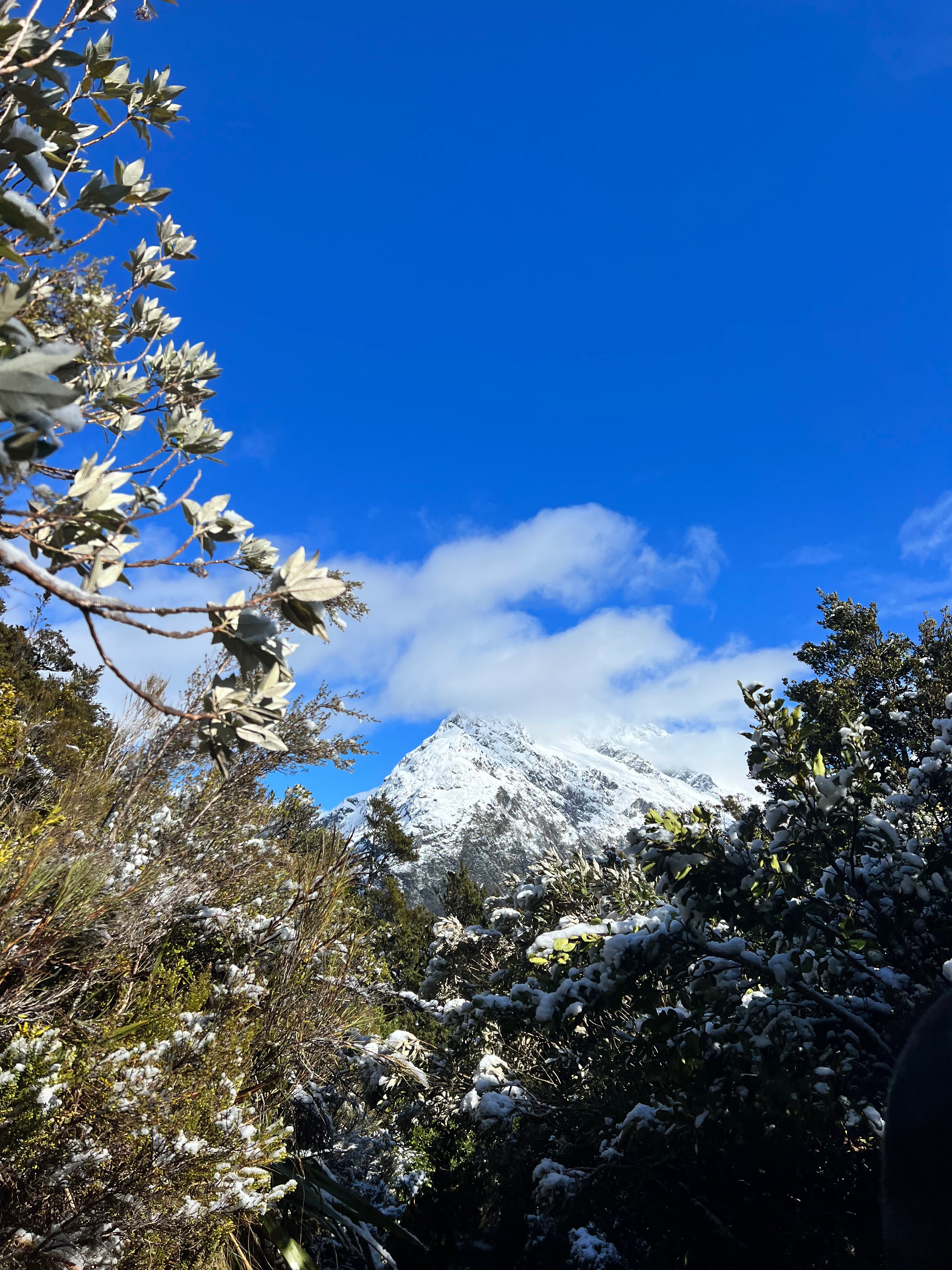
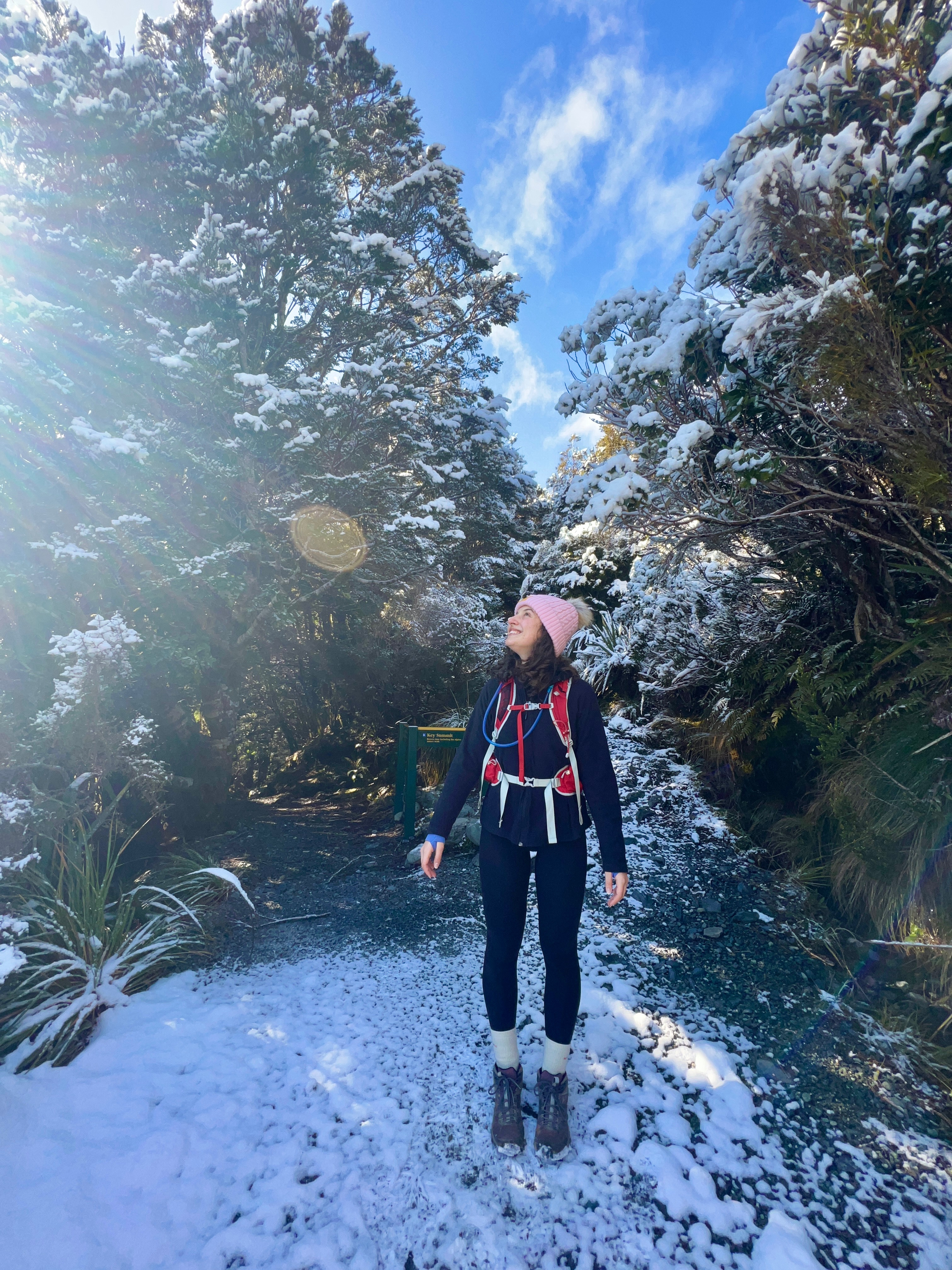
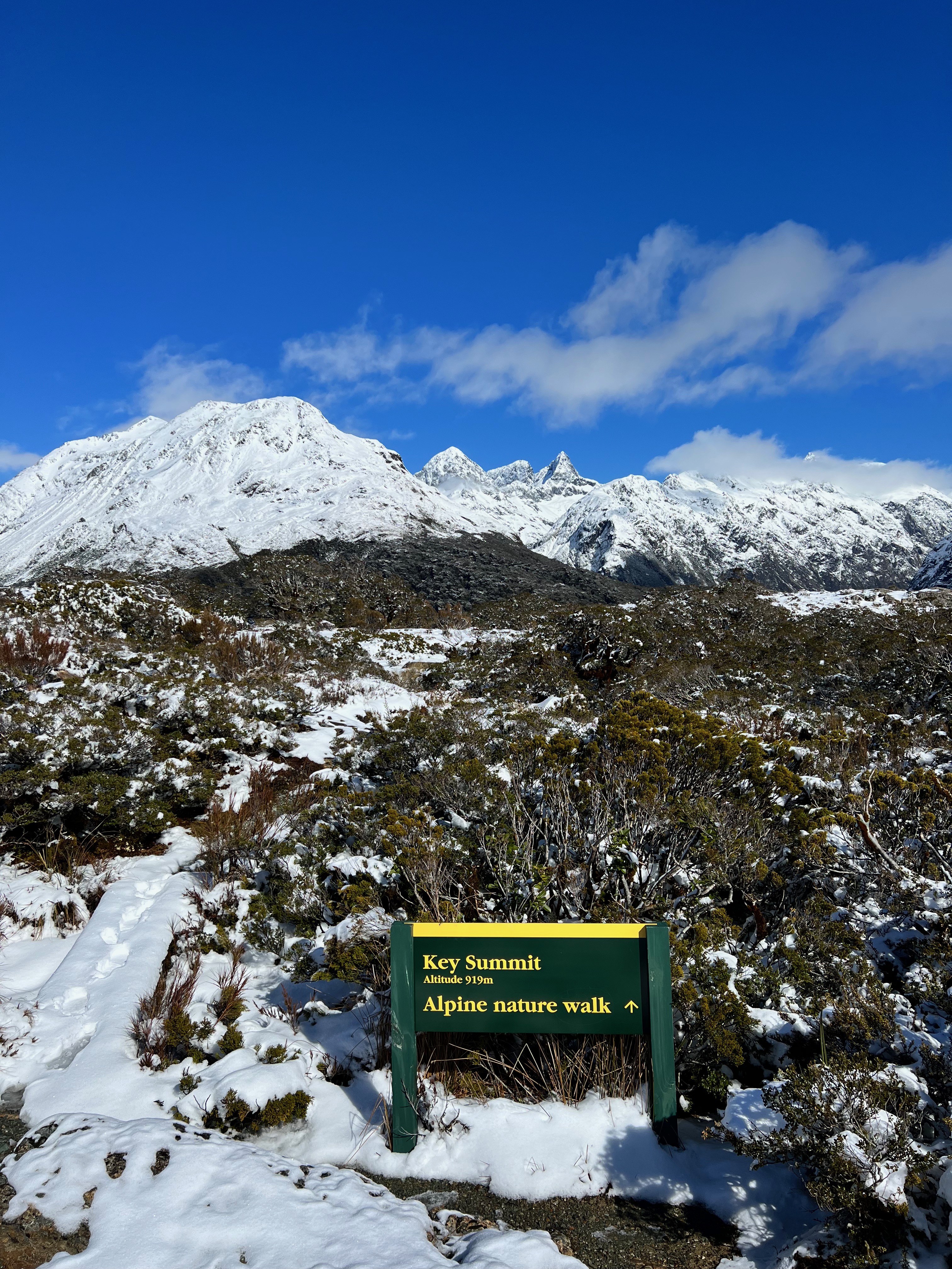
I’m kick-starting the list of the best walks on the South Island with one of the best short hikes in New Zealand. Although there is approximately 450m of elevation, it is never steep. You can comfortably complete the track in around 3 hours with a break for lunch.
Starting at The Divide as part of the more extensive, multi-day Routeburn Track, Key Summit will take you through approximately 2.5km of extraordinary mossy forest. This offers some much-needed shelter from the harsh New Zealand sun before the trail flattens, and you are greeted with spectacular views of mountain tops. From this point, it’s just 700m to the Key Summit Alpine Nature Walk (the views only get better as you get higher!). The track continues the switchback, but at no point is it overly steep, and you’ll soon be treated to toilets with the world’s best view! Like most day walks in New Zealand, the bathrooms usually have toilet paper, but I also like to be on the safe side and bring my own.
It took us just under an hour to reach the Key Summit Alpine Nature Walk. This section of the track is a short, scenic walk that takes you in a loop around the summit. In the summer, you can see a boardwalk. However, we visited in the early spring, so snow covered the ground. We followed the DOC ranger’s footsteps!
Once you reach the top, you’ve got 360-degree views of mountain ranges and Lake Marian (although it’s a very distant view). Make sure to spend some time at the top, soaking in the sights and having lunch before retracing your steps along the same path back to the car park.
Key Summit is the one hike I will recommend time and time again to anyone visiting Fiordland and Milford Sound. So, be sure to check it out! The easy terrain and spectacular alpine views make it a treat for all.
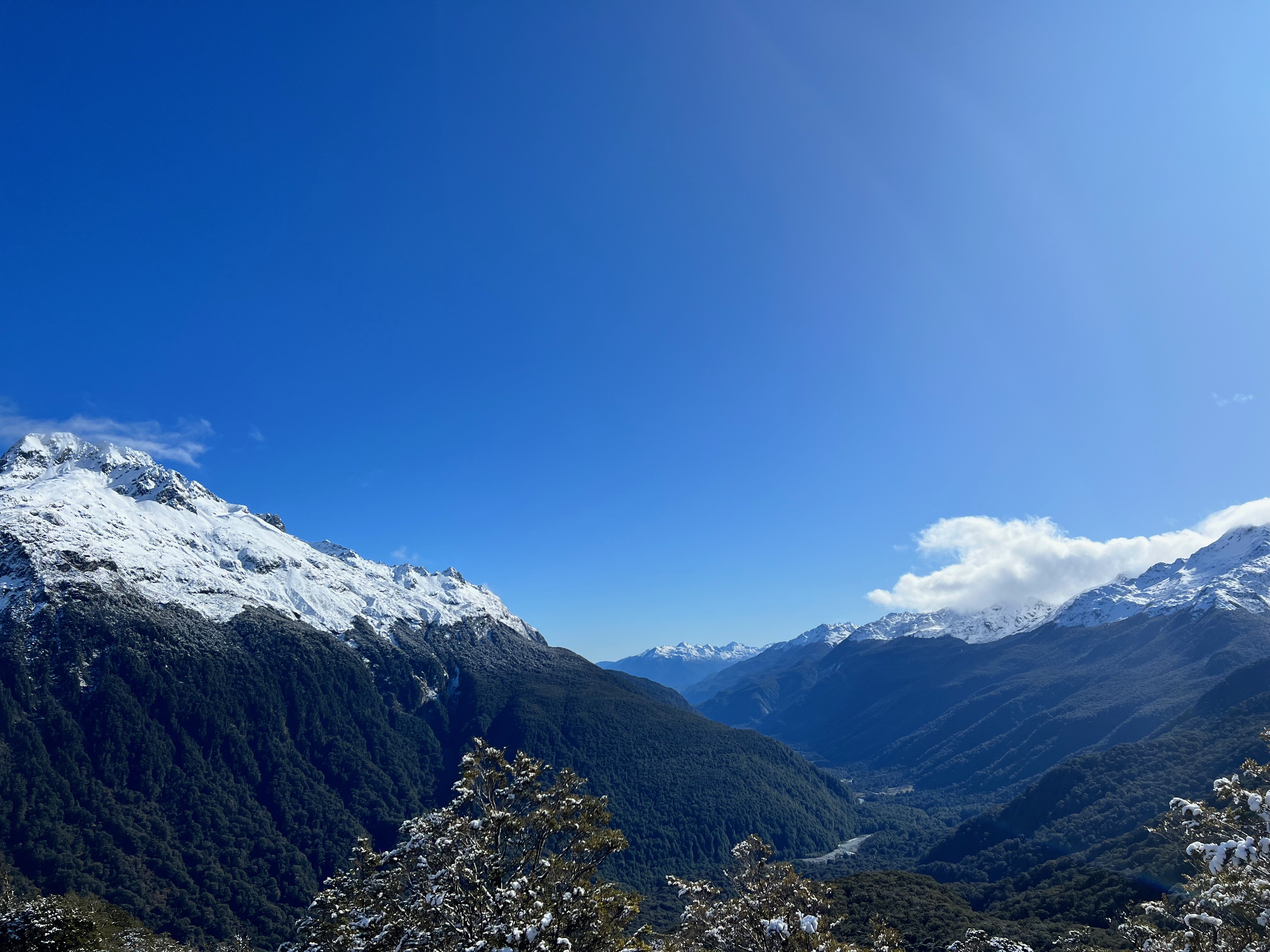
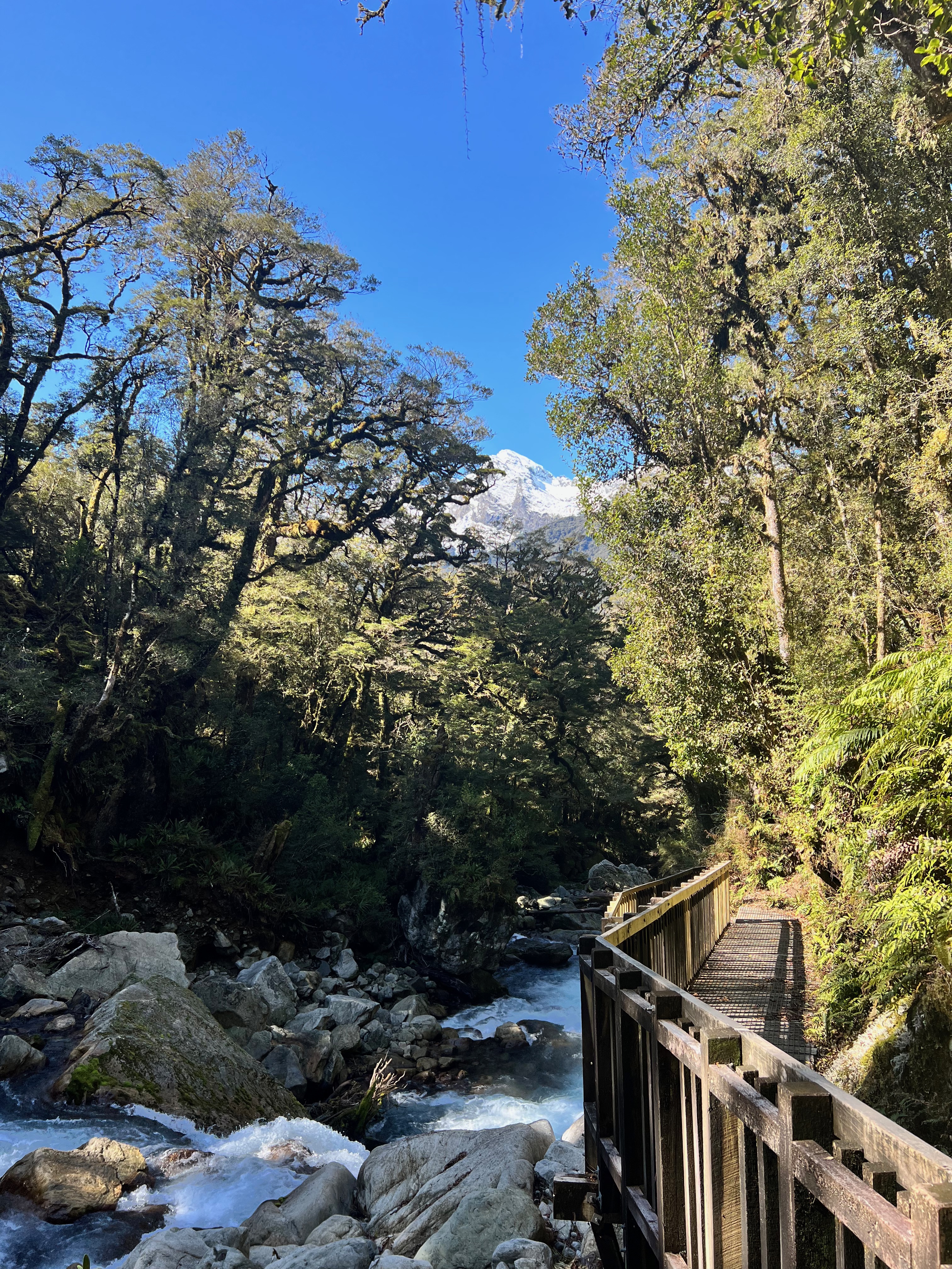
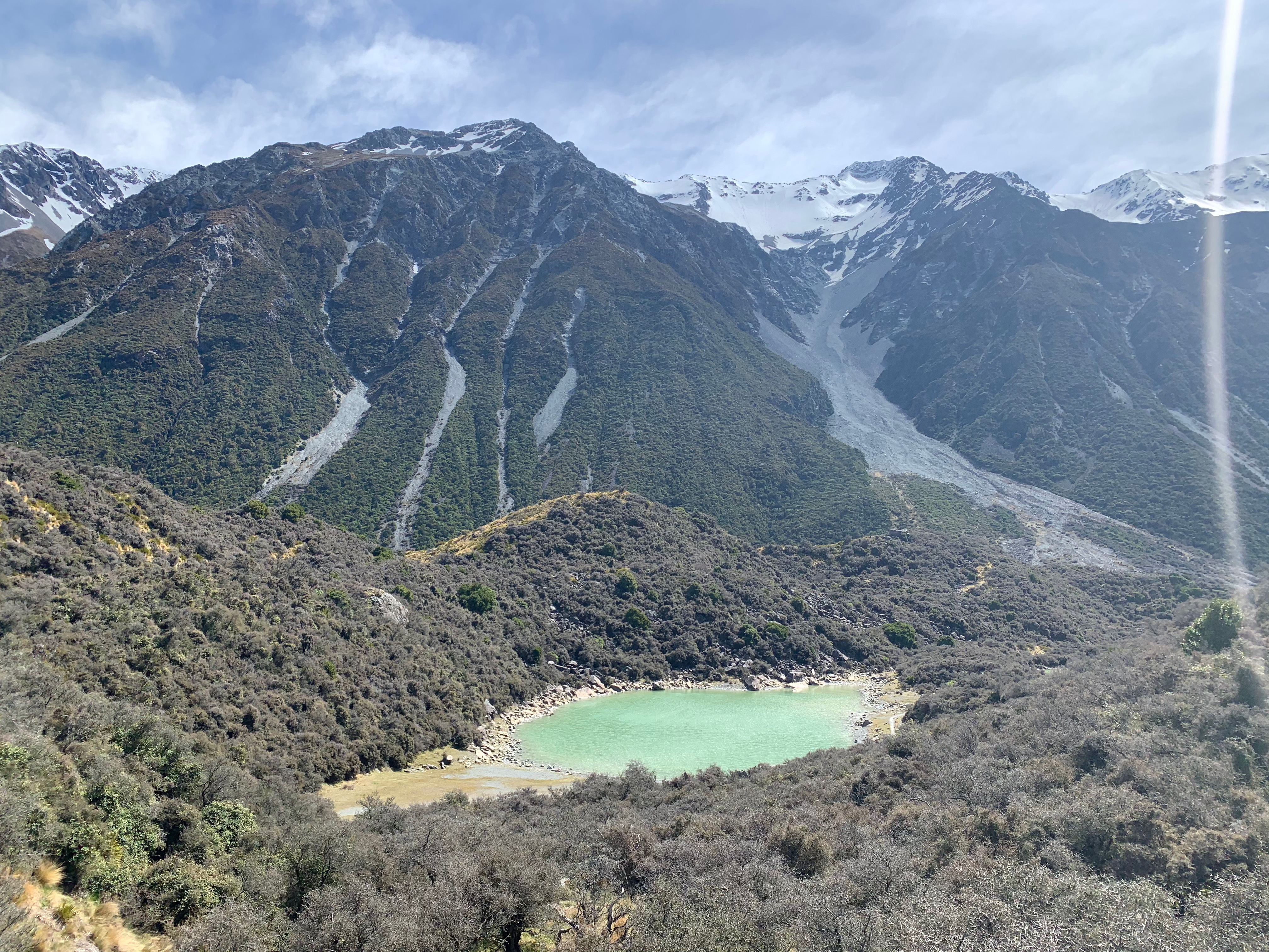
Lake Marian
Fiordland
3 hours return (plus an hour at the lake) – 6km – Moderate
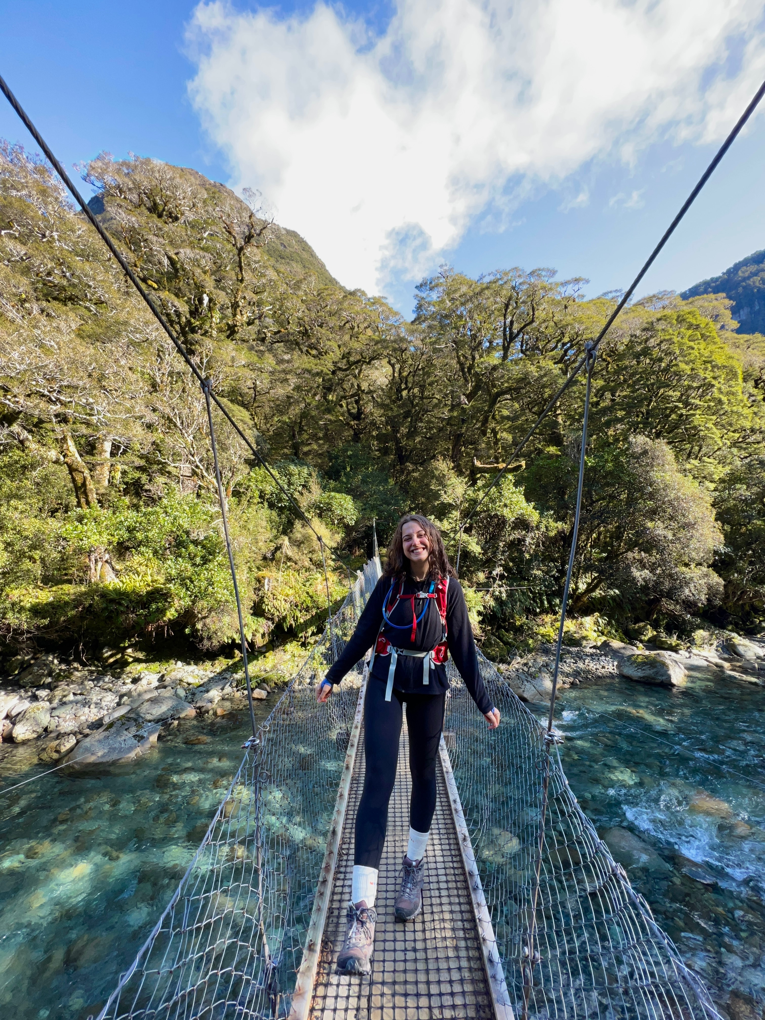
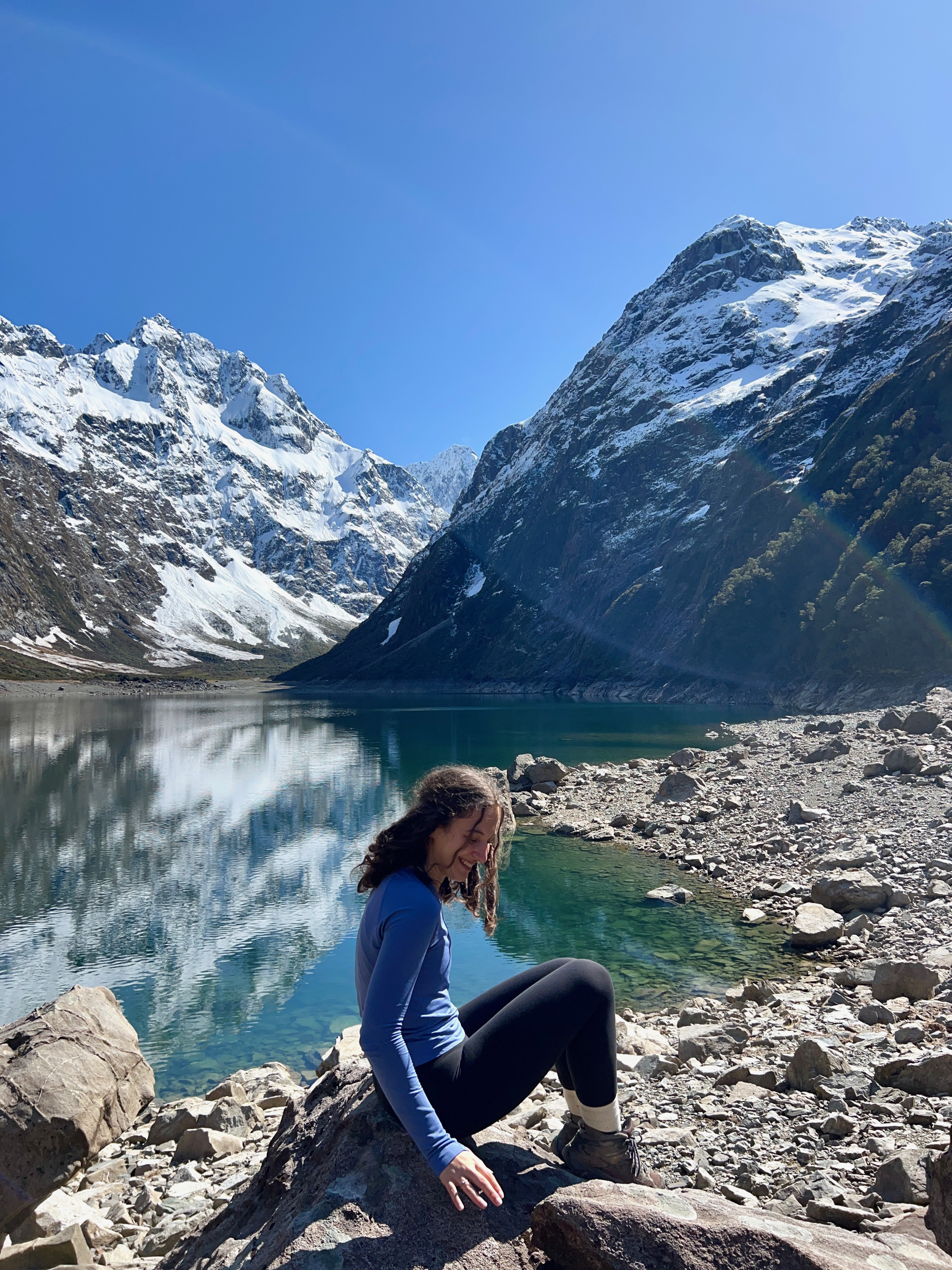
Another incredible hike on Milford Road is the beautiful Lake Marian. If you have already completed Key Summit, you will have had a little peek at this beautiful glacial lake. One morning, years ago, I was scrolling through Pinterest, looking at photos of New Zealand travel. I came across Lake Marian, and it became etched in my mind – I was on a mission to get down to Fiordland and tackle this hike and was thrilled to tick it off my bucket list late last year!
Starting from Hollyford Road, the beginning of the Lake Marian track will take you over swing bridges and across a well-paved boardwalk. After about ten minutes of easy walking, you will come to the Marian waterfalls and a beautiful lookout.
Once you venture beyond the waterfalls, the track becomes uneven and steep in sections. Although I never found it very strenuous and was not out of breath, the track has very few flat/downhill sections. I would recommend having a good level of fitness and balance before attempting this hike. However, it is never technical, and your route is marked with bright orange arrows, so you will never lose your way.
The track continues to be steep and uneven until you reach a clearing a few meters before Lake Marian comes into view. I had to take a few deep breaths here – the suspense and excitement were killing me! The lake provides a beautiful place to stop and have lunch, catch your breath and take a few photos. There are some iconic photo locations around the lake – we walked around the lake to the right to snap the picture above.
It’s worth mentioning that as we travelled to Fiordland in September, the weather was good (although there was a slight amount of snow underfoot). However, the track may be slippery and muddy in sections if you are travelling in the winter. Make sure to wear proper footwear and take care. Also, walking around the lake’s perimeter is not recommended in the winter due to the avalanche threat.
After spending some time by the lake, retrace your footsteps along the same path to the car park. I found the way back a lot easier as it is mostly downhill, but still, be sure to take care as it can get slippery!
I loved this hike, and Lake Marian truly lived up to every single one of my expectations.
Roys Peak
Wanaka
6 hours return – 16km – Moderate to hard
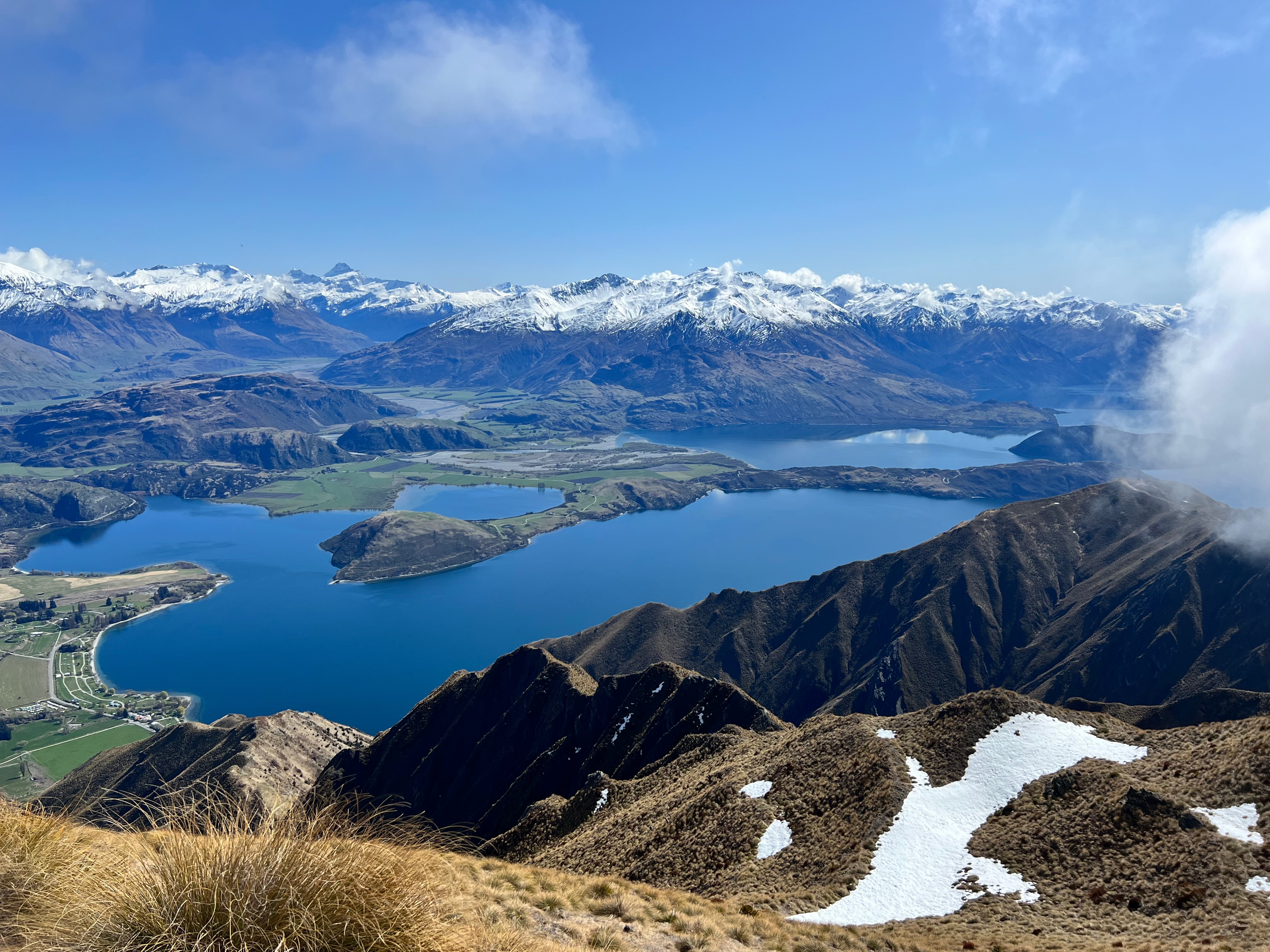
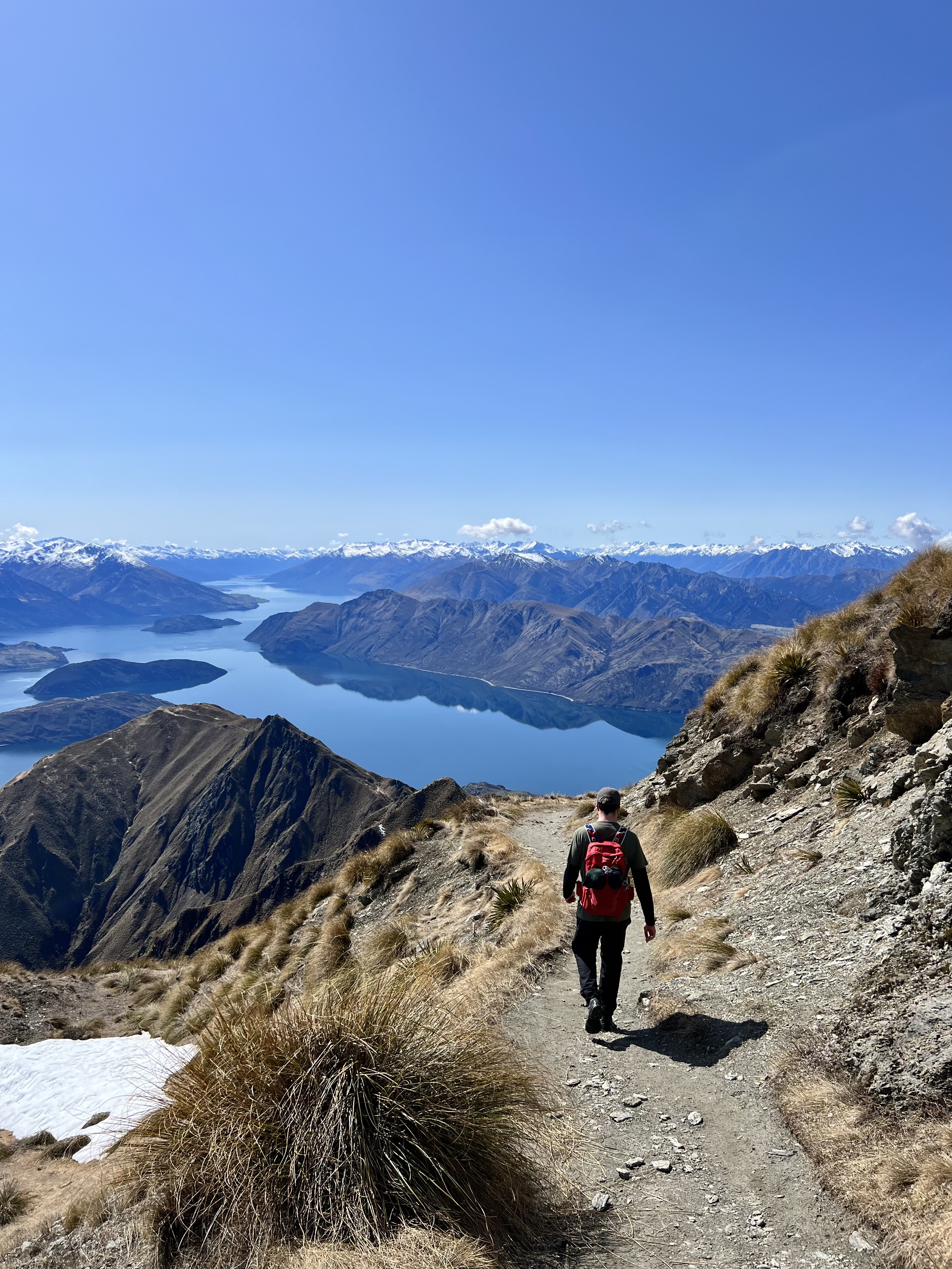
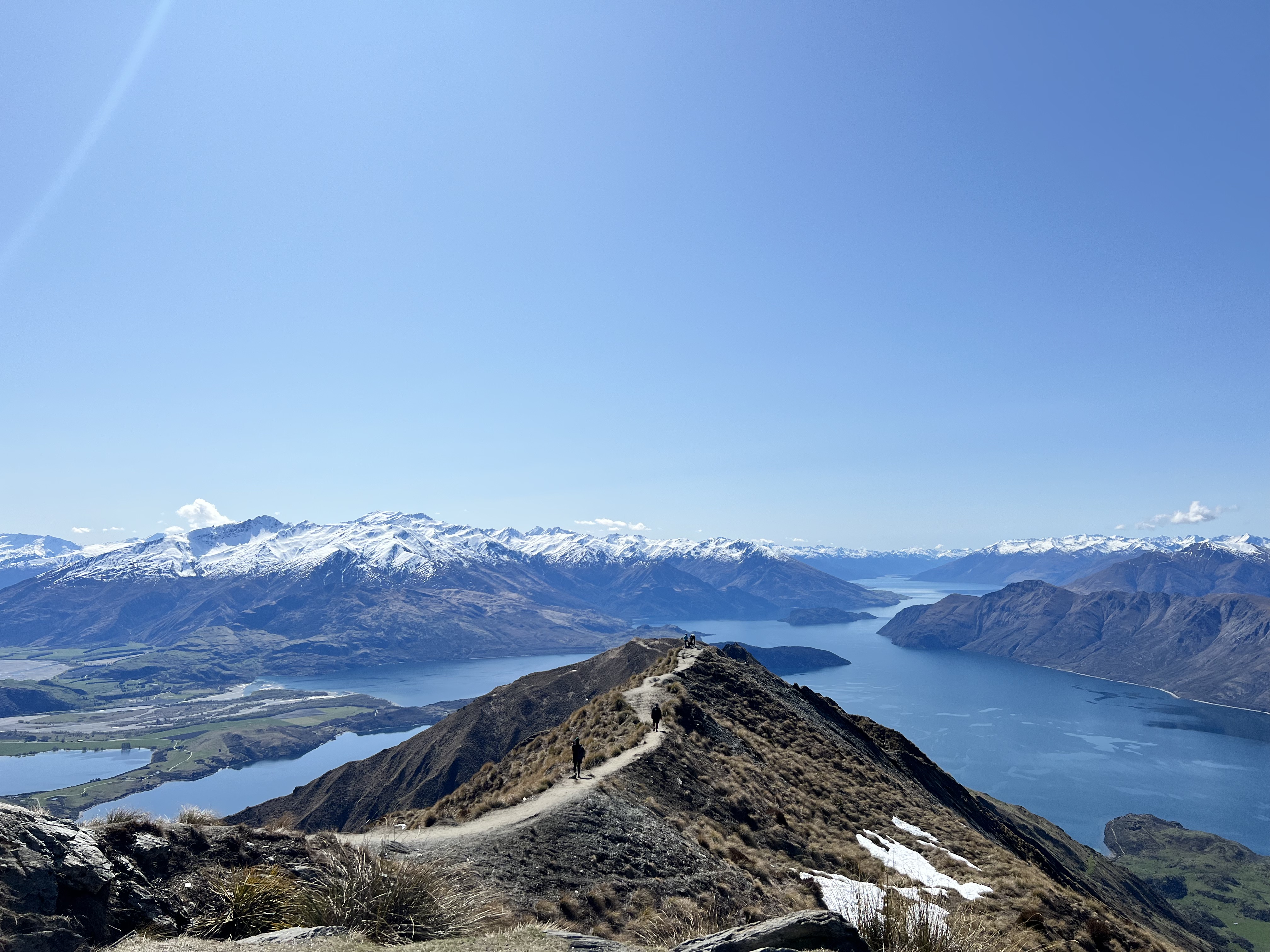
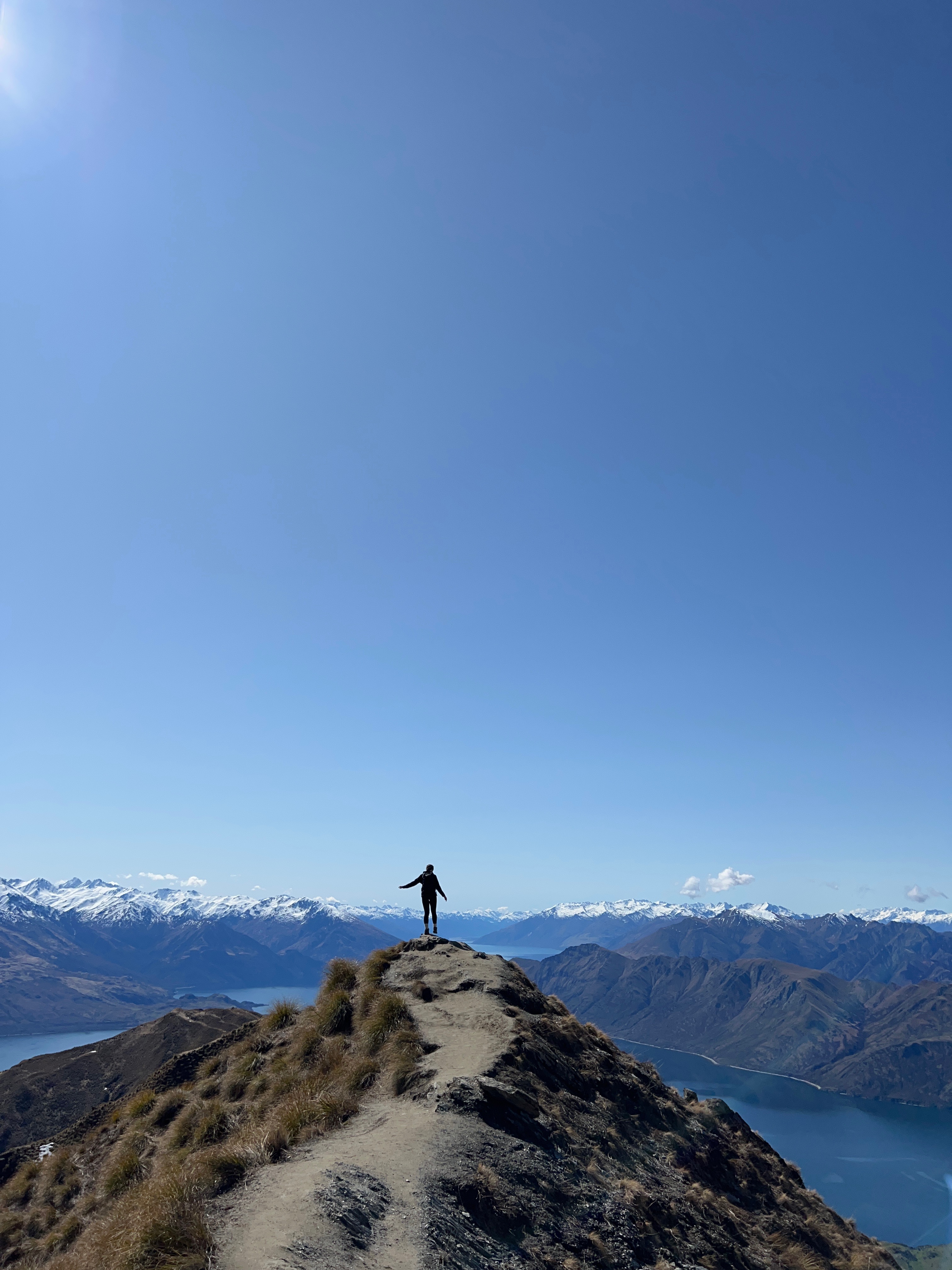
If you’ve spent any time scrolling through photos of New Zealand on Instagram, then you will have come across the iconic view of Lake Wanaka from Roys Peak. Dubbed the most’ Instagram worthy’ location in the South Island, a photo at the edge of Roy’s Peak sees visitors queueing up and is one of the most photographed places in Aotearoa. Luckily, we went in the shoulder season, so the weather was mild, and the queues had subsided. If you’re visiting in the summer, start early to avoid crowds.
You can get to Roys Peak easily from Wanaka, and there is a large car park at the track’s base. Bring your $2 gold coin donation per person to maintain the track!
This hike is not to be underestimated. Although the walk is not technical, it is challenging, and the first half of the walk sees you climb 8km of steep inclines with a total elevation gain of 1300m. However, you will be OK with a few breaks, enough water, and a packed lunch. Despite the challenging amount of uphill climbing, the track is really well-maintained and incredibly easy to walk on.
Before you reach the summit, you arrive at the iconic Roys Peak photo stop. This location is also conveniently home to the world’s smallest toilet (often toilet paper is available, but I’d recommend taking your own to be on the safe side). As you begin your final ascent to the top, you’ll be met with a last steep section before you reach the summit and are rewarded for your efforts with extraordinary views over Lake Wanaka, Treble Cone and, on a clear day, out to Mount Aspiring National Park.
We started our hike at 7 am and reached the summit just before lunch. Next time, I’d love to go for sunrise!
Before you attempt Roys Peak, note that the track is closed for lambing from the 1st of October till the 10th of November each year. Also, in winter, you will need to carry and be able to use alpine equipment such as an ice axe and crampons. Attempting the track in winter is only recommended for experienced hikers.
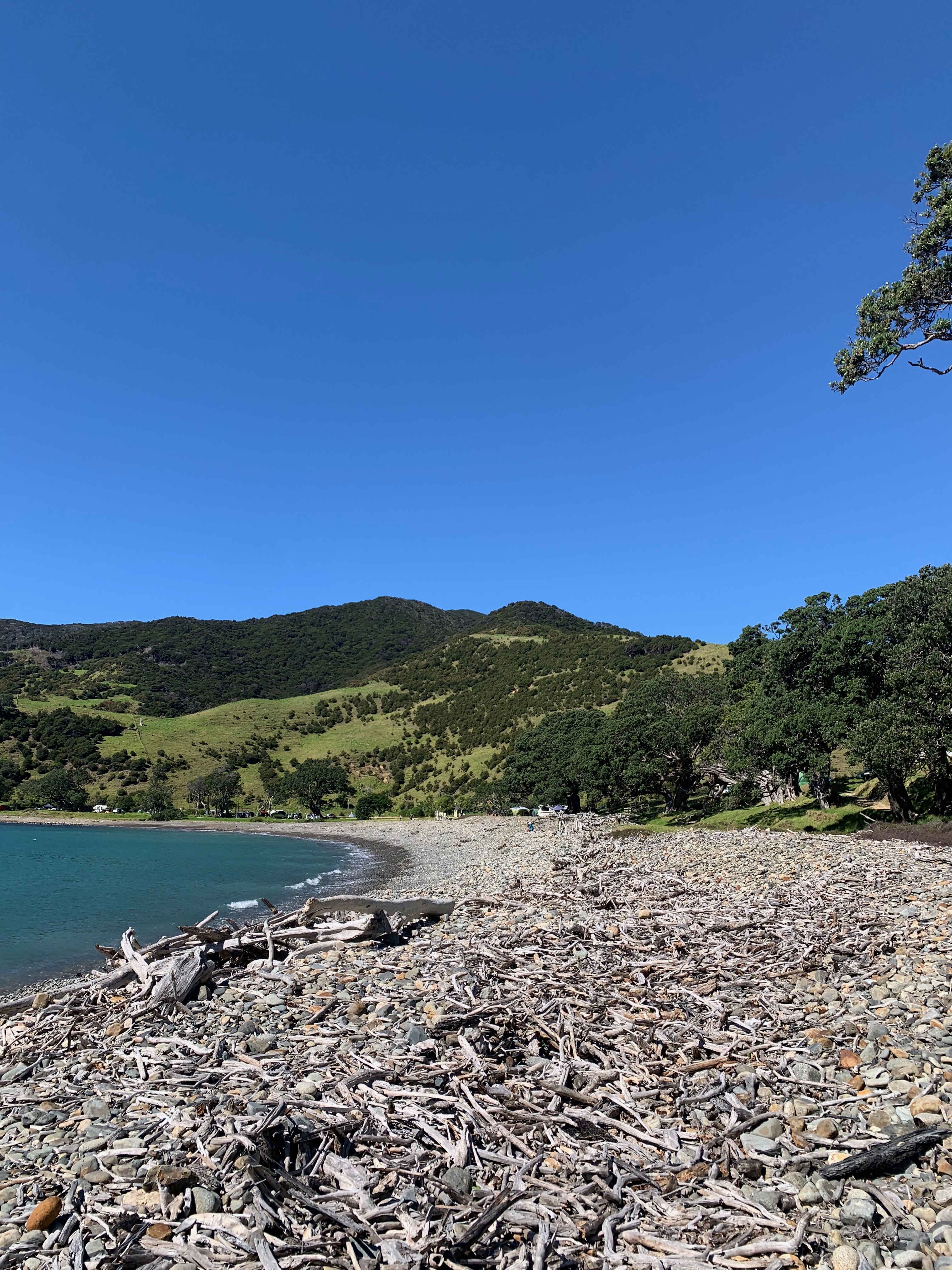
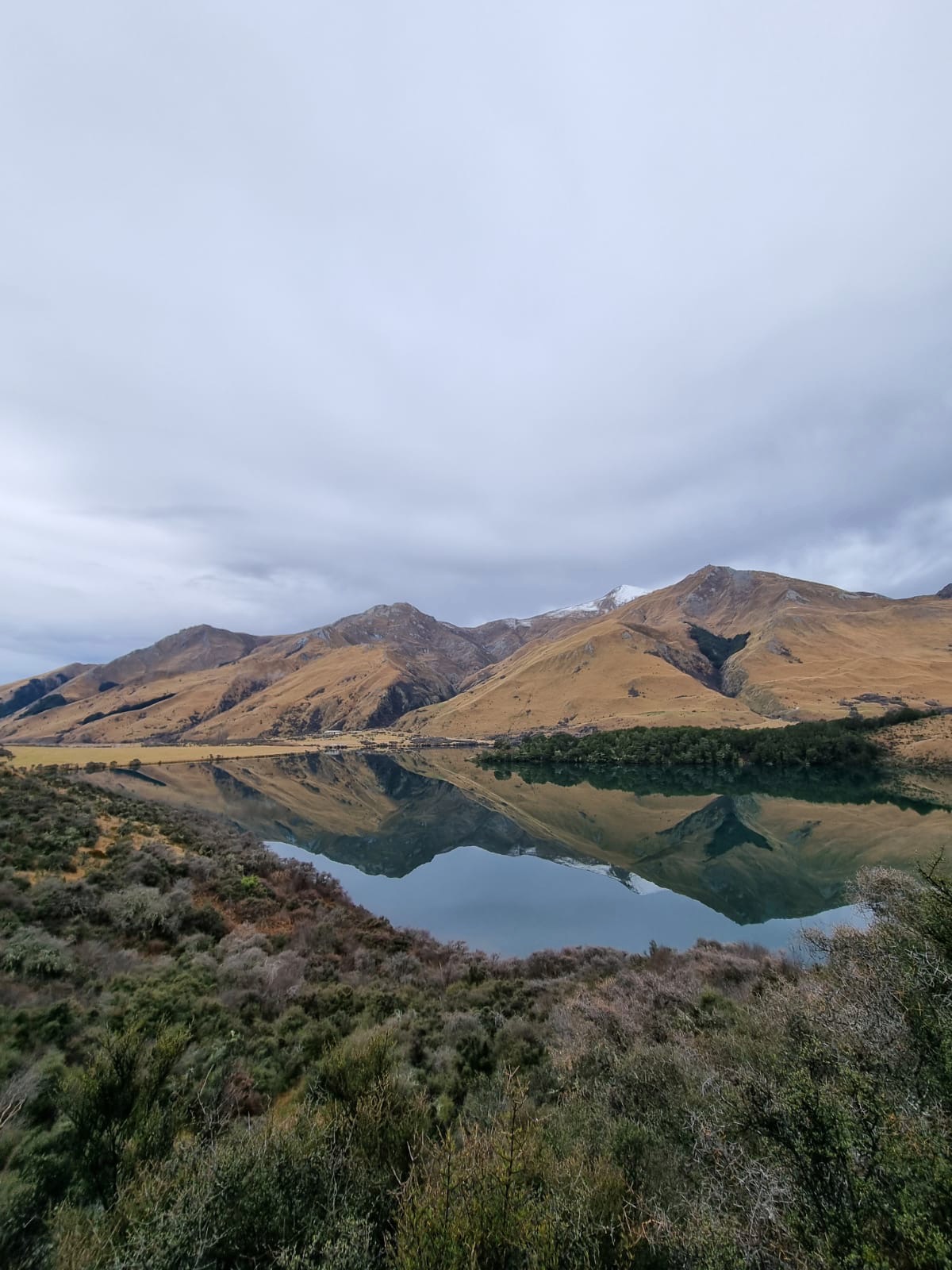
Moke Lake Loop Walk
Queenstown
2-3 hours – 6km loop – Easy
Located just 15 minutes outside of Queenstown CBD, Moke Lake is the perfect short hike to work up an appetite before heading to one of the best eateries in Queenstown. It’s a beautiful location, surrounded by remote farmland. We were lucky to be there at the beginning of spring, so lambs and calves roamed around.
There is plenty of parking at the lakefront, picnic tables and Moke Lake Campground. The campground is unpowered and home to 50’ first-come, first-served sites costing adults $15 per night.
The Moke Lake Loop Trail will take you around the lake’s perimeter. It isn’t very long, taking only three hours at a leisurely pace and is mostly flat, but there are a few steep sections. There are great opportunities across the walk for photos; on a calm day, you can see the mountain’s reflections in the lake. This was unlike anything I had ever seen before! Take your time soaking in the view before heading back to the carpark to call ‘dibs’ on one of the picnic tables and settling down for lunch.
If you are staying at Moke Lake Campground or in Queenstown, the mountains around the lake block out a lot of the city’s light pollution, making it an incredible place to stargaze. This is on our bucket list for next time!
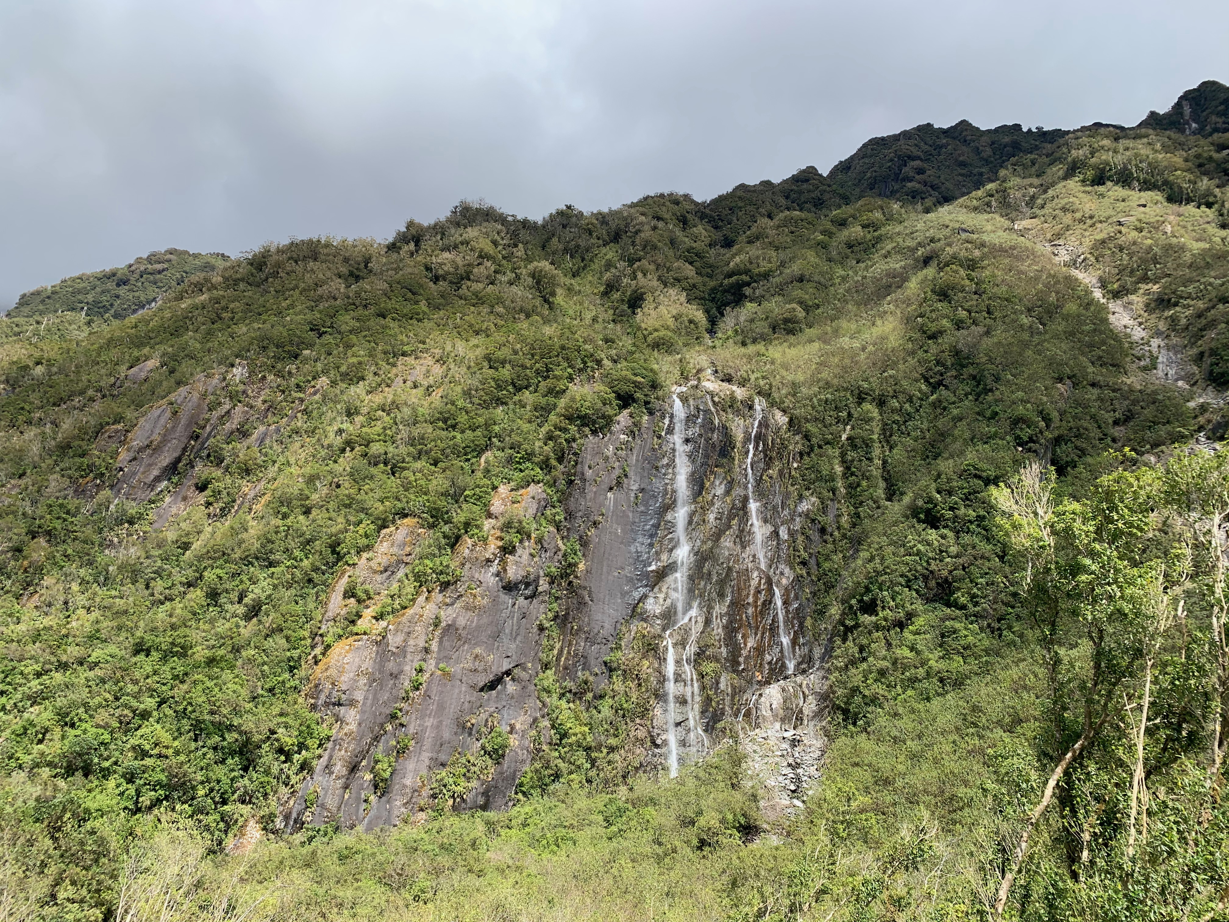
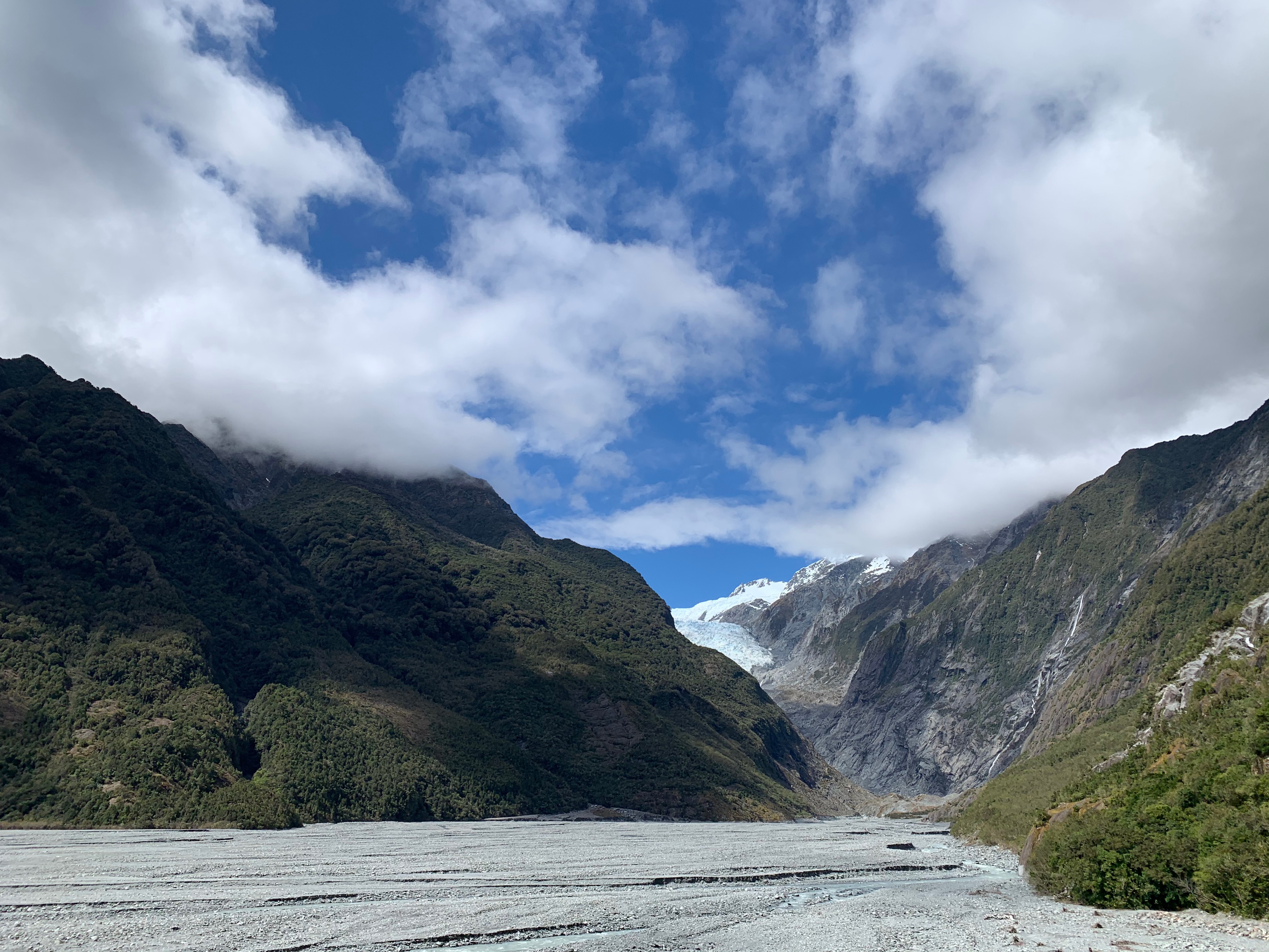
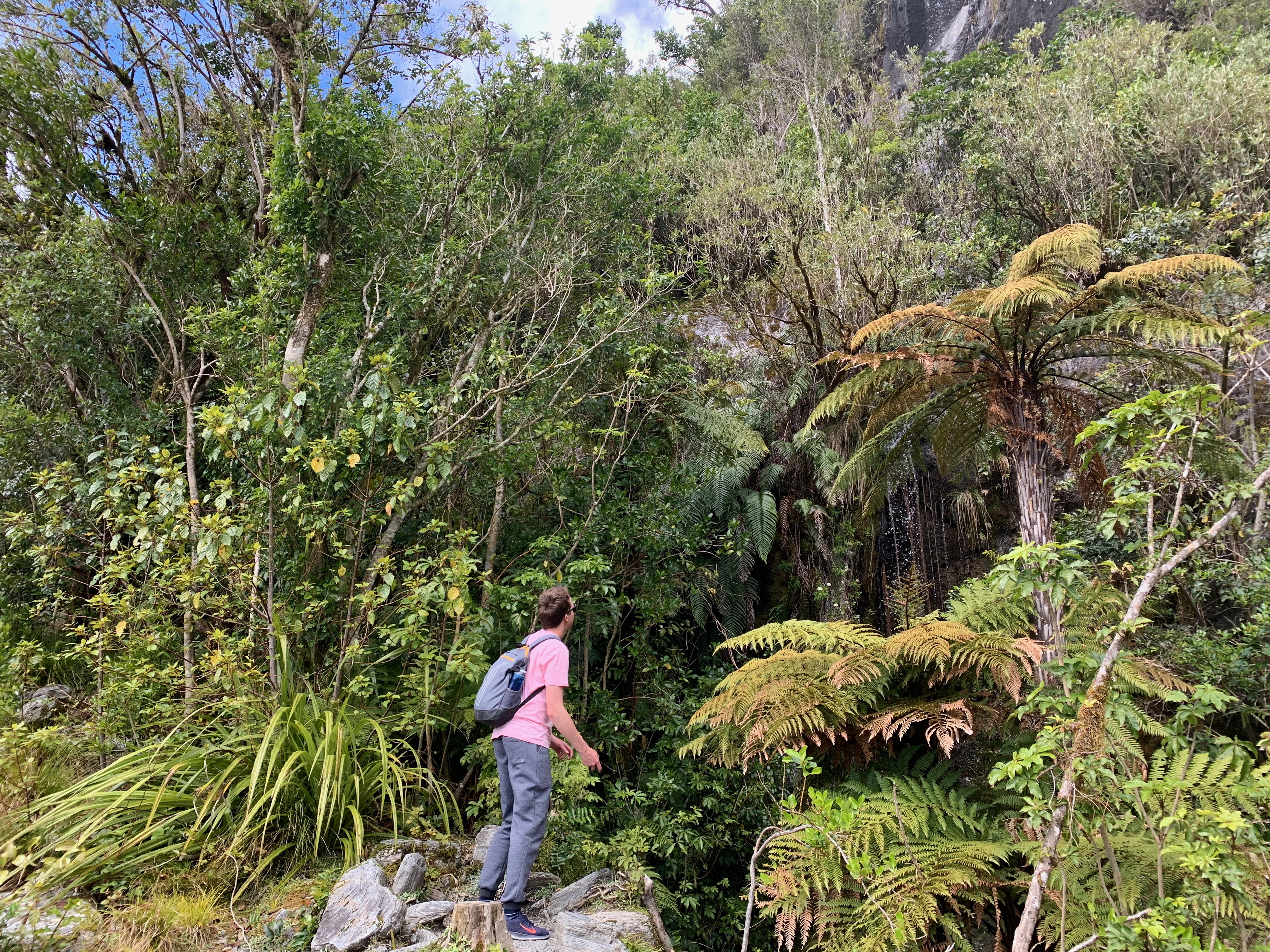
Franz Josef Glacier Walk
Franz Josef
30 minutes return – 1.7km – Easy
If you’re anything like me, your budget didn’t quite stretch to the Franz Josef Glacier Helicopter Ride. Don’t lose faith if you still want to see the glacier! Walking to the viewpoint is easy (and most importantly, free!).
The first 15 minutes of the Franz Josef walk winds easily through the beautiful rainforest. On a clear day, you’ll be greeted with stunning views of mountain tops and waterfalls before climbing a short uphill section to the glacier viewpoint. Here you will see Waiho River winding its way towards the coast and get a glimpse of the last of Franz Josef Glacier 750m away.
Unfortunately, the riverbed is a hazardous area with ice and rockfall, river surges and flooding, which has limited access up the valley. Therefore, going further on foot is no longer possible, and the track stops at the viewing area. However, the view is still spectacular and well worth your efforts!
Top tip: if you’re sticking around in Franz Josef overnight, stay at the Franz Josef Rainforest Retreat! The accommodation, staff and restaurant there are phenomenal, and we cannot wait to come back.
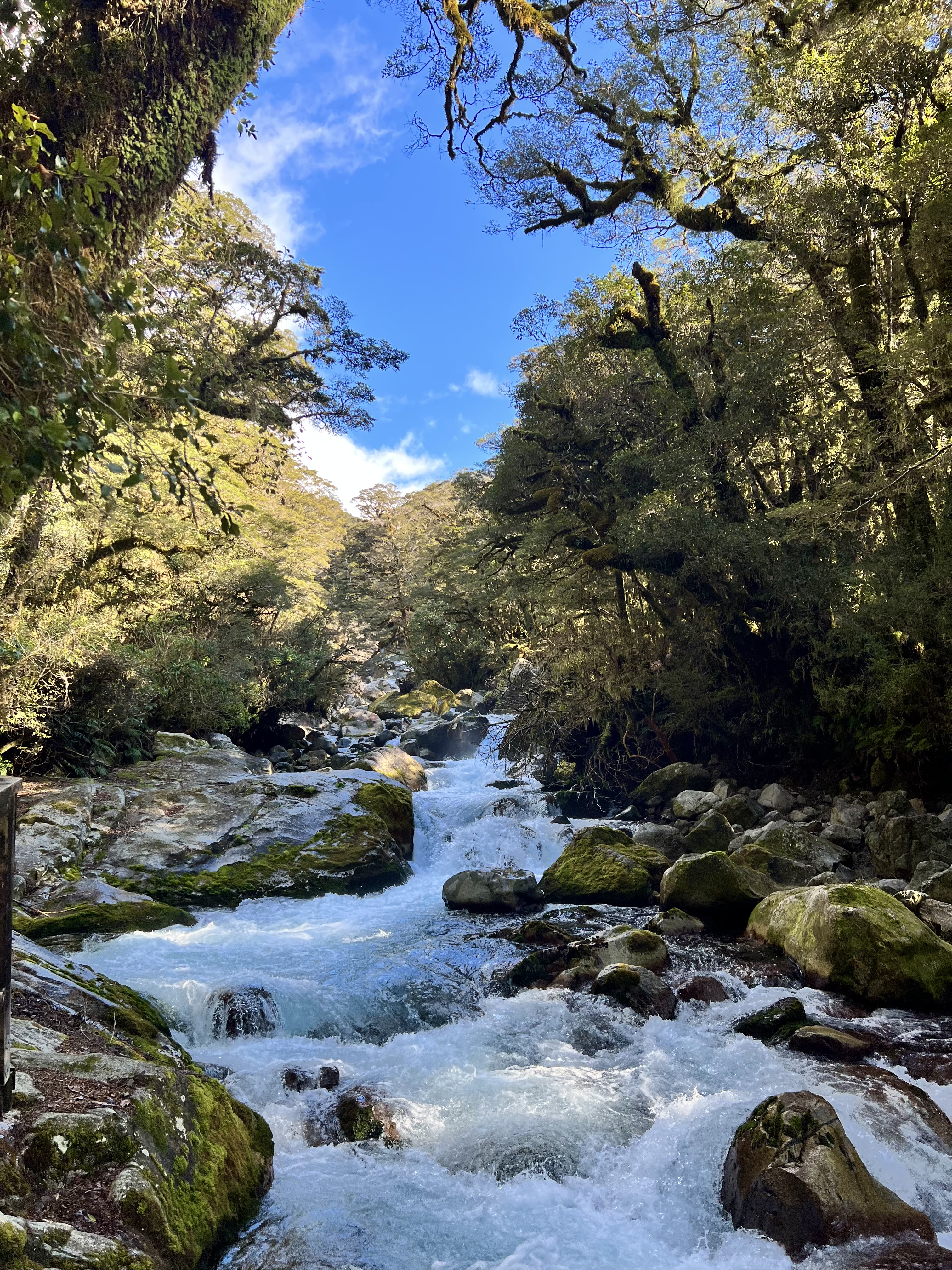
Blue Pools Track
Mount Aspiring National Park (near Wanaka)
1 hour return – 3km – Easy
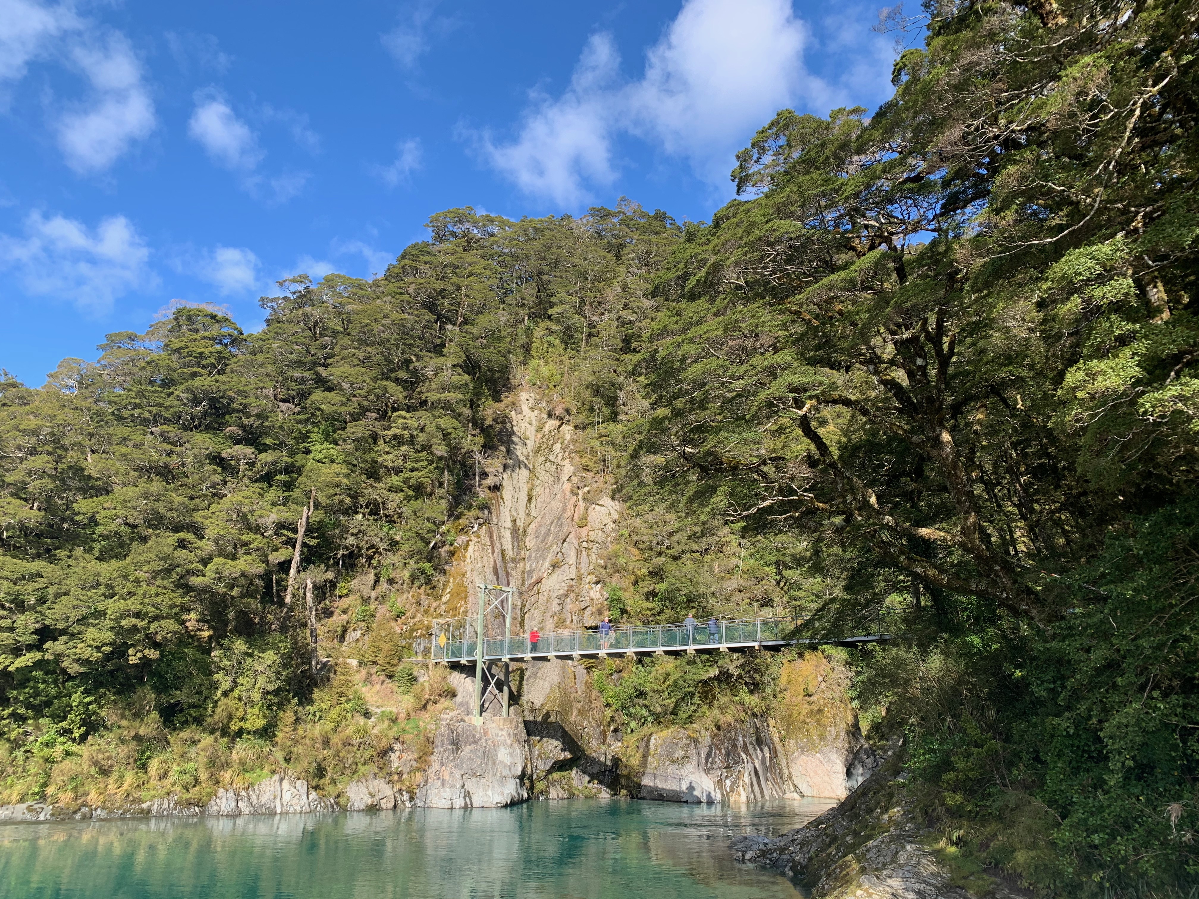
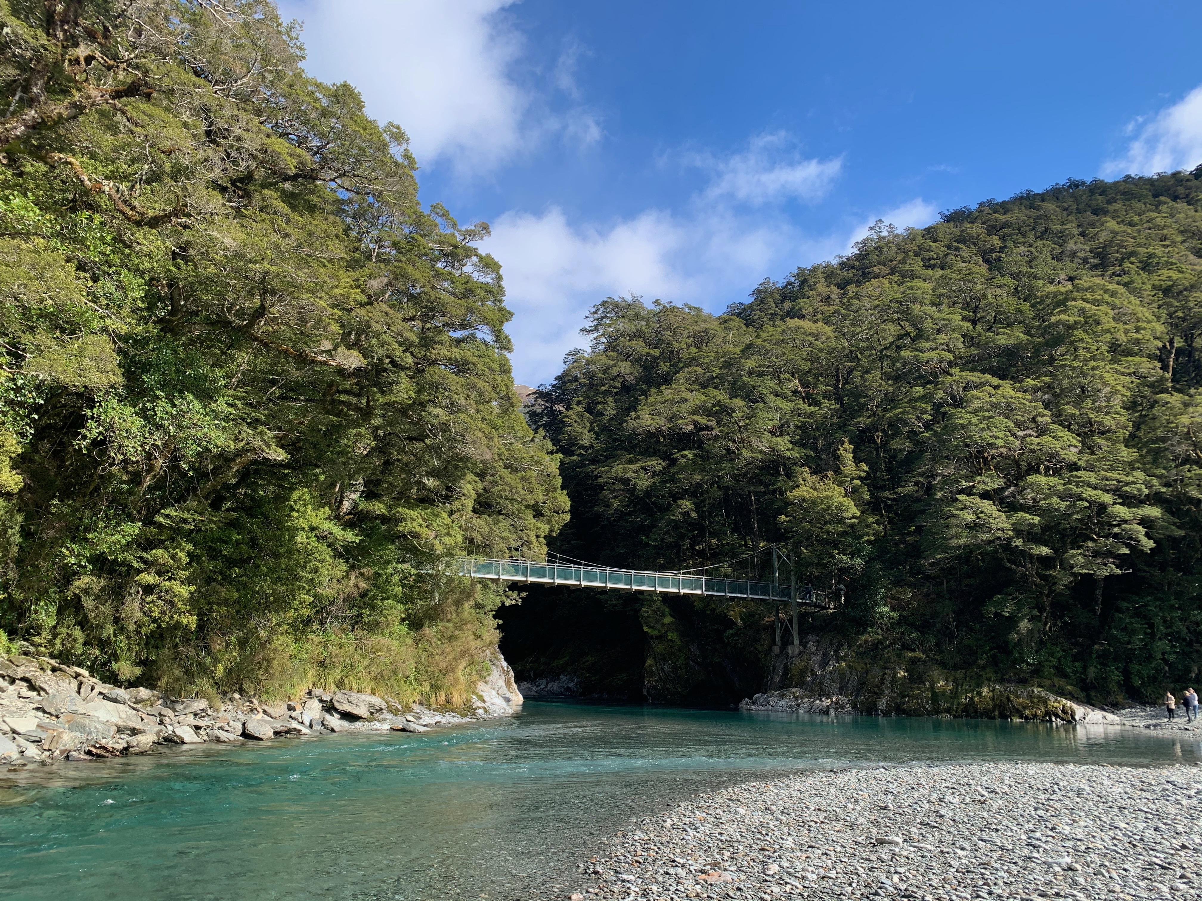

On the hunt for a day trip from Wanaka, passing through Mount Aspiring National Park, or have a thing for swing bridges and beautiful, glacial rivers? The Blue Pools Track is for you! Starting from an easily accessible car park on State Highway 6, this is one of Aotearoa’s best short walks!
The Blue Pools Track will take you through beech and podocarp forests as you breathe phenomenal mountain views and fresh air! After approximately 15 minutes of light walking, you will reach a beautiful swing bridge allowing you to cross Makarora River. From here, you continue along the boardwalk to a second swing bridge (pictured above, the iconic viewing platform over the Blue Pools.
If you cross this bridge, you will be greeted with great views up the river gorge and a small path that will take you down to the river bed.
If you visit in summer, note that it can get busy, so be prepared to wait for a while to cross the swing bridges and share the walk with others! Put this one on your bucket list for your next New Zealand Road Trip.
Hooker Valley Track
Mount Cook National Park
3 hours return – 10km – Easy
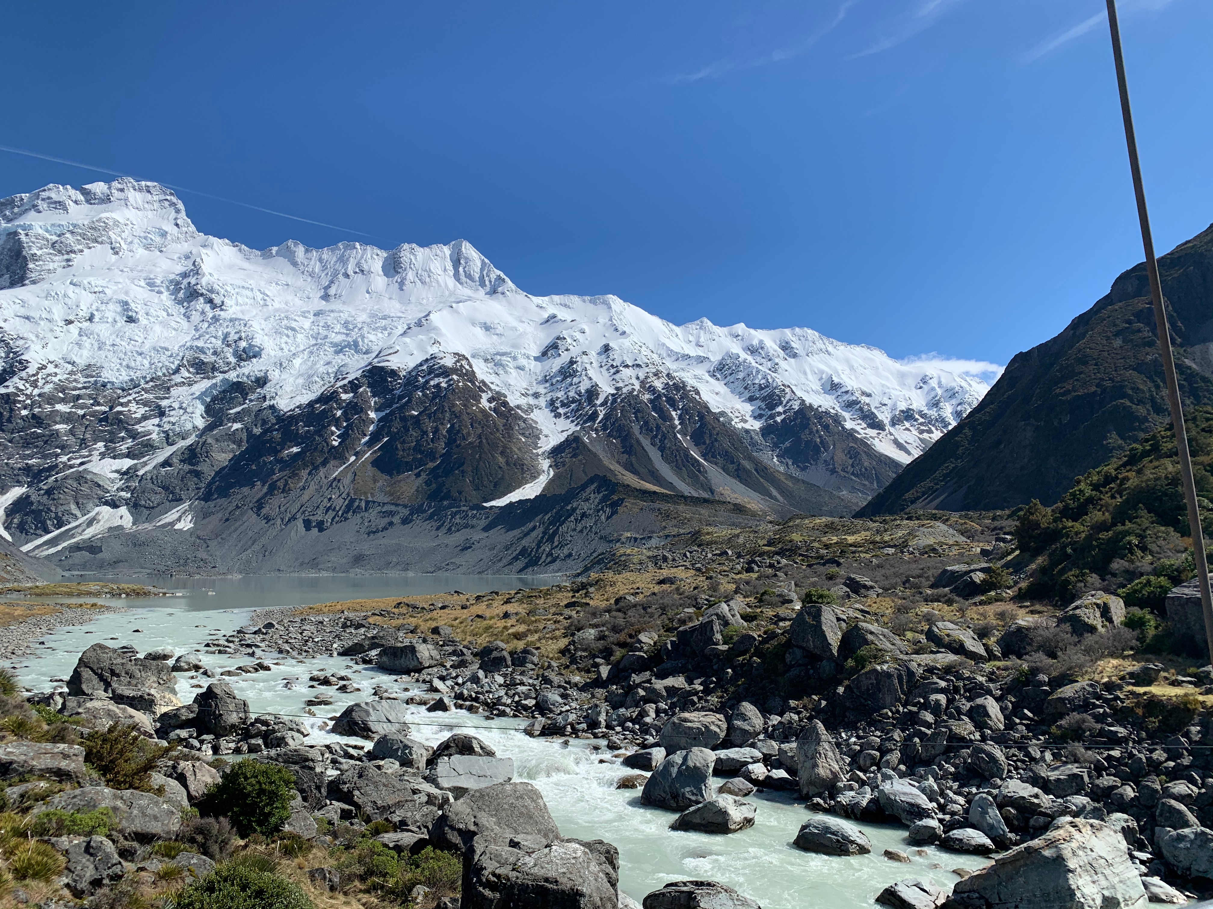
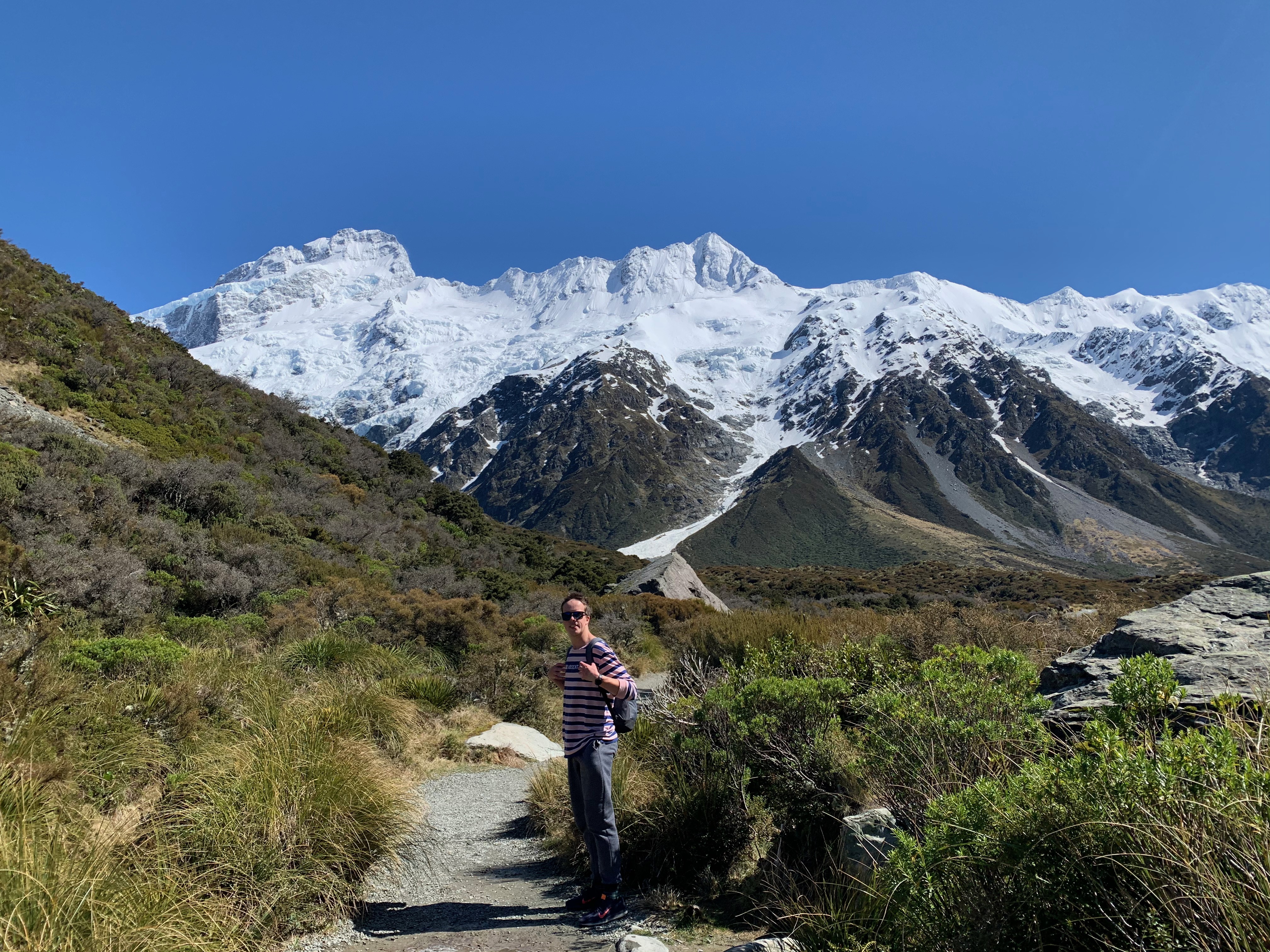
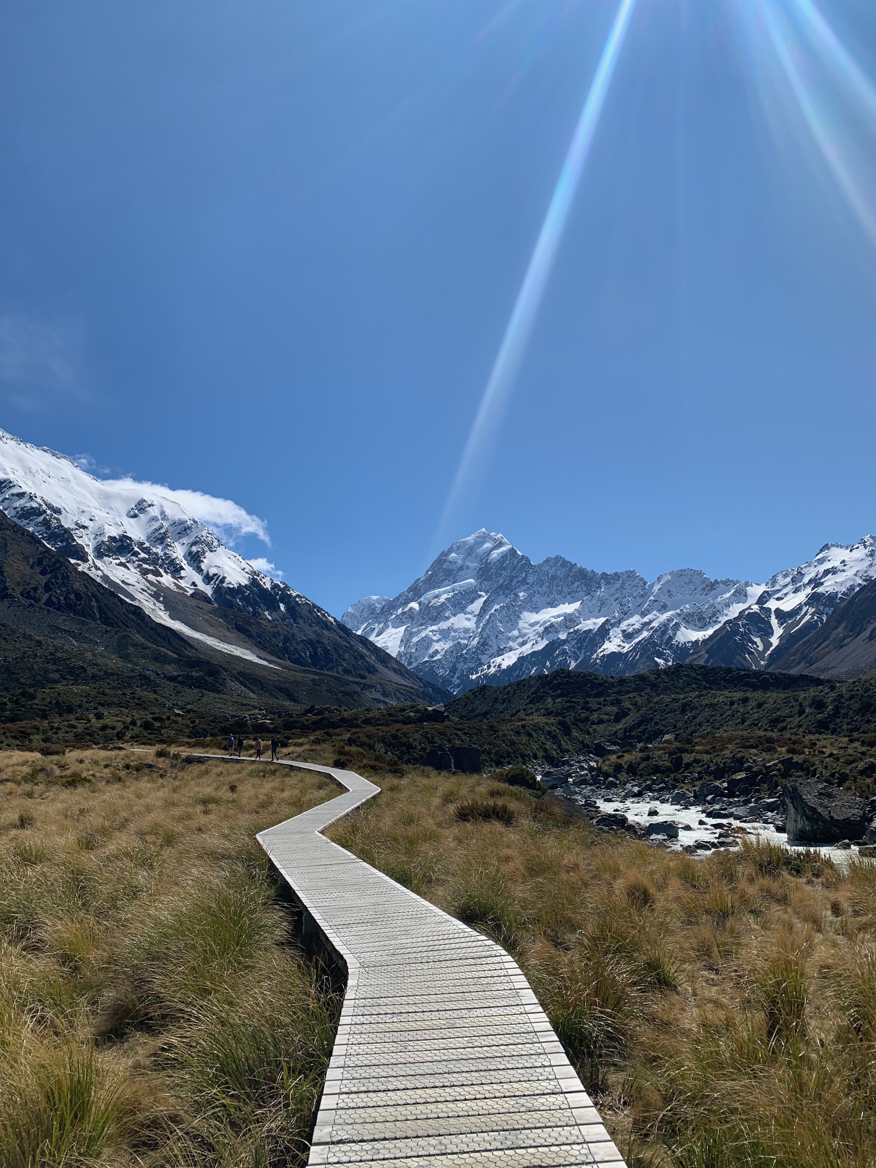
Who am I kidding? No list of the best walks on the South Island would be complete without this goodie – the Hooker Valley Track. The Hooker Valley Track is an exceptional day hike located in Mount Cook National Park. It offers an experience that you will always remember. The track starts at White Horse Hill Campground and follows the Hooker River. The glacial sediment in the water causes its unique chalky white colour.
This easy, flat, and well-paved walk sees you pass over not one, not two, but three swing bridges (!!), crossing large rivers before turning the corner and rounding on phenomenal views of New Zealand’s highest mountain, Mount Cook (Aoraki).
When you reach the end of the track, you will see Hooker Lake (a glacial lake home to icebergs, incredible views and a lovely lunch spot). It can get busy in the summer, so be prepared to share the views with other travellers! We enjoyed our lunch and a walk down the lakeside before returning along the same path and returning to the car.
Tip: This area is a Dark Sky Reserve. If you’re lucky enough to stay at White Horse Hill campground or within Mount Cook village for the night, you will be able to see astonishing numbers of stars.
Blue Lakes and Tasman Glacier View
Mount Cook National Park
40 minutes return (plus 1 hour for Blue Lakes detour) – 1.8km – Easy
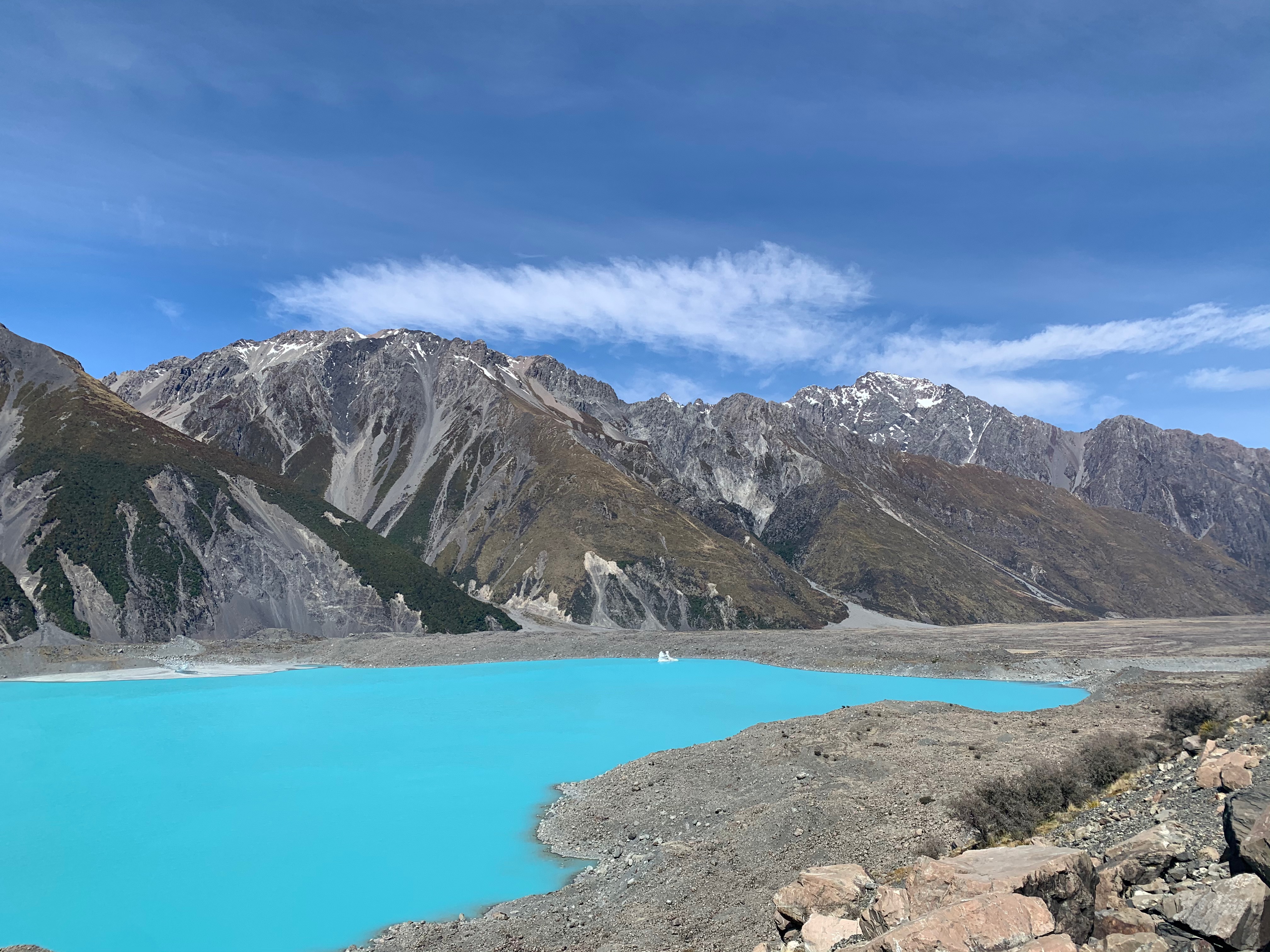
On our most recent trip to Mount Cook, we finished up the Hooker Valley Track. We intended to return to our campervan when we saw signposts to The Blue Lakes and Tasman Glacier View track. We didn’t even realise this walk was here! Boy, are we pleased we stuck around – this hike was one of the best on that trip to the South Island.
This is one you shouldn’t miss if you’re in the area! From the car park (the same one you parked in for the Hooker Valley Track), head up to the Blue Lakes Shelter to a viewpoint on the moraine wall. As you near the halfway point, you’ll see a detour to visit the Blue Lakes. The detour hike takes about 1-hour return without counting photo stops, but it’s well worth the effort!
Once you’ve visited the Blue Lakes, you’ll continue heading to Tasman Glacier. There are quite a few steps on the way up, but the views at the top reward your efforts tenfold!
You will have spectacular views of the Tasman Glacier (the longest glacier in New Zealand), terminal lake and the surrounding mountains. As of 2017, the glacier was 23 km long, although it’s shrinking rapidly 😦
What hikes would you add?
I hope you enjoyed reading about my favourite hikes in New Zealand. I can’t wait to tick more off of my bucket list!
Are there any dream hikes missing on this list that you think I should tackle next? Let me know in the comments below – I’d love to hear from you.

Leave a comment